Area Overview for BR6 0TF
Photos of BR6 0TF


Area Information
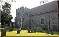
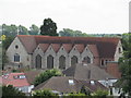
BR6 0TF is a small residential postcode area in England, part of a suburban cluster at the edge of Greater London. With a population of just 2,297, it reflects a quiet, tightly knit community. The area’s history is rooted in Orpington Ward, which has been an electoral district since 2002, and its character blends historic elements with modern infrastructure. The median age of 47 suggests a stable, middle-aged population, with adults aged 30–64 making up the largest demographic. Flats dominate the housing stock, reflecting a mix of owner-occupied and rental properties. The area’s proximity to Orpington, a town with a rich heritage, offers access to landmarks like the Orpington War Memorial and the Walnuts Shopping Centre, built in the 1970s. While the postcode lacks natural or protected landscapes, its connectivity to rail, trams, and nearby airports ensures practical access to London and surrounding areas. However, the high crime risk, rated as critical, is a notable challenge for residents. BR6 0TF is not a sprawling suburb but a compact, defined space where daily life revolves around local amenities and community ties.
- Area Type
- Postcode
- Area Size
- Not available
- Population
- Not available
- Population Density
- Not available
BR6 0TF’s property market is characterised by a 56% home ownership rate, with flats comprising the majority of housing stock. This indicates a mix of owner-occupied properties and rental units, though the small size of the postcode area suggests limited housing diversity. The prevalence of flats may reflect a focus on high-density living, potentially influenced by the area’s proximity to transport hubs and amenities. For buyers, this small cluster of homes presents a constrained market, with little scope for expansion. Those seeking property in BR6 0TF may need to consider adjacent areas for greater choice, though the existing stock caters to those prioritising convenience over space. The lack of listed buildings or historic properties means the market is unlikely to attract buyers seeking heritage features. Given the high crime risk, property values may be influenced by perceived safety, though the area’s connectivity to rail and trams could enhance its appeal for commuters.
House Prices in BR6 0TF
No properties found in this postcode.
Energy Efficiency in BR6 0TF
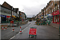
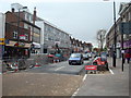
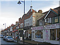
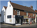
Life in BR6 0TF revolves around accessible amenities, including five retail outlets such as Iceland Orpington, Sainsburys Orpington, and Tesco Orpington. These shops cater to daily needs, while the Walnuts Shopping Centre, built in the 1970s, offers a broader range of services. The area’s transport links—rail, trams, and nearby airports—enhance mobility, making it practical for both work and leisure. However, the data does not mention parks or green spaces, suggesting limited recreational options within the postcode. The presence of historic sites like the Orpington War Memorial and the Memorial Cross in Canadian Corner adds cultural value, though leisure activities may require travel beyond the immediate area. The mix of retail and transport infrastructure supports a functional lifestyle, though residents may need to venture further for more diverse leisure opportunities.
Amenities
Schools
The nearest schools to BR6 0TF include Orpington College of Further Education, a sixth-form college, and Dorton College of Further Education, a special school. These institutions cater to older students, offering post-16 education and specialist provisions, but no primary or secondary schools are listed in the data. This means families with younger children may need to look beyond BR6 0TF for primary or secondary education. The absence of local schools for younger age groups could be a limitation for families prioritising proximity to schools. However, the presence of further education colleges suggests the area supports continued learning and vocational training. For those requiring special educational needs support, Dorton College provides a dedicated resource. The mix of school types reflects the area’s role as a commuter hub rather than a primary residential zone for young families.
| Rank | School | Type | Entry gender | Ages |
|---|---|---|---|---|
| 1 | Orpington College of Further Education | sixth-form | N/A | N/A |
| 2 | Dorton College of Further Education | special | N/A | N/A |
Explore more schools in this area
Go to Schools tabDemographics
The population of BR6 0TF is predominantly adults aged 30–64, with a median age of 47. This suggests a mature, established community with a strong presence of middle-aged residents. Home ownership rates stand at 56%, indicating a balance between owner-occupied properties and rental housing. The accommodation type is largely flats, reflecting a mix of purpose-built residential units and possibly converted buildings. The predominant ethnic group is White, which aligns with broader demographic trends in the surrounding London Borough of Bromley. The data does not provide specific figures on deprivation, but the high crime risk—rated critical—may impact perceived safety and quality of life. This could influence housing desirability, though the area’s proximity to essential services and transport links may offset some concerns. The demographic profile suggests a community focused on stability, with limited generational turnover, and a reliance on local infrastructure for daily needs.
Household Size
Accommodation Type
Tenure
Ethnic Group
Religion
Household Composition
Age
Household Deprivation
NS-SEC
Explore more demographic insights in this area
Go to Demographics tabPlanning
Planning Constraints
- Flood RiskPremium
- Ramsar Wetland SitesPremium
- Area of Outstanding Natural BeautyPremium
- Protected Nature ReservePremium
- Protected WoodlandPremium
- Crime RiskPremium