Area Overview for BR6 0DP
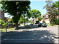
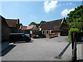
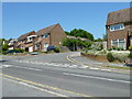
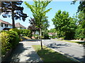
Photos of BR6 0DP


Area Information
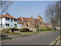
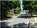
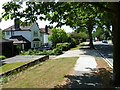
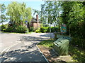
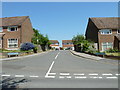
BR6 0DP is a compact postcode in St. Mary Cray, part of the London Borough of Bromley. Situated 13 miles south-east of Charing Cross, this area blends historical charm with suburban practicality. Its 673 m² covers a small residential cluster with a population of 1,691, translating to a high density of 2.5 million people per km². Once a market town in medieval Kent, St. Mary Cray retains traces of its past—such as the 13th-century church and the River Cray—which still shapes its character. Today, it is a mix of older flint-dressed houses and 19th-century cottages, interspersed with modern developments. The area’s proximity to Orpington and its rail links to central London make it accessible yet distinctly rural in feel. With a median age of 47 and a population skewed toward adults aged 30–64, the community is settled and stable. Living here means balancing historical heritage with modern convenience, from nearby schools to retail hubs and transport options that connect to both Kent and Greater London.
- Area Type
- Postcode
- Area Size
- 673 m²
- Population
- Not available
- Population Density
- Not available
BR6 0DP is a predominantly owner-occupied area, with 75% of homes owned by residents rather than rented. The accommodation type is exclusively houses, which is unusual for a small postcode but reflects the area’s suburban character and historical development. This focus on owner-occupied housing suggests a market where long-term residency is common, and property values may be influenced by the area’s proximity to amenities and transport links. The limited size of the postcode means the housing stock is constrained, potentially increasing competition among buyers. For those seeking homes here, the availability of houses rather than flats or apartments may appeal to families or those prioritising space. The area’s blend of older and newer properties, combined with its connectivity to London and Kent, positions it as a niche market for buyers valuing both historical charm and practicality.
House Prices in BR6 0DP
No properties found in this postcode.
Energy Efficiency in BR6 0DP
Residents of BR6 0DP have access to a range of amenities within practical reach. Retail options include Iceland Orpington, Sainsburys Orpington, and Co-op Carlton, ensuring everyday shopping needs are met. The area’s rail and metro connections, including Orpington Station and New Addington Tram Stop, provide easy access to London and surrounding towns. The River Cray, a defining natural feature, adds to the area’s character, while historical sites like St. Mary’s Church and Cray Wanderers F.C.’s original ground offer cultural and recreational value. The mix of retail, transport, and natural features supports a lifestyle that balances convenience with a connection to the area’s heritage. The presence of nearby schools, parks, and community spaces further enhances the appeal of daily life in this small but well-connected postcode.
Amenities
Schools
The area near BR6 0DP includes Perry Hall Primary School, which has an Ofsted rating of outstanding, and another Perry Hall Primary School with a rating of good. Additionally, Clannad Education Centre, a special needs school, is rated good by Ofsted. This mix of primary schools and a special education centre provides families with options for both mainstream and specialist education. The presence of two primary schools with high ratings suggests a strong foundation for early education, while Clannad Education Centre addresses specific needs for students with learning difficulties. The proximity of these schools to residential areas ensures accessibility for local families. The variety of school types indicates a commitment to inclusive education, though no secondary schools are listed in the data. Parents should consider the specific requirements of their children when evaluating these options.
| Rank | School | Type | Entry gender | Ages |
|---|
Explore more schools in this area
Go to Schools tabDemographics
The population of BR6 0DP is 1,691, with a median age of 47, indicating a community dominated by middle-aged adults. The most common age range is 30–64 years, suggesting a mature, established population. Home ownership is high at 75%, reflecting a preference for long-term residency over rental properties. The accommodation type is predominantly houses, which aligns with the area’s suburban layout and historical housing stock. The predominant ethnic group is White, though no data on diversity beyond this is provided. This demographic profile implies a community focused on stability and family life, with fewer transient residents. The absence of specific data on deprivation or income levels means the area’s quality of life must be inferred from its amenities and infrastructure. The high home ownership rate and older population suggest a low turnover of residents, contributing to a cohesive local environment.
Household Size
Accommodation Type
Tenure
Ethnic Group
Religion
Household Composition
Age
Household Deprivation
NS-SEC
Explore more demographic insights in this area
Go to Demographics tabPlanning
Planning Constraints
- Flood RiskPremium
- Ramsar Wetland SitesPremium
- Area of Outstanding Natural BeautyPremium
- Protected Nature ReservePremium
- Protected WoodlandPremium