Area Overview for BR5 4ZY
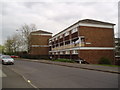
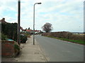
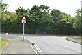
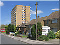
Photos of BR5 4ZY


Area Information
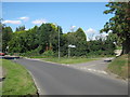
BR5 4ZY is a small residential postcode area in England, home to 1,241 people. Nestled in the London Borough of Bromley, it lies just north of Orpington and 13 miles south-east of Charing Cross. Historically a market town in Kent, St. Mary Cray retains echoes of its past as a rural settlement, though it now blends suburban housing with commercial development. The River Cray, central to the area’s character, once powered water mills and shaped the local economy. Today, the area offers a mix of older flint-dressed homes, 19th-century cottages with long gardens, and modern housing. Its proximity to Orpington and rail links makes it accessible to London’s wider infrastructure. The community is tightly knit, with amenities like Sainsburys and local rail stations within reach. For those seeking a quieter life on the edge of London, BR5 4ZY combines historical charm with practical modern living.
- Area Type
- Postcode
- Area Size
- Not available
- Population
- Not available
- Population Density
- Not available
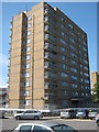
BR5 4ZY is a largely owner-occupied area, with 92% of homes owned by residents rather than rented out. The accommodation type is predominantly houses, which are typically larger and more spacious than flats. This suggests a market skewed towards family homes and long-term residents, with limited turnover. As a small postcode cluster, the property stock is finite, meaning buyers may find fewer options compared to larger areas. The high home ownership rate indicates a stable market, but also means competition for available properties. For those seeking a home, BR5 4ZY offers a mix of older and newer houses, many with gardens, reflecting the area’s suburban character. However, the small size of the postcode means buyers should consider nearby areas for more choices.
House Prices in BR5 4ZY
No properties found in this postcode.
Energy Efficiency in BR5 4ZY
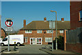
Living in BR5 4ZY offers a blend of convenience and character. Within practical reach are five retail stores, including Sainsburys Orpington and Iceland Orpington, ensuring access to groceries and everyday needs. The area’s rail network, with stations like St Mary Cray and Chelsfield, connects residents to London and beyond, while Biggin Hill Airport provides regional travel options. The River Cray, a defining natural feature, adds a peaceful backdrop to daily life. The mix of older and newer buildings, along with the village green and historical sites like St. Mary’s Church, contributes to a unique local identity. This balance of amenities, transport, and heritage makes BR5 4ZY a practical yet distinctive place to live.
Amenities
Schools
| Rank | School | Type | Entry gender | Ages |
|---|
Explore more schools in this area
Go to Schools tabDemographics
The population of BR5 4ZY is 1,241, with a median age of 47. The majority of residents fall within the 30-64 age range, reflecting a mature, established community. Home ownership is exceptionally high at 92%, indicating a stable, long-term resident base. The area is predominantly composed of houses, with few flats or apartments. The predominant ethnic group is White, though specific data on diversity is not provided. This demographic profile suggests a community focused on family living and long-term investment. The high home ownership rate implies lower rental activity, which can contribute to a sense of permanence and shared local identity. With no data on deprivation, the area appears to avoid the socio-economic challenges that might affect quality of life.
Household Size
Accommodation Type
Tenure
Ethnic Group
Religion
Household Composition
Age
Household Deprivation
NS-SEC
Explore more demographic insights in this area
Go to Demographics tabPlanning
Planning Constraints
- Flood RiskPremium
- Ramsar Wetland SitesPremium
- Area of Outstanding Natural BeautyPremium
- Protected Nature ReservePremium
- Protected WoodlandPremium