Area Overview for BR5 4AN
Photos of BR5 4AN
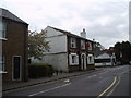
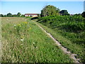

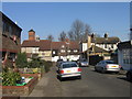

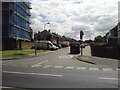
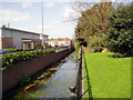
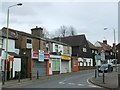
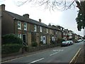
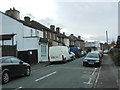
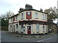
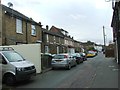
90 photos from this area
Area Information
Key information about the BR5 4AN including its size, population, and administrative classification.
- Area Type
- Postcode
- Area Size
- 1.2 hectares
- Population
- Not available
- Population Density
- Not available
House Prices in BR5 4AN
34
Properties
£304,846
Average Sold Price
£133,500
Lowest Price
£450,000
Highest Price
Showing 34 properties
| Address | Type | Beds | Baths | Last Sale Price | Last Sale Date | |
|---|---|---|---|---|---|---|
| 61 Anglesea Road, Orpington, BR5 4AN | Semi-detached | 3 | 1 | £407,000 | Jul 2024 | |
| 11 Anglesea Road, Orpington, BR5 4AN | Terraced | 3 | 1 | £359,000 | Dec 2023 | |
| 65 Anglesea Road, Orpington, BR5 4AN | Semi-detached | 3 | 1 | £410,000 | Nov 2023 | |
| 57 Anglesea Road, Orpington, BR5 4AN | Semi-detached | 3 | 1 | £450,000 | Mar 2023 | |
| 51 Anglesea Road, Orpington, BR5 4AN | house | - | - | £300,000 | Jan 2023 | |
| 61A Anglesea Road, Orpington, BR5 4AN | Retail | 3 | 1 | £420,000 | Jun 2022 | |
| 9 Anglesea Road, Orpington, BR5 4AN | Terraced | 1 | 1 | £240,000 | Dec 2018 | |
| 13 Anglesea Road, Orpington, BR5 4AN | Terraced | 3 | 1 | £296,000 | Mar 2016 | |
| 69 Anglesea Road, Orpington, BR5 4AN | house | - | - | £357,500 | Oct 2011 | |
| 59 Anglesea Road, Orpington, BR5 4AN | house | - | - | £195,000 | Aug 2009 |
Page 1 of 4
Energy Efficiency in BR5 4AN
Amenities
Schools
| Rank | School | Type | Entry gender | Ages |
|---|
Explore more schools in this area
Go to Schools tabDemographics
Household Size
One person
most common
Accommodation Type
Houses
most common
Tenure
51
majority
Ethnic Group
White
most common
Religion
N/A
most common
Household Composition
N/A
most common
Age
47
median
Adults (30-64 years)
most common
Household Deprivation
N/A
with no deprivation
NS-SEC
33
in Lower managerial occupations
Explore more demographic insights in this area
Go to Demographics tabPlanning
Planning Constraints
- Flood RiskPremium
- Ramsar Wetland SitesPremium
- Area of Outstanding Natural BeautyPremium
- Protected Nature ReservePremium
- Protected WoodlandPremium