Area Overview for BR5 3NE
Photos of BR5 3NE
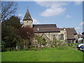
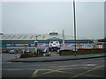
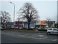
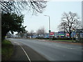
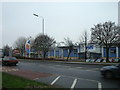
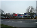
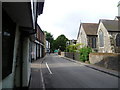
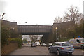
100 photos from this area
Area Information
Key information about the BR5 3NE including its size, population, and administrative classification.
- Area Type
- Postcode
- Area Size
- 1.2 hectares
- Population
- Not available
- Population Density
- Not available
House Prices in BR5 3NE
40
Properties
£282,823
Average Sold Price
£37,500
Lowest Price
£450,000
Highest Price
Showing 40 properties
| Address | Type | Beds | Baths | Last Sale Price | Last Sale Date | |
|---|---|---|---|---|---|---|
| 20 Teal Avenue, Orpington, BR5 3NE | Terraced | 2 | 1 | £340,000 | Dec 2024 | |
| 3 Teal Avenue, Orpington, BR5 3NE | Terraced | 3 | 1 | £430,000 | Jul 2024 | |
| 2B Teal Avenue, Orpington, BR5 3NE | Maisonette | 2 | 1 | £243,700 | Apr 2023 | |
| 17 Teal Avenue, Orpington, BR5 3NE | Terraced | 3 | 1 | £399,999 | Nov 2022 | |
| 6 Teal Avenue, Orpington, BR5 3NE | house | 3 | 1 | £375,000 | Oct 2022 | |
| 7 Teal Avenue, Orpington, BR5 3NE | Semi-detached | 3 | 2 | £450,000 | Feb 2021 | |
| 26 Teal Avenue, Orpington, BR5 3NE | Terraced | 3 | 1 | £347,000 | Jan 2018 | |
| 2 Teal Avenue, Orpington, BR5 3NE | Terraced | 3 | 1 | £325,000 | Feb 2017 | |
| 2A Teal Avenue, Orpington, BR5 3NE | Maisonette | 2 | 1 | £215,000 | May 2016 | |
| 4 Teal Avenue, Orpington, BR5 3NE | Terraced | - | - | £197,000 | Apr 2008 |
Page 1 of 4
Energy Efficiency in BR5 3NE
Amenities
Schools
| Rank | School | Type | Entry gender | Ages |
|---|
Explore more schools in this area
Go to Schools tabDemographics
Household Size
Family (3-5 people)
most common
Accommodation Type
Houses
most common
Tenure
57
majority
Ethnic Group
White
most common
Religion
N/A
most common
Household Composition
N/A
most common
Age
47
median
Adults (30-64 years)
most common
Household Deprivation
N/A
with no deprivation
NS-SEC
32
in Lower managerial occupations
Explore more demographic insights in this area
Go to Demographics tabPlanning
Planning Constraints
- Flood RiskPremium
- Ramsar Wetland SitesPremium
- Area of Outstanding Natural BeautyPremium
- Protected Nature ReservePremium
- Protected WoodlandPremium