Area Overview for BR5 3JT
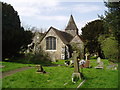
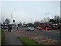
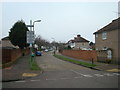
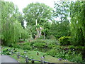
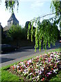
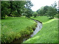
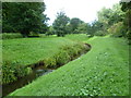
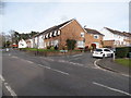
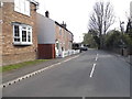
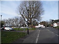
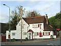
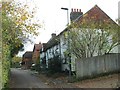
Photos of BR5 3JT
Area Information
BR5 3JT is a postcode cluster covering 9792 square metres within the suburb of St Paul's Cray, located in the London Borough of Bromley. This residential area sits on the banks of the River Cray and sits south of Sidcup and north of Orpington. The population is 1627 residents, creating a population density of 592 people per square kilometre. Living in BR5 3JT means residing in a small, defined cluster that reflects the broader character of St Paul's Cray. The locality possesses an ancient history, with evidence of Roman camps and early Saxon foundations dating back to the seventh century. Sir Simon de Cray held the manor during the reign of Edward I, and the area was documented as Paul Crey by William Camden in 1610. By the 19th century, the fast-flowing stream supported a paper production industry, before the area transitioned significantly after the Second World War. The twentieth century saw major residential expansion as London County Council estates and tower blocks were constructed from the 1950s onwards. Today, BR5 3JT represents a mix of this historic industrial heritage and modern suburban character. Residents live in a compact community that draws on both its deep local roots and its proximity to wider Greater London.
- Area Type
- Postcode
- Area Size
- 9792 m²
- Population
- 1627
- Population Density
- 592 people/km²
The property market in BR5 3JT is characterised by a strong ownership culture and specific housing stock types. Houses make up the vast majority of the accommodation in this small postcode area. The high home ownership rate of 68% means that the area is primarily owner-occupied rather than a high-density rental zone. Prospective buyers looking at BR5 3JT will find a mix of established homes, many of which were part of the council estate developments built in the 1950s and 1960s. The presence of tower blocks from the 1960s indicates that the housing stock includes mid-rise social housing alongside private family homes. Since the area saw significant residential development following the Second World War, much of the housing was designed for families. The 68% ownership figure is a key indicator for buyers considering this location. It implies that the community is financially stable and that property values may be supported by owner-occupier motivation. A move into BR5 3JT would likely involve purchasing a house, aligning with the area's historical shift from industrial paper production to permanent family residence. The small size of the area, covering just under 10,000 square metres, ensures a contained market.
House Prices in BR5 3JT
Showing 10 properties
| Address | Type | Beds | Baths | Last Sale Price | Last Sale Date | |
|---|---|---|---|---|---|---|
| 6 Andrews Close, Orpington, BR5 3JT | Bungalow | - | - | £315,000 | Sep 2020 | |
| 4 Andrews Close, Orpington, BR5 3JT | Semi-detached | 2 | - | £238,000 | Oct 2013 | |
| 8 Andrews Close, Orpington, BR5 3JT | Semi-detached | 2 | - | £210,250 | Jul 2013 | |
| 10 Andrews Close, Orpington, BR5 3JT | Bungalow | 2 | - | £212,000 | Mar 2013 | |
| 7 Andrews Close, Orpington, BR5 3JT | Semi-detached | - | - | £177,500 | Apr 2004 | |
| 9 Andrews Close, Orpington, BR5 3JT | Bungalow | - | - | £74,000 | Apr 1999 | |
| 1 Andrews Close, Orpington, BR5 3JT | Semi-detached | - | - | - | - | |
| 3 Andrews Close, Orpington, BR5 3JT | Semi-detached | - | - | - | - | |
| 5 Andrews Close, Orpington, BR5 3JT | Semi-detached | - | - | - | - | |
| 2 Andrews Close, Orpington, BR5 3JT | Semi-detached | - | - | - | - |
Energy Efficiency in BR5 3JT
Daily life in BR5 3JT benefits from a range of amenities within practical reach. Retail options include Tesco St Pauls, Aldi Springvale, and Lidl London, providing five major supermarkets within easy distance. Residents can handle most weekly shopping needs without travelling far. For those who prefer rail travel, five stations are accessible, including St Mary Cray and Swanley Railway Station. Five airfields, notably Biggin Hill Airport and London Biggin Hill Airport, are located nearby. These facilities offer extensive leisure and travel possibilities beyond standard shopping. The character of BR5 3JT is defined by this convenient access to essential and optional services. The local history of paper production has long since vanished, replaced by suburban commerce. Living in this area means you have immediate access to food retailers and transport hubs. The 592 people per square kilometre density ensures that while you have these amenities close by, the environment avoids overcrowding. You can walk to Tesco St Pauls or catch a train at St Mary Cray with minimal congestion. The blend of retail, rail, and aviation access makes BR5 3JT a self-contained yet well-connected part of St Paul's Cray.
Amenities
Schools
Parents considering schools near BR5 3JT have access to specific local institutions. Riverside School is the nearest school to this postcode. It operates as a special school. The school serves pupils with particular educational needs and is a key facility for families in the St Paul's Cray area. While the data does not provide an Ofsted rating, the presence of a special school indicates a diverse range of educational provision within the locality. For families seeking mainstream education, this special school serves as a local resource. The proximity of Riverside School ensures that residents have institutional support close to their homes in BR5 3JT. The area's history as a residential expansion zone from the 1950s suggests a long-standing presence of families who value local education. Although no other primary or secondary schools are listed for this specific postcode cluster, the availability of Riverside School demonstrates that the community has dedicated educational infrastructure. Families with children requiring special educational support will find Riverside School convenient as they live in or near BR5 3JT.
| Rank | School | Type | Entry gender | Ages |
|---|
Explore more schools in this area
Go to Schools tabDemographics
The demographic makeup of BR5 3JT reflects a mature, established community. The median age is 47 years, and adults between 30 and 64 years represent the most common age range. This profile suggests an area dominated by families and professionals in mid-career stages rather than singles or retirees. Home ownership stands at 68%, indicating that the majority of residents own their property outright or with a mortgage. Houses are the predominant form of accommodation within this postcode area. The community is predominantly White, consistent with the broader patterns of the London Borough of Bromley. With 68% of residents owning their homes, the area feels stable and rooted. The high proportion of adults in the 30 to 64 age bracket means the local shops and services cater well to working parents and households with children. This age structure also supports a relatively steady demand for household services and maintenance rather than a transient rental population. The low density of 592 people per square kilometre further reinforces a quiet, family-oriented environment where neighbours are likely to know one another.
Household Size
Accommodation Type
Tenure
Ethnic Group
Religion
Household Composition
Age
Household Deprivation
NS-SEC
Explore more demographic insights in this area
Go to Demographics tabPlanning
Planning Constraints
- Flood RiskPremium
- Ramsar Wetland SitesPremium
- Area of Outstanding Natural BeautyPremium
- Protected Nature ReservePremium
- Protected WoodlandPremium