Area Overview for BR5 3FA
Photos of BR5 3FA
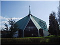
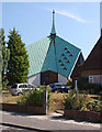
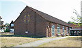
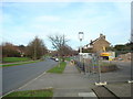
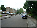
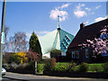
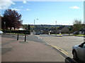
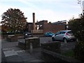
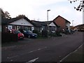
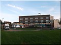
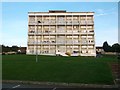
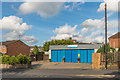
47 photos from this area
Area Information
Key information about the BR5 3FA including its size, population, and administrative classification.
- Area Type
- Postcode
- Area Size
- 1.4 hectares
- Population
- Not available
- Population Density
- Not available
House Prices in BR5 3FA
45
Properties
£410,196
Average Sold Price
£345,500
Lowest Price
£485,000
Highest Price
Showing 45 properties
| Address | Type | Beds | Baths | Last Sale Price | Last Sale Date | |
|---|---|---|---|---|---|---|
| 40 Stilwell Close, Orpington, BR5 3FA | Terraced | 3 | 2 | £478,000 | Nov 2025 | |
| 18 Stilwell Close, Orpington, BR5 3FA | Terraced | 3 | 2 | £440,000 | Jun 2025 | |
| 9 Stilwell Close, Orpington, BR5 3FA | Flat | 2 | 2 | £395,000 | Jan 2025 | |
| 8 Stilwell Close, Orpington, BR5 3FA | Terraced | 3 | 1 | £480,000 | Jul 2024 | |
| 6 Stilwell Close, Orpington, BR5 3FA | Terraced | 2 | 2 | £430,000 | Nov 2023 | |
| 4 Stilwell Close, Orpington, BR5 3FA | Terraced | 3 | 2 | £422,500 | Jan 2023 | |
| 13 Stilwell Close, Orpington, BR5 3FA | Terraced | 3 | 1 | £425,000 | Jun 2022 | |
| 17 Stilwell Close, Orpington, BR5 3FA | Terraced | 3 | 1 | £425,000 | Dec 2020 | |
| 5 Stilwell Close, Orpington, BR5 3FA | house | - | - | £360,000 | Oct 2020 | |
| 1 Stilwell Close, Orpington, BR5 3FA | house | - | - | £449,950 | May 2018 |
Page 1 of 5
Energy Efficiency in BR5 3FA
Amenities
Schools
| Rank | School | Type | Entry gender | Ages |
|---|
Explore more schools in this area
Go to Schools tabDemographics
Household Size
One person
most common
Accommodation Type
Houses
most common
Tenure
37
majority
Ethnic Group
White
most common
Religion
N/A
most common
Household Composition
N/A
most common
Age
47
median
Adults (30-64 years)
most common
Household Deprivation
N/A
with no deprivation
NS-SEC
27
in Lower managerial occupations
Explore more demographic insights in this area
Go to Demographics tabPlanning
Planning Constraints
- Flood RiskPremium
- Ramsar Wetland SitesPremium
- Area of Outstanding Natural BeautyPremium
- Protected Nature ReservePremium
- Protected WoodlandPremium