Area Overview for BR5 3DQ
Photos of BR5 3DQ
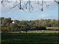
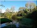
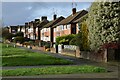
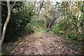
59 photos from this area
Area Information
Key information about the BR5 3DQ including its size, population, and administrative classification.
- Area Type
- Postcode
- Area Size
- 4.0 hectares
- Population
- 1548
- Population Density
- 3011 people/km²
House Prices in BR5 3DQ
28
Properties
£258,127
Average Sold Price
£119,000
Lowest Price
£510,000
Highest Price
Showing 28 properties
| Address | Type | Beds | Baths | Last Sale Price | Last Sale Date | |
|---|---|---|---|---|---|---|
| 14 Valley Road, Orpington, BR5 3DQ | Maisonette | 2 | 1 | £303,000 | Sep 2024 | |
| 24 Valley Road, Orpington, BR5 3DQ | Flat | 2 | 1 | £285,000 | Aug 2024 | |
| 16 Valley Road, Orpington, BR5 3DQ | Flat | 2 | 1 | £280,000 | Apr 2023 | |
| 10 Valley Road, Orpington, BR5 3DQ | Semi-detached | 3 | 2 | £510,000 | Apr 2022 | |
| 30 Valley Road, Orpington, BR5 3DQ | Maisonette | 2 | 1 | £307,406 | Feb 2022 | |
| 20 Valley Road, Orpington, BR5 3DQ | Maisonette | 2 | 1 | £263,000 | Dec 2019 | |
| 54 Valley Road, Orpington, BR5 3DQ | house | 4 | - | £325,000 | Jul 2012 | |
| 42 Valley Road, Orpington, BR5 3DQ | house | 5 | - | £438,000 | Jul 2010 | |
| 44 Valley Road, Orpington, BR5 3DQ | Semi-detached | - | - | £265,000 | Jun 2009 | |
| 34 Valley Road, Orpington, BR5 3DQ | Maisonette | - | - | £136,000 | Jun 2007 |
Page 1 of 3
Energy Efficiency in BR5 3DQ
Amenities
Schools
| Rank | School | Type | Entry gender | Ages |
|---|
Explore more schools in this area
Go to Schools tabDemographics
Household Size
Family (3-5 people)
most common
Accommodation Type
Houses
most common
Tenure
58
majority
Ethnic Group
White
most common
Religion
N/A
most common
Household Composition
N/A
most common
Age
47
median
Adults (30-64 years)
most common
Household Deprivation
N/A
with no deprivation
NS-SEC
29
in Lower managerial occupations
Explore more demographic insights in this area
Go to Demographics tabPlanning
Planning Constraints
- Flood RiskPremium
- Ramsar Wetland SitesPremium
- Area of Outstanding Natural BeautyPremium
- Protected Nature ReservePremium
- Protected WoodlandPremium