Area Overview for BR5 1LR
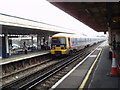
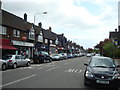
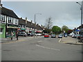
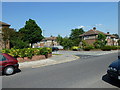
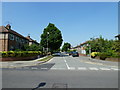
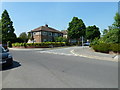
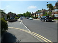
Photos of BR5 1LR
Area Information
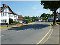
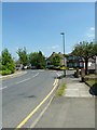
BR5 1LR is a small residential cluster in the London Borough of Bromley, part of the Petts Wood and Knoll Ward. With a population of 1665, it retains a semi-rural character shaped by its 1920s development as a garden suburb. The area sits south of Chislehurst and west of St Paul’s Cray, surrounded by woodland preserved by the National Trust. Its layout reflects inter-war housing design, with larger homes to the east of the railway and smaller, denser properties to the west. This makes it a commuter-friendly suburb close to central London, with easy access to rail and tram networks. The presence of Petts Wood and Hawkwood, over 300 acres of managed woodland, adds a green dimension to daily life. Residents benefit from a mix of historical features, including the Daylight Inn and a sundial memorial to William Willett, the inventor of Daylight Saving Time. The area’s compact size and preserved natural spaces create a distinct balance between suburban convenience and rural tranquillity.
- Area Type
- Postcode
- Area Size
- Not available
- Population
- Not available
- Population Density
- Not available
BR5 1LR is predominantly an owner-occupied area, with 74% of homes owned by residents rather than rented. The accommodation type is largely houses, reflecting the suburb’s 1920s garden design. This mix of larger and smaller homes caters to different household needs, though the small postcode area means the housing stock is limited. The high home ownership rate indicates a stable market, with properties likely retaining value due to their historical and environmental appeal. Buyers should consider the area’s proximity to London’s transport networks, which enhances its appeal for commuters. However, the limited number of properties means competition could be fierce, particularly for homes near the preserved woodland areas. The focus on houses rather than flats suggests a preference for private, spacious living, aligning with the area’s semi-rural character.
House Prices in BR5 1LR
No properties found in this postcode.
Energy Efficiency in BR5 1LR
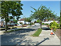
Living in BR5 1LR offers a blend of suburban convenience and natural beauty. Nearby amenities include retail options such as Sainsburys Petts Wood, Iceland Petts, and Cook Petts, providing everyday shopping needs. The area’s rail and metro stations connect residents to broader networks, while Biggin Hill Airport adds regional travel flexibility. The preserved Petts Wood and Hawkwood woodlands offer walking and leisure opportunities, managed by the National Trust. Historic sites like the Daylight Inn and the William Willett sundial add cultural depth. The semi-rural setting, combined with practical amenities, creates a lifestyle that balances green space with easy access to urban services. The presence of listed buildings and protected woodlands ensures a unique character, making daily life both functional and enriched by heritage and nature.
Amenities
Schools
| Rank | School | Type | Entry gender | Ages |
|---|
Explore more schools in this area
Go to Schools tabDemographics
The population of BR5 1LR has a median age of 47, with the majority aged between 30 and 64. This suggests a community of established professionals and families. Home ownership is high at 74%, with houses being the predominant accommodation type. The predominant ethnic group is White, though specific diversity statistics are not detailed. The age profile indicates a stable, mature demographic, likely with strong ties to the area. The absence of significant deprivation data implies a relatively consistent quality of life, though the lack of detailed diversity metrics means the community’s full composition remains unexplored. The age range and home ownership figures suggest a settled, long-term resident base with a focus on family-oriented living.
Household Size
Accommodation Type
Tenure
Ethnic Group
Religion
Household Composition
Age
Household Deprivation
NS-SEC
Explore more demographic insights in this area
Go to Demographics tabPlanning
Planning Constraints
- Flood RiskPremium
- Ramsar Wetland SitesPremium
- Area of Outstanding Natural BeautyPremium
- Protected Nature ReservePremium
- Protected WoodlandPremium