Area Overview for BR5 1FB
Photos of BR5 1FB

Area Information
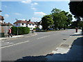
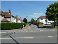
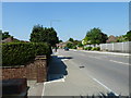
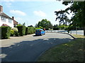
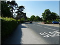
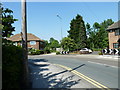
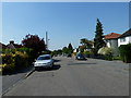
BR5 1FB is a small residential cluster in the London Borough of Bromley, characterised by its semi-rural charm and inter-war architectural heritage. With a population of 1,640, it is a quiet suburb developed in the 1920s and 1930s as a garden suburb for London commuters. The area is defined by its preserved woodland, including Petts Wood and Hawkwood, managed by the National Trust. These spaces offer a rare blend of natural tranquillity and historical significance, such as the British Summer Time sundial commemorating William Willett. Residents benefit from proximity to central London via rail, with Petts Wood station serving the area since 1928. The suburb’s layout features large homes to the east of the railway and smaller, densely packed properties to the west, creating a quasi-rural environment. Its history as a commuter hub endures, with modern residents enjoying a balance of green spaces and practical connectivity. The area’s character is shaped by its origins as a high-quality garden suburb, offering a peaceful alternative to urban living while remaining within reach of London’s amenities.
- Area Type
- Postcode
- Area Size
- Not available
- Population
- 1640
- Population Density
- 4780 people/km²
BR5 1FB is a predominantly owner-occupied area, with 90% of homes owned by residents rather than rented. The accommodation type is largely houses, which is consistent with its status as a garden suburb developed for families. This housing stock suggests a focus on spacious, traditional properties, many of which were built in the 1920s and 1930s. The high home ownership rate indicates a stable market with limited rental activity, which may appeal to buyers seeking long-term investment or family homes. The area’s small size means the immediate surroundings are likely to mirror its characteristics, with similar housing types and ownership patterns. For buyers, this translates to a market where properties are likely to be well-maintained and in demand, given the area’s semi-rural appeal and proximity to London. The mix of larger homes east of the railway and smaller, denser properties to the west offers a range of options for different household needs.
House Prices in BR5 1FB
No properties found in this postcode.
Energy Efficiency in BR5 1FB
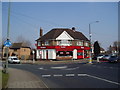
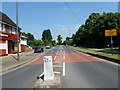
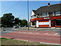
Living in BR5 1FB offers access to a range of amenities within practical reach. Retail options include Morrisons Daily, Waitrose Little Waitrose, and Morrisons Petts, providing everyday shopping convenience. The area’s transport network connects residents to nearby rail and metro stations, including Petts Wood and St Mary Cray, facilitating easy access to London and surrounding areas. The proximity to Petts Wood and Hawkwood woodlands, managed by the National Trust, offers recreational opportunities in a semi-rural setting. These spaces feature diverse tree species and historical landmarks, such as the British Summer Time sundial. The combination of retail, transport, and green spaces creates a balanced lifestyle, blending suburban tranquillity with practical connectivity. Residents can enjoy both the natural environment and the convenience of nearby amenities, making BR5 1FB appealing to those seeking a mix of nature and accessibility.
Amenities
Schools
| Rank | School | Type | Entry gender | Ages |
|---|
Explore more schools in this area
Go to Schools tabDemographics
The population of BR5 1FB is 1,640, with a median age of 47, indicating a mature demographic. The most common age range is adults aged 30–64, suggesting a stable community of established residents. Home ownership is exceptionally high at 90%, reflecting a strong preference for long-term residency. The area is predominantly composed of houses, aligning with its suburban character. The predominant ethnic group is White, which is typical for this part of south-east London. This demographic profile implies a community with a focus on family living and stability. The absence of specific data on deprivation or diversity metrics means the area’s social dynamics are not quantified, but the high home ownership and age distribution suggest a low turnover of residents and a cohesive local identity. The presence of inter-war housing also indicates a long-standing residential base, with properties likely to have been occupied by multiple generations.
Household Size
Accommodation Type
Tenure
Ethnic Group
Religion
Household Composition
Age
Household Deprivation
NS-SEC
Explore more demographic insights in this area
Go to Demographics tabPlanning
Planning Constraints
- Flood RiskPremium
- Ramsar Wetland SitesPremium
- Area of Outstanding Natural BeautyPremium
- Protected Nature ReservePremium
- Protected WoodlandPremium