Area Overview for BR4 0NP
Photos of BR4 0NP


Area Information
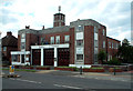
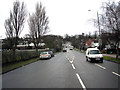
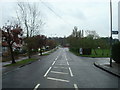
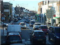
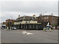
BR4 0NP lies within the West Wickham Ward of the London Borough of Bromley, a historically significant area with roots tracing back to Roman times. This small postcode area, home to 1,757 residents, is a quiet residential cluster nestled between Bromley town centre and the sprawling suburbs of south-east London. The area’s character is defined by its 1930s housing stock, creating a cohesive, suburban feel with a unified architectural identity. Despite modern developments, the High Street retains a mix of independent shops and local services, offering a blend of convenience and charm. West Wickham’s proximity to transport links—rail, metro, and nearby airports—makes it accessible to London’s broader network, while its historical ties to the Roman London to Lewes Way add a layer of intrigue. The area’s transition from village to suburb in the early 20th century is evident in its layout, with fields once transformed into housing. For those seeking a stable, family-oriented community with a touch of history, BR4 0NP provides a snapshot of London’s suburban evolution.
- Area Type
- Postcode
- Area Size
- Not available
- Population
- Not available
- Population Density
- Not available
BR4 0NP is a predominantly owner-occupied area, with 66% of residents living in their own homes. The housing stock is almost entirely composed of houses, reflecting the suburban development patterns of the 1930s. This contrasts with areas dominated by flats or rental properties, making BR4 0NP a niche market for buyers seeking family homes with long-term value. The high home ownership rate suggests a stable market with limited turnover, which can be advantageous for buyers looking for security in property investment. However, the small size of the postcode area means the housing options are limited to the immediate vicinity, requiring buyers to consider nearby suburbs for broader choices. The presence of 1930s housing also implies a need for maintenance, though the area’s low flood risk and absence of planning constraints make it attractive for those prioritising safety and development flexibility.
House Prices in BR4 0NP
No properties found in this postcode.
Energy Efficiency in BR4 0NP
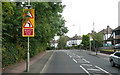
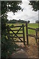
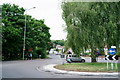
Living in BR4 0NP offers access to a range of amenities within practical reach. The High Street features independent shops, restaurants, and a library, while supermarkets like Sainsburys West and M&S West Wickham SF provide everyday convenience. Rail stations such as West Wickham and Eden Park connect residents to Bromley and beyond, with the Addington Village Tram Stop offering further local mobility. The area’s proximity to Biggin Hill Airport caters to frequent travellers. West Wickham Common, partially preserved by the Corporation of London, offers green space for leisure, though its reduced size compared to historical extents means it is not a major recreational hub. The character of the area is defined by its blend of suburban practicality and historical charm, with the High Street retaining a distinct identity despite modern developments. For residents, the balance of retail, transport, and limited green space creates a lifestyle that prioritises convenience and accessibility over expansive natural amenities.
Amenities
Schools
| Rank | School | Type | Entry gender | Ages |
|---|
Explore more schools in this area
Go to Schools tabDemographics
The population of BR4 0NP is 1,757, with a median age of 47, indicating a community skewed toward middle-aged and older residents. The most common age range is adults aged 30–64, suggesting a stable, established population with strong family ties. Home ownership rates are high at 66%, reflecting a preference for long-term residency over rental properties. The area is predominantly composed of houses, which aligns with the suburban character of West Wickham. The predominant ethnic group is White, though specific diversity metrics are not detailed in the data. This demographic profile implies a community with lower turnover, where residents are likely to have built careers and raised families. The absence of explicit deprivation data means the area’s quality of life can be inferred from its amenities and safety assessments, which suggest a balanced, low-risk environment for daily living.
Household Size
Accommodation Type
Tenure
Ethnic Group
Religion
Household Composition
Age
Household Deprivation
NS-SEC
Explore more demographic insights in this area
Go to Demographics tabPlanning
Planning Constraints
- Flood RiskPremium
- Ramsar Wetland SitesPremium
- Area of Outstanding Natural BeautyPremium
- Protected Nature ReservePremium
- Protected WoodlandPremium