Area Overview for BR4 0ES
Photos of BR4 0ES
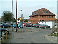
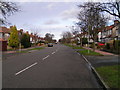
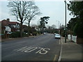
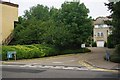
57 photos from this area
Area Information
Key information about the BR4 0ES including its size, population, and administrative classification.
- Area Type
- Postcode
- Area Size
- 1.6 hectares
- Population
- 1571
- Population Density
- 1816 people/km²
House Prices in BR4 0ES
28
Properties
£535,536
Average Sold Price
£98,500
Lowest Price
£890,000
Highest Price
Showing 28 properties
| Address | Type | Beds | Baths | Last Sale Price | Last Sale Date | |
|---|---|---|---|---|---|---|
| 8 Goodhart Way, West Wickham, BR4 0ES | house | - | - | £600,000 | Jul 2025 | |
| 56 Goodhart Way, West Wickham, BR4 0ES | Detached | 3 | 2 | £855,000 | Sep 2024 | |
| 54 Goodhart Way, West Wickham, BR4 0ES | Detached | 5 | 3 | £595,000 | May 2023 | |
| 46 Goodhart Way, West Wickham, BR4 0ES | house | 5 | 3 | £880,000 | Feb 2022 | |
| 40 Goodhart Way, West Wickham, BR4 0ES | house | - | - | £890,000 | Nov 2021 | |
| 16 Goodhart Way, West Wickham, BR4 0ES | house | - | - | £607,000 | Dec 2020 | |
| 22 Goodhart Way, West Wickham, BR4 0ES | house | - | - | £615,000 | Oct 2020 | |
| 62 Goodhart Way, West Wickham, BR4 0ES | house | - | - | £635,000 | Dec 2015 | |
| 4 Goodhart Way, West Wickham, BR4 0ES | house | - | - | £446,500 | Jun 2015 | |
| 58 Goodhart Way, West Wickham, BR4 0ES | Detached | 3 | 1 | £627,000 | Oct 2014 |
Page 1 of 3
Energy Efficiency in BR4 0ES
Amenities
Schools
| Rank | School | Type | Entry gender | Ages |
|---|
Explore more schools in this area
Go to Schools tabDemographics
Household Size
Family (3-5 people)
most common
Accommodation Type
Houses
most common
Tenure
88
majority
Ethnic Group
White
most common
Religion
N/A
most common
Household Composition
N/A
most common
Age
47
median
Adults (30-64 years)
most common
Household Deprivation
N/A
with no deprivation
NS-SEC
48
in Lower managerial occupations
Explore more demographic insights in this area
Go to Demographics tabPlanning
Planning Constraints
- Flood RiskPremium
- Ramsar Wetland SitesPremium
- Area of Outstanding Natural BeautyPremium
- Protected Nature ReservePremium
- Protected WoodlandPremium