Area Overview for BR3 4EL
Photos of BR3 4EL

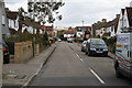
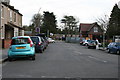
100 photos from this area
Area Information
Key information about the BR3 4EL including its size, population, and administrative classification.
- Area Type
- Postcode
- Area Size
- 2065 m²
- Population
- 1470
- Population Density
- 4515 people/km²
House Prices in BR3 4EL
9
Properties
£354,989
Average Sold Price
£187,000
Lowest Price
£537,000
Highest Price
Showing 9 properties
| Address | Type | Beds | Baths | Last Sale Price | Last Sale Date | |
|---|---|---|---|---|---|---|
| 159 Elmers End Road, Beckenham, BR3 4EL | Semi-detached | 3 | 2 | £537,000 | Oct 2023 | |
| 167 Elmers End Road, Beckenham, BR3 4EL | Terraced | 3 | 2 | £460,000 | May 2021 | |
| 169 Elmers End Road, Beckenham, BR3 4EL | house | - | - | £350,000 | Feb 2021 | |
| 153 Elmers End Road, Beckenham, BR3 4EL | house | - | - | £475,000 | Feb 2021 | |
| 165 Elmers End Road, Beckenham, BR3 4EL | Terraced | 3 | 2 | £454,000 | Aug 2019 | |
| 163 Elmers End Road, Beckenham, BR3 4EL | Terraced | 3 | - | £352,000 | Apr 2014 | |
| 157 Elmers End Road, Beckenham, BR3 4EL | Terraced | - | - | £187,000 | Apr 2001 | |
| 155 Elmers End Road, Beckenham, BR3 4EL | Terraced | - | - | £189,950 | Apr 2001 | |
| 161 Elmers End Road, Beckenham, BR3 4EL | Terraced | - | - | £189,950 | Aug 2000 |
Energy Efficiency in BR3 4EL
Amenities
Schools
| Rank | School | Type | Entry gender | Ages |
|---|
Explore more schools in this area
Go to Schools tabDemographics
Household Size
Family (3-5 people)
most common
Accommodation Type
Houses
most common
Tenure
77
majority
Ethnic Group
White
most common
Religion
N/A
most common
Household Composition
N/A
most common
Age
47
median
Adults (30-64 years)
most common
Household Deprivation
N/A
with no deprivation
NS-SEC
45
in Lower managerial occupations
Explore more demographic insights in this area
Go to Demographics tabPlanning
Planning Constraints
- Flood RiskPremium
- Ramsar Wetland SitesPremium
- Area of Outstanding Natural BeautyPremium
- Protected Nature ReservePremium
- Protected WoodlandPremium