Area Overview for BR3 3PN
Photos of BR3 3PN
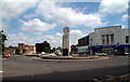
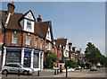
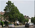
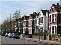
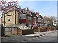
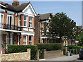
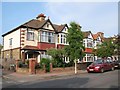
100 photos from this area
Area Information
Key information about the BR3 3PN including its size, population, and administrative classification.
- Area Type
- Postcode
- Area Size
- 4924 m²
- Population
- 1666
- Population Density
- 4527 people/km²
House Prices in BR3 3PN
34
Properties
£378,516
Average Sold Price
£78,500
Lowest Price
£650,000
Highest Price
Showing 34 properties
| Address | Type | Beds | Baths | Last Sale Price | Last Sale Date | |
|---|---|---|---|---|---|---|
| 2B Faversham Road, Beckenham, BR3 3PN | Flat | 1 | 1 | £272,500 | Aug 2025 | |
| 9 Faversham Road, Beckenham, BR3 3PN | Terraced | 2 | 1 | £512,750 | Jan 2025 | |
| 11 Faversham Road, Beckenham, BR3 3PN | Terraced | 2 | 1 | £450,000 | Aug 2024 | |
| 16 Faversham Road, Beckenham, BR3 3PN | Terraced | 2 | 1 | £459,335 | May 2024 | |
| 2A Faversham Road, Beckenham, BR3 3PN | Flat | 2 | 1 | £295,000 | Feb 2024 | |
| 26 Faversham Road, Beckenham, BR3 3PN | Terraced | 2 | 1 | £487,500 | Jul 2023 | |
| 24 Faversham Road, Beckenham, BR3 3PN | Terraced | 3 | 2 | £650,000 | Aug 2021 | |
| 8 Faversham Road, Beckenham, BR3 3PN | Terraced | 2 | 1 | £580,000 | Oct 2020 | |
| 20 Faversham Road, Beckenham, BR3 3PN | Terraced | 2 | 1 | £536,000 | Sep 2018 | |
| Alma Cottage, 13 Faversham Road, Beckenham, BR3 3PN | house | - | - | £505,000 | Oct 2017 |
Page 1 of 4
Energy Efficiency in BR3 3PN
Amenities
Schools
| Rank | School | Type | Entry gender | Ages |
|---|
Explore more schools in this area
Go to Schools tabDemographics
Household Size
Family (3-5 people)
most common
Accommodation Type
Houses
most common
Tenure
88
majority
Ethnic Group
White
most common
Religion
N/A
most common
Household Composition
N/A
most common
Age
47
median
Adults (30-64 years)
most common
Household Deprivation
N/A
with no deprivation
NS-SEC
50
in Lower managerial occupations
Explore more demographic insights in this area
Go to Demographics tabPlanning
Planning Constraints
- Flood RiskPremium
- Ramsar Wetland SitesPremium
- Area of Outstanding Natural BeautyPremium
- Protected Nature ReservePremium
- Protected WoodlandPremium