Area Overview for BR2 9LT
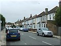
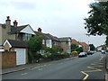
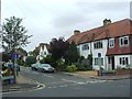
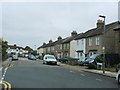
Photos of BR2 9LT
Area Information
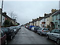
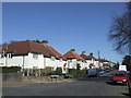
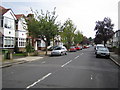
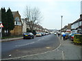
BR2 9LT sits within a small residential cluster defined by the BR2 postcode area in the London Borough of Bromley. This location covers 939 square metres and holds a population of 2,271 residents. You are looking at a specific plotted space that gives a population density of 2,418,003 people per square kilometre according to the data provided. This ward lies in the Holwood and Bromley Common area, situated approximately 9.5 miles southeast of Charing Cross. The history here goes back to the enclosure of Bromley Common in 1826, which turned former bishopric land into suburban housing. The arrival of the railway in 1858 catalysed rapid growth, transforming the settlement from an agrarian community to a residential district by the late nineteenth century. Today, the area preserves notable features such as Norman Park and Rookery Lane, remnants of the Norman family's historical influence on the local estates. Daily life in BR2 9LT is shaped by this layered history and modern convenience. The ward was first used in the 2022 elections, marking its formal status in local governance. You find yourself in a zone where Victorian developments meet twentieth-century buildings, separated by a southern green lung. Historically, this area shifted from farming uses like Hook Farm and Turpington Farm to a focus on residential living and commercial activity by 1924. The proximity to major transport hubs and shopping centres in Bromley defines the current rhythm of the neighbourhood. Residents benefit from the established infrastructure of Hastings Road and access to local colleges and independent facilities. The area offers a settled environment where you can observe the legacy of late nineteenth-century church building, with St. Luke's Church opening in 1887 to serve the rapidly expanding population.
- Area Type
- Postcode
- Area Size
- 939 m²
- Population
- 2271
- Population Density
- 6623 people/km²
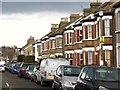
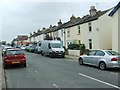
The property market in BR2 9LT is characterised by a significant level of private stability. Home ownership reaches 58% of the total population, establishing this as a predominantly owner-occupied area rather than a rental hub. This statistic suggests that the local housing stock has matured, with residents holding onto their properties over the long term. Flats are the main accommodation type found here, reflecting the historical development patterns of Bromley Common where density played a key role in urban expansion. You are likely to find a mix of properties that evolved from the Victorian boom following the 1858 railway opening to the more recent architectural styles of the twentieth century. For buyers looking at this small area, the high ownership rate means a market of motivated sellers rather than transient tenants. The presence of flats indicates a layout suiting smaller households or those preferring low-maintenance living within a compact footprint. The area's history of development, from the initial villas along Hastings Road to the dense cottage-style accommodation around Chatterton Road and Raglan Road, influences the current type of homes available. When you purchase a home here, you enter a market where investment and permanence are the guiding principles. The 58% ownership figure is a concrete indicator of community buy-in and residential security. This level of ownership often supports better local service retention and neighbourhood upkeep compared to areas with high rental turnover. You can expect a market driven by homeowners seeking to maintain their assets for their families.
House Prices in BR2 9LT
Showing 6 properties
| Address | Type | Beds | Baths | Last Sale Price | Last Sale Date | |
|---|---|---|---|---|---|---|
| 6, South Ridge, 33 Bromley Common, Bromley, BR2 9LT | Flat | 2 | 1 | - | - | |
| 4, South Ridge, 33 Bromley Common, Bromley, BR2 9LT | Flat | 2 | 1 | - | - | |
| 5, South Ridge, 33 Bromley Common, Bromley, BR2 9LT | Flat | 2 | 1 | - | - | |
| 1, South Ridge, 33 Bromley Common, Bromley, BR2 9LT | Flat | - | - | - | - | |
| 2, South Ridge, 33 Bromley Common, Bromley, BR2 9LT | Flat | - | - | - | - | |
| 3, South Ridge, 33 Bromley Common, Bromley, BR2 9LT | Flat | - | - | - | - |
Energy Efficiency in BR2 9LT
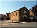
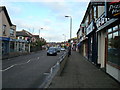
Your lifestyle in BR2 9LT is defined by immediate access to essential amenities and historic landmarks. Retail convenience is high with five key shops within walking distance. You can shop at Co-op Bromley and Waitrose Bromley for groceries and household goods. Tesco Bromley is also available for larger weekly shopping trips. These stores are clustered to ensure you do not need to travel far for daily necessities. Transport options are equally diverse, featuring five stations across rail and metro networks. You can catch the tube at Beckenham Road Tram Stop or the train at Bromley South Station. Leisure and green space are woven into the fabric of this ward. Norman Park and Rookery Lane provide local recreation areas for exercise or relaxation. St. Luke's Church, opened in 1887, and Holy Trinity Church, built in 1839, add cultural and community depth to the neighbourhood. The southern part of the common acts as a green lung, offering open space between the Victorian and modern developments. The area also hosts Biggin Hill Airport and London Biggin Hill Airport, which occasionally hosts community aviation events. Schools like Clark's College and the various Ravensbourne branches contribute to a lively local calendar. You live in a blend of Victorian history and modern convenience. The Hastings Road and the history of the Norman family estates provide a backdrop to your day-to-day life. This mixture of old and new creates a balanced environment for families and individuals alike.
Amenities
Schools
Living in BR2 9LT places you within easy reach of a diverse range of educational institutions. The nearest schools listed include several primary options and specialist facilities. The Ravensbourne School for Girls and The Ravensbourne School serve as primary education providers for younger children in the vicinity. These schools offer structured learning environments for students entering the formal education system. You also have access to the Ravensbourne School for Boys, completing the trio of primary institutions in your immediate local network. Beyond the state sector, Clark's College operates as an independent school, offering an alternative educational path for families seeking private education for their children. The Bromley Pupil Referral Service is another notable institution nearby, operating as a unique educational pathway for students with specific needs. This mixture of schools means you have choices ranging from state primary education to independent schooling and specialist support. Families in BR2 9LT benefit from having multiple options within a short distance. The presence of both boys' and girls' schools caters to different academic preferences or social structures some parents prefer. For those without older children, the primary focus remains on these educational providers rather than secondary options. The variety ensures that if you are considering this area for a home, you will find educational infrastructure designed to support children through their early schooling years.
| Rank | School | Type | Entry gender | Ages |
|---|
Explore more schools in this area
Go to Schools tabDemographics
The community in BR2 9LT reflects a mature and established settlement. The median age for residents is 47 years, indicating a population dominated by adults between the ages of 30 and 64 years. This age profile suggests a neighbourhood populated by parents, families with grown children, and individuals in the middle to later stages of their careers. Home ownership stands at 58%, meaning more than half of the homes in this postcode are privately owned rather than rented. This figure indicates a stable community where long-term residents are a significant majority. The predominant ethnic group is White, which shapes the cultural character of the local shops and community events. Flats are the primary form of accommodation type identified in the data for this area. You are living in a demographic environment where stability is the norm. The high percentage of home owners often correlates with families who have anchored themselves in the area for many years. The age range of 30 to 64 years covers the bulk of the workforce and child-rearing years, suggesting strong demand for schools and family-friendly amenities. The accommodation type of flats aligns with the urban density of Bromley Common, offering a different living experience than detached houses found elsewhere in the borough. With a population of 2,271 people spread across this small footprint, you have a closely knit community. The demographics show a clear focus on adult life stages rather than teen populations or retirees. This balance creates a quiet atmosphere suitable for families seeking a settled neighbourhood without the transient feel of a student area or high-rise council estate. The data confirms a straightforward, owner-occupied demographic structure typical of historic London suburbs.
Household Size
Accommodation Type
Tenure
Ethnic Group
Religion
Household Composition
Age
Household Deprivation
NS-SEC
Explore more demographic insights in this area
Go to Demographics tabPlanning
Planning Constraints
- Flood RiskPremium
- Ramsar Wetland SitesPremium
- Area of Outstanding Natural BeautyPremium
- Protected Nature ReservePremium
- Protected WoodlandPremium