Area Overview for BR2 8LJ
Photos of BR2 8LJ
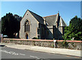
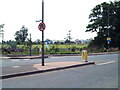
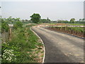
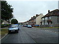
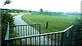
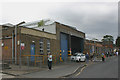
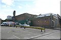
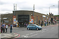
85 photos from this area
Area Information
Key information about the BR2 8LJ including its size, population, and administrative classification.
- Area Type
- Postcode
- Area Size
- 1.1 hectares
- Population
- 1663
- Population Density
- 2099 people/km²
House Prices in BR2 8LJ
35
Properties
£409,365
Average Sold Price
£245,000
Lowest Price
£810,000
Highest Price
Showing 35 properties
| Address | Type | Beds | Baths | Last Sale Price | Last Sale Date | |
|---|---|---|---|---|---|---|
| 52 Lower Gravel Road, Bromley, BR2 8LJ | Detached | 3 | 1 | £524,000 | Dec 2025 | |
| 92 Lower Gravel Road, Bromley, BR2 8LJ | Detached | 5 | 2 | £810,000 | Aug 2025 | |
| 72 Lower Gravel Road, Bromley, BR2 8LJ | Terraced | 2 | 1 | £505,000 | Mar 2025 | |
| 96 Lower Gravel Road, Bromley, BR2 8LJ | Semi-detached | 4 | 3 | £695,000 | Aug 2022 | |
| 90 Lower Gravel Road, Bromley, BR2 8LJ | house | - | - | £687,000 | Jun 2021 | |
| 88 Lower Gravel Road, Bromley, BR2 8LJ | Semi-detached | 5 | 3 | £600,000 | Jun 2021 | |
| 80 Lower Gravel Road, Bromley, BR2 8LJ | house | - | - | £475,000 | Oct 2020 | |
| 66 Lower Gravel Road, Bromley, BR2 8LJ | Terraced | 3 | 1 | £422,000 | Sep 2020 | |
| 70 Lower Gravel Road, Bromley, BR2 8LJ | house | - | - | £300,000 | Apr 2020 | |
| 98 Lower Gravel Road, Bromley, BR2 8LJ | Detached | 3 | 2 | £680,000 | Mar 2020 |
Page 1 of 4
Energy Efficiency in BR2 8LJ
Amenities
Schools
| Rank | School | Type | Entry gender | Ages |
|---|
Explore more schools in this area
Go to Schools tabDemographics
Household Size
Family (3-5 people)
most common
Accommodation Type
Houses
most common
Tenure
78
majority
Ethnic Group
White
most common
Religion
N/A
most common
Household Composition
N/A
most common
Age
47
median
Adults (30-64 years)
most common
Household Deprivation
N/A
with no deprivation
NS-SEC
40
in Lower managerial occupations
Explore more demographic insights in this area
Go to Demographics tabPlanning
Planning Constraints
- Flood RiskPremium
- Ramsar Wetland SitesPremium
- Area of Outstanding Natural BeautyPremium
- Protected Nature ReservePremium
- Protected WoodlandPremium