Area Overview for BR2 8LB
Photos of BR2 8LB
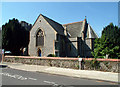
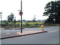
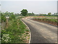
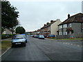
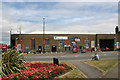
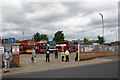
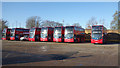
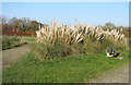
85 photos from this area
Area Information
Key information about the BR2 8LB including its size, population, and administrative classification.
- Area Type
- Postcode
- Area Size
- 2.4 hectares
- Population
- 1859
- Population Density
- 2230 people/km²
House Prices in BR2 8LB
15
Properties
£321,000
Average Sold Price
£118,000
Lowest Price
£575,000
Highest Price
Showing 15 properties
| Address | Type | Beds | Baths | Last Sale Price | Last Sale Date | |
|---|---|---|---|---|---|---|
| 28 Church Lane, Bromley, BR2 8LB | Semi-detached | 3 | 1 | £575,000 | Jun 2025 | |
| 24 Church Lane, Bromley, BR2 8LB | house | - | - | £530,000 | Jan 2022 | |
| 12 Church Lane, Bromley, BR2 8LB | Semi-detached | 3 | 1 | £465,000 | Apr 2016 | |
| 20 Church Lane, Bromley, BR2 8LB | house | - | - | £295,000 | Jan 2013 | |
| 18 Church Lane, Bromley, BR2 8LB | house | - | - | £335,000 | Aug 2012 | |
| 10 Church Lane, Bromley, BR2 8LB | Semi-detached | - | - | £130,000 | Jul 1999 | |
| 8 Church Lane, Bromley, BR2 8LB | Semi-detached | - | - | £120,000 | Nov 1998 | |
| 14 Church Lane, Bromley, BR2 8LB | Semi-detached | 4 | 2 | £118,000 | Aug 1997 | |
| Holy Trinity Church Rooms, Church Lane, Bromley, BR2 8LB | commercial | - | - | - | - | |
| 26 Church Lane, Bromley, BR2 8LB | Semi-detached | - | - | - | - |
Page 1 of 2
Energy Efficiency in BR2 8LB
Amenities
Schools
| Rank | School | Type | Entry gender | Ages |
|---|
Explore more schools in this area
Go to Schools tabDemographics
Household Size
Family (3-5 people)
most common
Accommodation Type
Houses
most common
Tenure
78
majority
Ethnic Group
White
most common
Religion
N/A
most common
Household Composition
N/A
most common
Age
47
median
Adults (30-64 years)
most common
Household Deprivation
N/A
with no deprivation
NS-SEC
39
in Lower managerial occupations
Explore more demographic insights in this area
Go to Demographics tabPlanning
Planning Constraints
- Flood RiskPremium
- Ramsar Wetland SitesPremium
- Area of Outstanding Natural BeautyPremium
- Protected Nature ReservePremium
- Protected WoodlandPremium