Area Overview for BR2 8EB
Photos of BR2 8EB
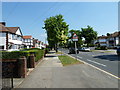
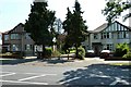
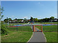
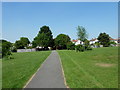
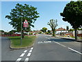
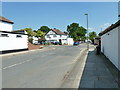
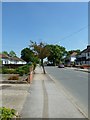
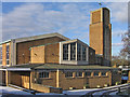
79 photos from this area
Area Information
Key information about the BR2 8EB including its size, population, and administrative classification.
- Area Type
- Postcode
- Area Size
- 8088 m²
- Population
- 1681
- Population Density
- 5265 people/km²
House Prices in BR2 8EB
14
Properties
£290,611
Average Sold Price
£78,000
Lowest Price
£525,000
Highest Price
Showing 14 properties
| Address | Type | Beds | Baths | Last Sale Price | Last Sale Date | |
|---|---|---|---|---|---|---|
| 64 Lovelace Avenue, Bromley, BR2 8EB | Terraced | 3 | 1 | £525,000 | Apr 2023 | |
| 66 Lovelace Avenue, Bromley, BR2 8EB | Terraced | 3 | 1 | £470,000 | Sep 2022 | |
| 42 Lovelace Avenue, Bromley, BR2 8EB | Semi-detached | 3 | 1 | £509,000 | Jul 2022 | |
| 44 Lovelace Avenue, Bromley, BR2 8EB | Semi-detached | - | - | £335,000 | Apr 2016 | |
| 60 Lovelace Avenue, Bromley, BR2 8EB | Semi-detached | - | - | £231,000 | Jul 2007 | |
| 58 Lovelace Avenue, Bromley, BR2 8EB | Semi-detached | - | - | £198,000 | Jun 2006 | |
| 46 Lovelace Avenue, Bromley, BR2 8EB | Terraced | - | - | £155,500 | Jul 2002 | |
| 56 Lovelace Avenue, Bromley, BR2 8EB | Semi-detached | - | - | £114,000 | Jul 2001 | |
| 54 Lovelace Avenue, Bromley, BR2 8EB | house | - | - | £78,000 | Feb 1997 | |
| 62 Lovelace Avenue, Bromley, BR2 8EB | Terraced | - | - | - | - |
Page 1 of 2
Energy Efficiency in BR2 8EB
Amenities
Schools
| Rank | School | Type | Entry gender | Ages |
|---|
Explore more schools in this area
Go to Schools tabDemographics
Household Size
Family (3-5 people)
most common
Accommodation Type
Houses
most common
Tenure
67
majority
Ethnic Group
White
most common
Religion
N/A
most common
Household Composition
N/A
most common
Age
47
median
Adults (30-64 years)
most common
Household Deprivation
N/A
with no deprivation
NS-SEC
37
in Lower managerial occupations
Explore more demographic insights in this area
Go to Demographics tabPlanning
Planning Constraints
- Flood RiskPremium
- Ramsar Wetland SitesPremium
- Area of Outstanding Natural BeautyPremium
- Protected Nature ReservePremium
- Protected WoodlandPremium