Area Overview for BR2 8DN
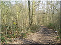
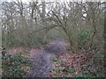
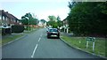
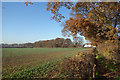
Photos of BR2 8DN


Area Information
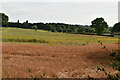
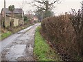
BR2 8DN represents a specific residential cluster within the Bromley Common and Holwood Ward, sitting approximately 15 kilometres southeast of Charing Cross. This 5-hectare neighbourhood accommodates a population of 1663 people, creating a tightly knit community with a population density of 33,157 people per square kilometre. The area emerged from a history that began with common land owned by the Bishops of Rochester, later transforming after the enclosure act of 1826. The arrival of the railway in 1858 catalysed rapid suburban development, shifting the local economy from agrarian roots to a residential focus. While the wider area once saw dramatic population growth exceeding 27,000 residents by 1901, BR2 8DN now hosts a stable, mature settlement. Residents in this postcode live within the boundary that historically separated northern and southern Bromley parish settlements. Daily life here is defined by proximity to landmarks such as St. Luke's Church, which opened in 1887, and Norman Park, a reminder of the Norman family's historical influence over the Rookery estate. Living in BR2 8DN offers access to both Victorian and twentieth-century developments, while the southern part of the common provides a green lung that separates older housing from newer building to the east and south. The area functions as a established part of Greater London, balancing historical character with modern suburban convenience.
- Area Type
- Postcode
- Area Size
- 5.0 hectares
- Population
- 1663
- Population Density
- 2099 people/km²
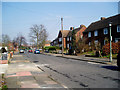
Homes in BR2 8DN form an overwhelmingly owner-occupied market. With 78% of properties owned outright or with a mortgage, this is not a rental-heavy district. The accommodation type is exclusively houses, meaning properties consist of detached, semi-detached, or terraced dwellings typical of suburban sprawl post-1858. This homogeneity suggests a market where buyers are looking for family-sized properties with gardens or private outdoor space rather than compact urban flats. The high home ownership rate indicates that most residents have a financial stake in the specific state of their homes and the long-term value of their neighbourhood. For buyers researching the area, the stock is likely to feature Victorian cottage-style accommodation, particularly in sections developed after 1870, as well as twentieth-century builds in the southern sections where development was slower due to the Norman family's influence. The small area size of 5 hectares limits the sheer volume of properties available but increases the desirability of each specific address due to scarcity. Residents are less likely to face the churn of short-term tenancies, leading to greater investment in property maintenance and local upkeep. This stability makes BR2 8DN an attractive option for those seeking to buy a home with long-term potential rather than a speculative investment.
House Prices in BR2 8DN
Showing 27 properties
| Address | Type | Beds | Baths | Last Sale Price | Last Sale Date | |
|---|---|---|---|---|---|---|
| 101 Whitebeam Avenue, Bromley, BR2 8DN | Terraced | 3 | 1 | £520,000 | Aug 2024 | |
| 105 Whitebeam Avenue, Bromley, BR2 8DN | Terraced | 3 | 1 | £470,000 | Mar 2023 | |
| 111 Whitebeam Avenue, Bromley, BR2 8DN | house | - | - | £475,000 | Aug 2022 | |
| 91 Whitebeam Avenue, Bromley, BR2 8DN | house | - | - | £390,000 | Feb 2021 | |
| 61 Whitebeam Avenue, Bromley, BR2 8DN | Semi-detached | 3 | 1 | £430,000 | Feb 2020 | |
| 93 Whitebeam Avenue, Bromley, BR2 8DN | Terraced | 5 | 2 | £480,000 | Jul 2018 | |
| 89 Whitebeam Avenue, Bromley, BR2 8DN | house | - | - | £120,312 | Nov 2013 | |
| 73 Whitebeam Avenue, Bromley, BR2 8DN | house | - | - | £250,000 | Sep 2013 | |
| 81 Whitebeam Avenue, Bromley, BR2 8DN | Terraced | - | - | £262,000 | Jun 2007 | |
| 83 Whitebeam Avenue, Bromley, BR2 8DN | house | - | - | £98,766 | Jun 2003 |
Energy Efficiency in BR2 8DN
Living in BR2 8DN provides convenient access to a variety of retail, leisure, and transport amenities within easy reach. Residents have five notable shopping options nearby, with Budgens Southborough, Lidl Locksbottom, and Morrisons Daily offering daily groceries and household necessities. The area is well-served by public transport, boasting five railway stations and five tram stops to facilitate travel to London and Kent. For those interested in leisure, Biggin Hill Airport and London Biggin Hill Airport provide access to aviation experiences and local events. The lifestyle here balances suburban convenience with proximity to historic landmarks like St. Luke's Church and Norman Park. The Hastings Road serves as the historical backbone of the area, providing a route to Hastings Road shops and services. The southern part of the common offers open space, functioning as a green lung between Victorian developments and more modern estates. Residents do not need to travel far for daily essentials, as the cluster of amenities ensures that food, shopping, and public transport are available without extensive journey planning. This integration of retail and transport hubs makes the postcode a practical choice for families who value infrastructure as much as housing.
Amenities
Schools
| Rank | School | Type | Entry gender | Ages |
|---|
Explore more schools in this area
Go to Schools tabDemographics
The community in BR2 8DN is defined by a stable, older demographic profile. The median age stands at 47 years, with the most common age range falling between 30 and 64 years. This concentration of adults indicates a neighbourhood dominated by established families and professionals rather than young singles or students. Home ownership is exceptionally high at 78%, suggesting that the vast majority of residents have purchased their properties rather than renting. This high level of tenure stability typically correlates with a quieter, more settled environment where residents have long-term roots in the area. The predominant ethnic group is White, reflecting the historical development patterns of the Bromley Common district. Accommodation in BR2 8DN consists primarily of houses, reinforcing the character of a traditional suburban street rather than a high-density block of flats. With a population of 1663, the area feels manageable and intimate yet remains connected to the wider infrastructure of the London Borough of Bromley. The lack of significant transient populations or large student cohorts creates a predictable lifestyle where neighbours know one another and local schools serve consistent cohorts directly from the immediate vicinity.
Household Size
Accommodation Type
Tenure
Ethnic Group
Religion
Household Composition
Age
Household Deprivation
NS-SEC
Explore more demographic insights in this area
Go to Demographics tabPlanning
Planning Constraints
- Flood RiskPremium
- Ramsar Wetland SitesPremium
- Area of Outstanding Natural BeautyPremium
- Protected Nature ReservePremium
- Protected WoodlandPremium