Area Overview for BR2 8BT
Photos of BR2 8BT
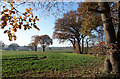
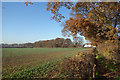
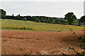
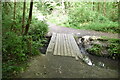
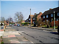
43 photos from this area
Area Information
Key information about the BR2 8BT including its size, population, and administrative classification.
- Area Type
- Postcode
- Area Size
- 16.5 hectares
- Population
- 1935
- Population Density
- 2222 people/km²
House Prices in BR2 8BT
38
Properties
£267,656
Average Sold Price
£76,800
Lowest Price
£560,000
Highest Price
Showing 38 properties
| Address | Type | Beds | Baths | Last Sale Price | Last Sale Date | |
|---|---|---|---|---|---|---|
| 95 Faringdon Avenue, Bromley, BR2 8BT | Terraced | 3 | 2 | £560,000 | Oct 2024 | |
| 109 Faringdon Avenue, Bromley, BR2 8BT | house | 3 | 1 | £495,000 | Apr 2022 | |
| 99 Faringdon Avenue, Bromley, BR2 8BT | house | - | - | £400,000 | Oct 2021 | |
| 115 Faringdon Avenue, Bromley, BR2 8BT | Semi-detached | 3 | 1 | £379,000 | Oct 2020 | |
| 75 Faringdon Avenue, Bromley, BR2 8BT | Terraced | 3 | - | £390,000 | Jun 2020 | |
| 97 Faringdon Avenue, Bromley, BR2 8BT | Semi-detached | 3 | - | £377,500 | Sep 2014 | |
| 101 Faringdon Avenue, Bromley, BR2 8BT | Semi-detached | 3 | 1 | £286,000 | Jan 2014 | |
| 103 Faringdon Avenue, Bromley, BR2 8BT | house | - | - | £257,000 | Oct 2011 | |
| 113 Faringdon Avenue, Bromley, BR2 8BT | house | 3 | - | £270,000 | Feb 2011 | |
| 123 Faringdon Avenue, Bromley, BR2 8BT | house | - | - | £204,000 | Feb 2009 |
Page 1 of 4
Energy Efficiency in BR2 8BT
Amenities
Schools
| Rank | School | Type | Entry gender | Ages |
|---|
Explore more schools in this area
Go to Schools tabDemographics
Household Size
Family (3-5 people)
most common
Accommodation Type
Houses
most common
Tenure
91
majority
Ethnic Group
White
most common
Religion
N/A
most common
Household Composition
N/A
most common
Age
47
median
Adults (30-64 years)
most common
Household Deprivation
N/A
with no deprivation
NS-SEC
48
in Lower managerial occupations
Explore more demographic insights in this area
Go to Demographics tabPlanning
Planning Constraints
- Flood RiskPremium
- Ramsar Wetland SitesPremium
- Area of Outstanding Natural BeautyPremium
- Protected Nature ReservePremium
- Protected WoodlandPremium