Area Overview for BR2 8BJ
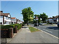
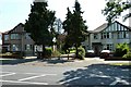
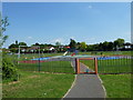
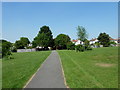
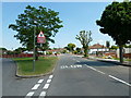
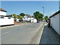
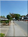
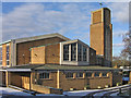
Photos of BR2 8BJ
Area Information
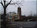
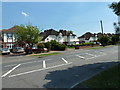
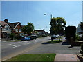
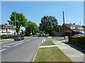
Living in BR2 8BJ means residing within the Bromley Common and Holwood ward, a distinct residential cluster situated approximately 9.5 miles southeast of Charing Cross. This postcode covers a small residential cluster spanning 1.9 hectares, supporting a population of 1681 people. The area represents a mature community where daily life is shaped by its proximity to the historical Bromley Common area. Originally an extensive piece of land owned by the Bishops of Rochester, the land was enclosed by Act of Parliament in 1826 before the railway arrived in 1858 to drive rapid suburban development. Today, the ward encompasses parts of the northern and southern settlements that once straddled the Hastings Road. Residents enjoy a stable environment characterised by a significant proportion of owner-occupiers. The area serves as a home to those who value a established neighbourhood with deep historical roots dating back to the Victorian era. Churches such as St. Luke's, which opened in 1887, and Holy Trinity Church, built in 1839, form part of the local heritage. Living in BR2 8BJ offers access to the green lung that remains between the older Victorian developments to the north and twentieth-century buildings to the east. The community is close to practical transport links, including three stations: Petts Wood, Bickley, and Chislehurst, alongside tram stops like Fieldway and King Henry's Drive. This location provides residents with a balance of suburban quiet and connectivity to the wider London borough of Bromley.
- Area Type
- Postcode
- Area Size
- 1.9 hectares
- Population
- 1681
- Population Density
- 5265 people/km²
The property market in BR2 8BJ is characterised by a strong preference for owner-occupation. A 67 per cent home ownership rate signals that the majority of properties in this postcode are in the hands of residents rather than landlords. This statistic indicates a stable rental market with low turnover, suitable for buyers seeking a permanent residence rather than a short-term let. The accommodation type data confirms that Houses predominate within the area. This housing stock typically appeals to families and adults seeking detached or semi-detached living away from the density of central London. Homes in BR2 8BJ are situated within a specific residential cluster that, despite its small size of 1.9 hectares, supports a diverse range of domestic needs. The nature of the local building stock is influenced by the area's history, which saw rapid development following the arrival of the railway in 1858. Properties range from Victorian cottages around Chatterton Road and Raglan Road to more modern developments in the southern sections. The high ownership rate means that selling a property may involve dealing with owners who have a long history in the locality. For buyers looking at this small area and its immediate surroundings, the market reflects a community where residents have chosen to settle permanently. This environment fosters stable neighbourhoods where homes are often passed down or held for decades, creating a consistent property landscape for those studying the housing stock of the Bromley Common and Holwood ward.
House Prices in BR2 8BJ
Showing 23 properties
| Address | Type | Beds | Baths | Last Sale Price | Last Sale Date | |
|---|---|---|---|---|---|---|
| 35 Oxhawth Crescent, Bromley, BR2 8BJ | Semi-detached | 4 | 2 | £825,000 | Dec 2024 | |
| 31 Oxhawth Crescent, Bromley, BR2 8BJ | Bungalow | - | - | £630,000 | Sep 2022 | |
| 11 Oxhawth Crescent, Bromley, BR2 8BJ | Retail | 3 | 1 | £590,000 | Mar 2022 | |
| 27 Oxhawth Crescent, Bromley, BR2 8BJ | Bungalow | - | - | £470,000 | Jun 2021 | |
| 39 Oxhawth Crescent, Bromley, BR2 8BJ | Bungalow | 2 | - | £562,500 | Mar 2021 | |
| 37 Oxhawth Crescent, Bromley, BR2 8BJ | Bungalow | 2 | 1 | £500,000 | Oct 2020 | |
| 15 Oxhawth Crescent, Bromley, BR2 8BJ | Semi-detached | 5 | 2 | £545,000 | Sep 2020 | |
| 19 Oxhawth Crescent, Bromley, BR2 8BJ | Bungalow | - | - | £490,000 | Sep 2019 | |
| 25 Oxhawth Crescent, Bromley, BR2 8BJ | Semi-detached | - | - | £300,000 | Jul 2010 | |
| 45 Oxhawth Crescent, Bromley, BR2 8BJ | Detached | - | - | £490,000 | Apr 2007 |
Energy Efficiency in BR2 8BJ
The lifestyle in BR2 8BJ is centred on convenient access to a variety of amenities within practical reach of residents. Retail options are well distributed, with five local shops available, including Budgens Southborough, Morrisons Petts, and Waitrose Little Waitrose. These venues provide daily necessities and shopping opportunities without the need for long trips. Transport enthusiasts note five nearby rail stations and five tram stops, creating a network of five key travel hubs around the area. For residents who value cultural and historical features, the area includes Norman Park and Rookery Lane, which serve as landmarks of the Norman family's historical influence. St. Luke's Church, established in 1887, and Holy Trinity Church, built in 1839, offer community focal points and architectural interest. The southern part of the common acts as a green lung, providing open space between the Victorian developments to the north and twentieth-century building to the south. Five notable airport facilities, including Biggin Hill Airport, lie within reasonable distance, highlighting the area's strategic location. Dining and leisure options are supported by the presence of significant retailers and transport links. Living in BR2 8BJ offers a balanced lifestyle where residents can walk to shops like Waitrose Little Waitrose or commute via tram stops like Addington Village Tram Stop. The combination of retail, green spaces, and transport makes this a practical choice for families and professionals.
Amenities
Schools
| Rank | School | Type | Entry gender | Ages |
|---|
Explore more schools in this area
Go to Schools tabDemographics
The community in BR2 8BJ is defined by a stable, adult-focused population profile. The median age stands at 47 years, reflecting a demographic where Adults between the ages of 30 and 64 represent the most common age range. This suggests a neighbourhood settled by families, established couples, and professionals rather than transient young residents. Socially, the predominant ethnic group is White, creating a homogenous community fabric. More than two-thirds of residents own their homes outright, with home ownership reaching 67 per cent. This high rate indicates a community composed largely of long-term residents who have invested in the local property market. The local housing stock is dominated by Houses, aligning with the demographic of established families and those seeking permanence in this specific postcode area. The high level of ownership suggests that many residents have lived in their properties for considerable periods, contributing to a sense of local stability. While specific data on deprivation is not included in the current analysis, the demographic structure points towards a secure living environment. The population density is noted at 86,818 people per square kilometre, a figure that reflects the compact nature of the 1.9-hectare cluster. Residents here benefit from a close-knit atmosphere where the most common age group shapes the local culture, community events, and demand for services like schools near BR2 8BJ.
Household Size
Accommodation Type
Tenure
Ethnic Group
Religion
Household Composition
Age
Household Deprivation
NS-SEC
Explore more demographic insights in this area
Go to Demographics tabPlanning
Planning Constraints
- Flood RiskPremium
- Ramsar Wetland SitesPremium
- Area of Outstanding Natural BeautyPremium
- Protected Nature ReservePremium
- Protected WoodlandPremium