Area Overview for BR2 7RB
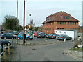
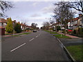
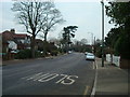
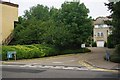
Photos of BR2 7RB
Area Information
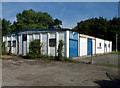
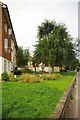
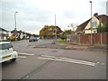
BR2 7RB is a small residential postcode in the London Borough of Bromley, encompassing parts of Hayes and Coney Hall. With a population of 1,815, it reflects a suburban character shaped by 1930s inter-war housing developments on former farmland. The area’s architecture includes two-storey homes with polygonal bay windows and half-timbered gables, centred around Glebe Road and Coney Hall roundabout. Historically, Hayes was an ancient parish dating to 1177, and notable figures like the Pitt family once resided there. Today, it balances traditional charm with modern convenience, offering proximity to rail, tram, and retail hubs. The postcode’s compact size means residents enjoy a tight-knit community feel, with amenities like Iceland Hayes and Sainsburys within walking distance. Its location, 11 miles south-east of Charing Cross, positions it as a quieter alternative to central London, yet within reach of major transport routes. For those seeking a stable, family-oriented environment with historical roots, BR2 7RB provides a blend of heritage and practicality.
- Area Type
- Postcode
- Area Size
- Not available
- Population
- 1815
- Population Density
- 4915 people/km²
BR2 7RB is overwhelmingly an owner-occupied area, with 96% of homes privately owned. This high rate of home ownership suggests a stable market with limited rental activity, which can be advantageous for buyers seeking long-term investment or family housing. The accommodation type is predominantly houses, reflecting a suburban character with traditional, two-storey properties. These homes, often built in the 1930s, feature architectural elements like polygonal bay windows and half-timbered gables, which may appeal to buyers valuing historical charm. The compact nature of the postcode means the housing stock is concentrated, with limited scope for new developments. For buyers, this implies a focus on existing properties rather than speculative growth. The area’s proximity to transport links and amenities also enhances its appeal as a practical, family-friendly location.
House Prices in BR2 7RB
No properties found in this postcode.
Energy Efficiency in BR2 7RB
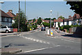
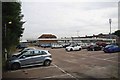
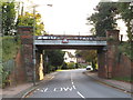
Living in BR2 7RB offers a mix of practical amenities and suburban convenience. Nearby retail options include Iceland Hayes, Sainsburys Station, and Morrisons Daily Hayes, providing essential shopping within walking distance. The area’s transport links are robust, with rail stations like Hayes and West Wickham, plus tram stops such as King Henry’s Drive, ensuring easy access to Bromley and London. For leisure, the proximity to Biggin Hill Airport and historic sites like Baston Manor and St Mary Cottages adds cultural and recreational value. The character of the area is defined by its 1930s architecture and quiet streets, offering a contrast to more urban settings. Residents can enjoy a balance of everyday necessities and low-density living, making it suitable for families or those seeking a stable, community-oriented environment.
Amenities
Schools
| Rank | School | Type | Entry gender | Ages |
|---|
Explore more schools in this area
Go to Schools tabDemographics
The population of BR2 7RB is predominantly adults aged 30–64, with a median age of 47. This suggests a mature, established community, likely with strong family ties and long-term residency. Home ownership is exceptionally high at 96%, indicating a stable housing market and a focus on private property rather than rental dwellings. The accommodation type is primarily houses, reflecting a suburban layout rather than high-density living. The predominant ethnic group is White, which aligns with broader trends in the London Borough of Bromley. While no specific data on deprivation is provided, the high home ownership and low crime risk (92/100) imply a relatively affluent and secure environment. The absence of detailed diversity metrics means the area’s social composition remains less defined in the data, but the demographic profile suggests a cohesive, long-settled population.
Household Size
Accommodation Type
Tenure
Ethnic Group
Religion
Household Composition
Age
Household Deprivation
NS-SEC
Explore more demographic insights in this area
Go to Demographics tabPlanning
Planning Constraints
- Flood RiskPremium
- Ramsar Wetland SitesPremium
- Area of Outstanding Natural BeautyPremium
- Protected Nature ReservePremium
- Protected WoodlandPremium