Area Overview for BR2 7DH
Photos of BR2 7DH
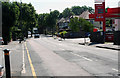
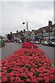
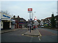
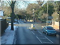

99 photos from this area
Area Information
Key information about the BR2 7DH including its size, population, and administrative classification.
- Area Type
- Postcode
- Area Size
- 1.4 hectares
- Population
- 1786
- Population Density
- 779 people/km²
House Prices in BR2 7DH
25
Properties
£525,163
Average Sold Price
£145,000
Lowest Price
£840,101
Highest Price
Showing 25 properties
| Address | Type | Beds | Baths | Last Sale Price | Last Sale Date | |
|---|---|---|---|---|---|---|
| 38 The Knoll, Hayes, Bromley, BR2 7DH | Semi-detached | - | - | £840,101 | Mar 2021 | |
| 36 The Knoll, Hayes, Bromley, BR2 7DH | house | - | - | £725,000 | Aug 2017 | |
| 2 The Knoll, Hayes, Bromley, BR2 7DH | house | 6 | - | £799,999 | Dec 2015 | |
| 6 The Knoll, Hayes, Bromley, BR2 7DH | Semi-detached | 3 | - | £670,000 | Sep 2014 | |
| 18 The Knoll, Hayes, Bromley, BR2 7DH | Semi-detached | 3 | - | £691,350 | Jul 2014 | |
| 42 The Knoll, Hayes, Bromley, BR2 7DH | house | 4 | - | £570,000 | Aug 2012 | |
| 12 The Knoll, Hayes, Bromley, BR2 7DH | Semi-detached | 3 | 2 | £485,000 | Aug 2011 | |
| 14 The Knoll, Hayes, Bromley, BR2 7DH | house | 4 | - | £510,500 | Sep 2010 | |
| 34 The Knoll, Hayes, Bromley, BR2 7DH | Semi-detached | - | - | £340,000 | Feb 2004 | |
| 16 The Knoll, Hayes, Bromley, BR2 7DH | Detached | - | - | £305,000 | Apr 2000 |
Page 1 of 3
Energy Efficiency in BR2 7DH
Amenities
Schools
| Rank | School | Type | Entry gender | Ages |
|---|
Explore more schools in this area
Go to Schools tabDemographics
Household Size
Family (3-5 people)
most common
Accommodation Type
Houses
most common
Tenure
78
majority
Ethnic Group
White
most common
Religion
N/A
most common
Household Composition
N/A
most common
Age
47
median
Adults (30-64 years)
most common
Household Deprivation
N/A
with no deprivation
NS-SEC
43
in Lower managerial occupations
Explore more demographic insights in this area
Go to Demographics tabPlanning
Planning Constraints
- Flood RiskPremium
- Ramsar Wetland SitesPremium
- Area of Outstanding Natural BeautyPremium
- Protected Nature ReservePremium
- Protected WoodlandPremium