Area Overview for BR2 6ZS
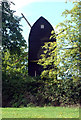
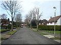
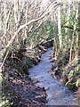
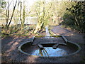
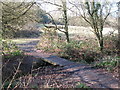
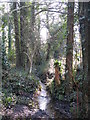
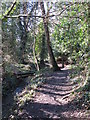
Photos of BR2 6ZS

Area Information
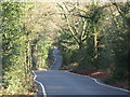
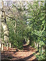
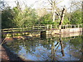
Living in BR2 6ZS offers a residential experience centred on the Bromley Common and Holwood Ward, located in the London Borough of Bromley approximately 9.5 miles southeast of Charing Cross. This specific postcode area covers a small residential cluster within a district that historically straddled the main route from Tunbridge Wells and Hastings to London. The historical development of the area, which transformed from an extensive piece of common land owned by the Bishops of Rochester into a rapidly growing suburb following the railway's arrival in 1858, has shaped its current character. Today, the ward encompasses significant open space known as a green lung, situated between Victorian developments to the north and twentieth-century buildings to the south. Normans Park and Rookery Lane remain notable features, serving as physical reminders of the Norman family's historical influence over the Rookery estate. Residents of this postal sector find themselves in a location where planning legislation changes later restricted large-scale building in some southern sections, resulting in a distinct密度 of housing. The population stands at 1,891, creating a neighbourhood where daily life is influenced by this mix of historical heritage, suburban growth, and preserved common land.
- Area Type
- Postcode
- Area Size
- Not available
- Population
- 1891
- Population Density
- 634 people/km²
The property market in BR2 6ZS is defined by a dominant stock of houses, reflecting the area's history as a site for both historic villas and rapid suburban cottage development after 1870. With 88% of dwellings in the cluster being owner-occupied, the area functions primarily as an owner-occupied market rather than a rental hub. This high ownership rate means that most transactions involve established owners, and the housing stock likely includes properties that have been in the same family for generations. Prospective buyers looking at homes in this postcode will find themselves negotiating in an environment where the Victorian and early twentieth-century architectural legacy is prominent. The accommodation type data confirms that flats or bedsits are rare compared to houses, making this location unsuitable for buyers seeking urban apartment living. Instead, the market caters to those seeking traditional suburban housing near the Hastings Road. The stability of the home ownership figures also implies lower vacancy rates, which can drive competitive pricing for the rare available properties. For investors, the high occupancy suggests resilience, but for family buyers, the focus remains on the specific houses available within this small residential cluster near Norman Park.
House Prices in BR2 6ZS
No properties found in this postcode.
Energy Efficiency in BR2 6ZS
Daily life in BR2 6ZS benefits from a practical network of amenities located within reach of residents. Retail options include five local venues, with notable providers such as Spar, Sainsburys in Locksbottom, and M&S Rosetta offering essential shopping and daily necessities. Transport links are extensive, featuring five railway stations including Hayes, Orpington, and Petts Wood, which facilitate travel to broader London destinations. The area is also served by two airport facilities, Biggin Hill Airport and London Biggin Hill Airport, alongside five metro tram stops such as New Addington and King Henry's Drive. These transport nodes provide residents of BR2 6ZS with diverse mobility choices, from national rail services to local tram connectivity. The presence of these specific venues and stations means that running errands or commuting is a matter of minutes rather than hours. The lifestyle here is defined by convenience, where grocery shopping, train rides, and airport access are all integrated into the locality. This density of practical amenities supports a self-sufficient daily routine, reducing the need for long commutes or extensive travel planning for ordinary household needs.
Amenities
Schools
Families residing in BR2 6ZS have access to a selection of primary and academy provision within the immediate vicinity. Two specific institutions stand out for their educational standing: Keston Church of England Primary School and Ravens Wood School. Both primary schools hold a good Ofsted rating, a designation that signals strong educational standards and structured learning environments. The Ravens Wood School operates as an academy, offering a maintained curriculum with a degree of autonomy in management, while Keston Church of England Primary School follows a faith-based educational approach. The presence of two schools rated good provides families with multiple high-quality options for their children's primary education. This mix of school types allows parents to choose between faith-based and academy settings without compromising on overall quality. The concentration of good-rated schools near the area supports the community profile of families with children. While comprehensive details on journey times are not available in the current data, the proximity of these specific institutions suggests that education is a central feature of daily life in BR2 6ZS, reinforcing the area's appeal to the demographic finding house prices stable but driven by family amenities.
| Rank | School | Type | Entry gender | Ages |
|---|
Explore more schools in this area
Go to Schools tabDemographics
The community within BR2 6ZS is characterised by a mature demographic profile with a median age of 47 years. The majority of residents are adults aged between 30 and 64 years, indicating a stability often associated with families or long-term singles rather than transient populations. Home ownership is exceptionally high at 88%, a figure that places this area among the most owner-occupied residential clusters in the surrounding region. This high level of tenure suggests a community invested in the long-term prospects of the property market within the postcode. The prevailing form of accommodation consists of houses, which aligns with the historical development patterns following the enclosure of the common land in 1826. Ethnically, the predominating group is White, though the high rate of home ownership provides a snapshot of a settled population. The concentration of homeowners means that leasehold disputes or rental instability are rare concerns for new arrivals. The age structure and tenure type combine to form a stable social fabric where residents are likely deeply connected to the local history and infrastructure of the Bromley Common area.
Household Size
Accommodation Type
Tenure
Ethnic Group
Religion
Household Composition
Age
Household Deprivation
NS-SEC
Explore more demographic insights in this area
Go to Demographics tabPlanning
Planning Constraints
- Flood RiskPremium
- Ramsar Wetland SitesPremium
- Area of Outstanding Natural BeautyPremium
- Protected Nature ReservePremium
- Protected WoodlandPremium