Area Overview for BR2 6JP
Photos of BR2 6JP
Area Information
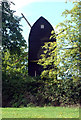
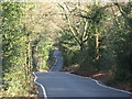
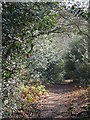
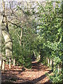
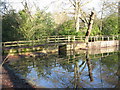
BR2 6JP represents a specific residential cluster within the Bromley Common and Holwood ward in the London Borough of Bromley. This location sits approximately 15 kilometres southeast of Charing Cross, forming part of a district with deep historical roots. As an electoral ward first used in 2022, the area encapsulates the legacy of Bromley Common, which historically straddled the Hastings Road. The land once belonged to the Bishops of Rochester before an 1826 Act of Parliament allowed limited development. Residential growth accelerated significantly after the railway arrived at Bromley in 1858, transforming the agrarian landscape into a suburban settlement. You are looking at a postcode where population density reaches 634 people per square kilometre, yet the area maintains a distinct character separate from the larger Bromley parish. The history of the ward includes significant fluctuations in population, rising from around 1,000 residents in 1858 to nearly 27,400 by 1901. Today, this small cluster offers a blend of Victorian and twentieth-century influence, situated near Norman Park and Rookery Lane. Living in BR2 6JP means being part of a community shaped by over a century of suburban expansion, anchored by historical landmarks like St. Luke's Church and Holy Trinity Church.
- Area Type
- Postcode
- Area Size
- Not available
- Population
- 1891
- Population Density
- 634 people/km²
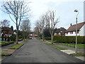
The housing stock in BR2 6JP is characterised by a strong leaning toward house ownership, with data showing that 88% of residents own their homes. Because the predominant accommodation type is houses, you can expect a neighbourhood composed primarily of detached or semi-detached properties rather than flats or terraced housing. This high ownership rate usually indicates that the area has matured significantly, passing the speculative development phases typical of newer estates. Buyers looking at BR2 6JP should note that the market operates largely within the private residence sector. The high concentration of house owners often means property values are influenced by local amenities rather than rental yields. When viewing homes in this postcode, focus on the condition of the main structures and outbuildings, as the older Victorian elements of the Bromley Common history may be reflected in some properties. The small size of the postal cluster means individual property prices can vary based on proximity to specific streets like Chatterton Road or Raglan Road. Understanding that this is an established housing estate will help you assess the character of any specific property viewings.
House Prices in BR2 6JP
No properties found in this postcode.
Energy Efficiency in BR2 6JP
Daily life in BR2 6JP offers practical convenience through a network of nearby amenities. Retail options are well represented within practical reach, with five major stores including Spar, Sainsburys Locksbottom, and M&S Rosetta Orpington BP. These supermarkets and convenience stores handle daily shopping needs without requiring a long drive. For travel, rail connections include Hayes, Orpington Station, and Petts Wood, facilitating trips into central London or visiting neighboring towns. You also have two airports nearby, Biggin Hill Airport and London Biggin Hill Airport, which may be relevant for aviation enthusiasts or air passengers. Public transport extends further with five metro stops such as King Henry's Drive Tram Stop and Fieldway Tram Stop. The historical Hastings Road remains a significant thoroughfare, connecting the area to Tunbridge Wells and London. Living here means you do not need to rely solely on personal vehicles for routine errands, although car ownership remains common due to the residential nature of the cluster.
Amenities
Schools
Families living in BR2 6JP have access to two primary education options within the immediate neighbourhood. Keston Church of England Primary School is located nearby and holds a good Ofsted rating. Secondly, Ravens Wood School serves this area as both a primary institution and an academy. The academy designation indicates that Ravens Wood School operates under the Academies Framework but retains its primary status. Having two schools with confirmed good ratings provides a stable educational choice for local families. This mix ensures that children within the catchment area have access to state-supported primary education without needing to travel far. The availability of a local primary academy is particularly relevant given the median age of 47, implying that any children residing here would benefit from short bus routes or safe walking distances to these specific institutions.
| Rank | School | Type | Entry gender | Ages |
|---|---|---|---|---|
| 1 | Keston Church of England Primary School | primary | N/A | N/A |
| 2 | Ravens Wood School | primary | N/A | N/A |
| 3 | Ravens Wood School | academy | N/A | N/A |
| 4 | Keston Church of England Primary School | primary | N/A | N/A |
Explore more schools in this area
Go to Schools tabDemographics
The community within BR2 6JP is defined by a mature demography with a median age of 47 years. The most common age range spans adults between 30 and 64 years, indicating a household structure dominated by families with older children or empty nesters. Home ownership stands at an exceptionally high level of 88%, suggesting this is overwhelmingly an owner-occupied neighbourhood rather than a rental market. This statistic aligns with the predominant accommodation type of houses, confirming the presence of substantial family properties. The local population is predominantly White, reflecting the historical development patterns of the Bromley area. With a density of 634 people per square kilometre, the area feels populated without being overcrowded. The high home ownership rate typically correlates with lower mortgage stress and greater stability for residents. This demographic profile suits those seeking a settled environment where long-term residents often influence local governance through ward elections. The age profile suggests a lower concentration of primary school-aged children compared to younger families, which influences local services and community activities. You will find a resident base that has likely lived in the area for generations, contributing to a consistent social fabric.
Household Size
Accommodation Type
Tenure
Ethnic Group
Religion
Household Composition
Age
Household Deprivation
NS-SEC
Explore more demographic insights in this area
Go to Demographics tabPlanning
Planning Constraints
- Flood RiskPremium
- Ramsar Wetland SitesPremium
- Area of Outstanding Natural BeautyPremium
- Protected Nature ReservePremium
- Protected WoodlandPremium
- Crime RiskPremium