Area Overview for BR2 6HQ
Photos of BR2 6HQ
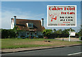
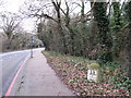
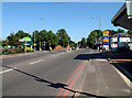
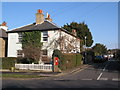
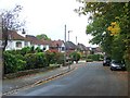
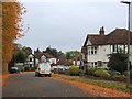
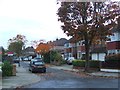
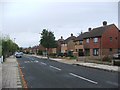
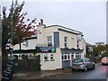
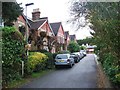
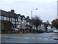
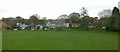
54 photos from this area
Area Information
Key information about the BR2 6HQ including its size, population, and administrative classification.
- Area Type
- Postcode
- Area Size
- 3903 m²
- Population
- 1891
- Population Density
- 634 people/km²
House Prices in BR2 6HQ
13
Properties
£344,833
Average Sold Price
£75,000
Lowest Price
£685,000
Highest Price
Showing 13 properties
| Address | Type | Beds | Baths | Last Sale Price | Last Sale Date | |
|---|---|---|---|---|---|---|
| 5, Leonard Place, Westerham Road, Keston, BR2 6HQ | Semi-detached | 3 | 2 | £685,000 | Jun 2022 | |
| 6, Leonard Place, Westerham Road, Keston, BR2 6HQ | Semi-detached | 3 | - | £440,000 | Dec 2015 | |
| 8, Leonard Place, Westerham Road, Keston, BR2 6HQ | Semi-detached | 2 | - | £308,000 | May 2013 | |
| 3, Leonard Place, Westerham Road, Keston, BR2 6HQ | house | 2 | - | £275,000 | May 2011 | |
| 7, Leonard Place, Westerham Road, Keston, BR2 6HQ | Semi-detached | - | - | £286,000 | Feb 2008 | |
| 4, Leonard Place, Westerham Road, Keston, BR2 6HQ | Semi-detached | 3 | 1 | £75,000 | Dec 1996 | |
| 1, Leonard Place, Westerham Road, Keston, BR2 6HQ | Office | - | - | - | - | |
| Merebrook Consulting Ltd, 1, First Floor Rear, Leonard Place, Westerham Road, Keston, BR2 6HQ | office_workshop | - | - | - | - | |
| Erinvale Developments Ltd, 1, First Floor Front, Leonard Place, Westerham Road, Keston, BR2 6HQ | Office | - | - | - | - | |
| Hml Pm Ltd, 1, Ground Floor Office 3, Leonard Place, Westerham Road, Keston, BR2 6HQ | Office | - | - | - | - |
Page 1 of 2
Energy Efficiency in BR2 6HQ
Amenities
Schools
| Rank | School | Type | Entry gender | Ages |
|---|
Explore more schools in this area
Go to Schools tabDemographics
Household Size
Two person
most common
Accommodation Type
Houses
most common
Tenure
88
majority
Ethnic Group
White
most common
Religion
N/A
most common
Household Composition
N/A
most common
Age
47
median
Adults (30-64 years)
most common
Household Deprivation
N/A
with no deprivation
NS-SEC
48
in Lower managerial occupations
Explore more demographic insights in this area
Go to Demographics tabPlanning
Planning Constraints
- Flood RiskPremium
- Ramsar Wetland SitesPremium
- Area of Outstanding Natural BeautyPremium
- Protected Nature ReservePremium
- Protected WoodlandPremium