Area Overview for BR2 6DD
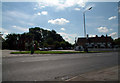
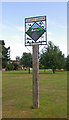
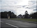
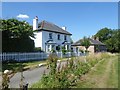
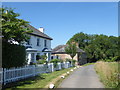
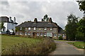
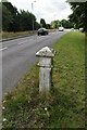
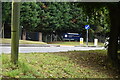
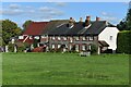
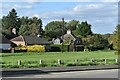
Photos of BR2 6DD


Area Information
Living in BR2 6DD offers a quiet residential experience within a specific postcode cluster covering 17.3 hectares. This small area hosts a population of 2,029 people, creating a close-knit local environment rather than a sprawling urban district. The community sits on the southern fringe of the London Borough of Bromley, near the historical heart of Downe where Charles Darwin once resided. You will find a setting that prioritises domestic peace, suitable for those who value space over city immediacy. The distinction of this postcode lies in its manageable scale and established character, blending modern convenience with historical depth. Residents enjoy a neighbourhood defined by its residential density of 204 people per square kilometre, ensuring a balance of activity and tranquillity. While the immediate surroundings may lack some of the grandeur of nearby historic estates, BR2 6DD provides a stable base for homeowners seeking a straightforward living arrangement. The area functions as a practical home for families and professionals who commute onwards to larger stations. You can expect a consistent experience of community life without the overwhelming pace of central development zones. This specific cluster stands out for its clear identity as a sought-after location for permanent residence. The community in BR2 6DD reflects a settled, mature demographic profile with a median age of 47 years. The majority of residents fall into the adult range between 30 and 64 years, indicating a workforce active in property ownership and stability. A significant 79% of homes in this postcode are owner-occupied, distinguishing the area from many high-rent London zones. Houses form the predominant accommodation type, meaning you will encounter streets lined with detached or semi-detached homes rather than flats or high-rise blocks. The population is primarily White, contributing to a relatively homogenous social structure familiar to many British suburbs. This high level of home ownership suggests a neighbourhood where families plan to stay long-term, fostering a sense of continuity. You are likely to meet neighbours who have invested deeply in their properties and the shared space. The age mix supports local schools and community activities, as the large adult cohort often accompanying school-aged children. Living here means engaging with a population that values security and established routines. This demographic reality creates a stable market where property transactions often involve moving homeowners rather than transient tenants. The property market in BR2 6DD is defined by its strong preference for private ownership. With 79% of residents owning their homes, you will find that selling or buying in this area typically involves two-home owners rather than investors or renters. Houses constitute the main accommodation type, ensuring that searches for a permanent home concentrate on the stock of detached or semi-detached properties. This concentration means new builds are less common, and the housing stock likely reflects several decades of development. For buyers looking at BR2 6DD, the market offers a straightforward environment where finding a buyer or tenant is generally secure due to the high ownership base. The small area size of 17.3 hectares limits the total volume of properties available, which can make inventory turn slower but also reduces competition within the immediate cluster. You should expect to negotiate with other established homeowners who understand the value of the local asset. This dynamic creates a market that rewards patience and knowledge of the specific neighbourhood rather than quick-turnover strategies. The focus on houses ensures that every transaction involves negotiating over a substantial footprint of land and structure. This environment suits those who wish to settle in a recognised estate with a history of ownership continuity. Digital connectivity in BR2 6DD supports a high standard of remote working and daily digital life. Fixed broadband scores an 89 out of 100, indicating excellent quality for streaming, video calls, and large file transfers. Mobile coverage also performs well with a score of 85 out of 100, ensuring you can stay connected while walking or driving around the 17.3 hectare area. These strong scores mean you can work from home without significant interruptions, a crucial factor for professionals using this postcode as their base. The high reliability of the internet network supports a modern lifestyle where connectivity drives productivity. Residents do not need to worry about weak signals or slow downloads affecting their day-to-day operations. The combination of robust fixed and mobile networks removes a common barrier to living in less central areas. You can rely on consistent connectivity for home schooling, online banking, and entertainment needs. This level of digital infrastructure complements the physical transport links available nearby. While the immediate area may lack major railway stations, the superior digital connection bridges the gap for remote employment. Living in BR2 6DD guarantees that you maintain a high-tech standard of living regardless of your physical proximity to city infrastructure. Residents of BR2 6DD enjoy practical access to a range of local amenities without needing to travel far. Within practical reach, you will find two airports, including Biggin Hill Airport and London Biggin Hill Airport, which may appeal to frequent flyers or aviation enthusiasts. For daily shopping needs, five retail options sit nearby, featuring Asda Biggin, Morrisons Daily, and Morrisons Daily New. These supermarkets provide comprehensive provisions for groceries and household essentials. A further five metro stops offer tram connectivity, specifically the New Addington Tram Stop, King Henry's Drive Tram Stop, and Fieldway Tram Stop. These links allow you to access wider transportation networks for commuting or leisure. Five railway stations are also listed in the vicinity, including Hayes, Chelsfield, and Orpington Station, giving you multiple departures for London and the south-east. This concentration of transport hubs means you have flexible options for getting around. The presence of these amenities creates a lifestyle that balances self-sufficiency with easy access to major travel routes. You can complete most errands locally while retaining the option to reach distant destinations quickly. The mix of retail and transport ensures that living in BR2 6DD does not require sacrificing convenience for a quieter residential setting. Safety and environmental assessments for BR2 6DD reveal a highly secure neighbourhood with minimal planning constraints. The crime risk assessment passes with a score of 70 out of 100, where a lower score indicates less risk. This places the area in a category of low crime risk, confirming that the neighbourhood has below-average crime rates compared to national standards. You can feel reassured that daily life involves a heightened sense of security. Environmental factors are equally non-concerning. The area passes all planning constraint tests with a score of 0 out of 100, which means there is no flood risk covering the postcode. There is also no Ramsar wetland site designation, no Area of Outstanding Natural Beauty overlay, no protected nature reserve coverage, and no protected woodland restrictions. This absence of regulatory red tape simplifies any potential future development or garden renovation plans. The combination of a safe crime record and a clean environmental profile makes BR2 6DD a practical choice for families. You do not need to contend with the uncertainties of flooding or protected landscapes. Living here provides a stable environment where safety priorities are consistently met without exception. Who makes up the community in BR2 6DD?The community is characterised by a mature age profile with a median age of 47 years. Most residents are adults aged between 30 and 64 years. A dominant 79% of properties are owner-occupied, and houses are the primary accommodation type. The population is predominantly White, reflecting a settled, long-term neighbourhood demographic suitable for families seeking stability. How are transport and internet connectivity?Digital connectivity is excellent, with fixed broadband scoring 89 out of 100 and mobile coverage reaching 85 out of 100. Physically, five metro stops and five rail stations, including Hayes, Chelsfield, and Orpington, provide access to wider networks. Two airports, Biggin Hill Airport and London Biggin Hill Airport, are also nearby. These links ensure strong connectivity for remote work and commuting. Is BR2 6DD a safe place to live?The area scores a 70 out of 100 on crime risk, where a lower score indicates less risk. This places BR2 6DD in a low crime risk category with below-average crime rates. Furthermore, there is no flood risk, no Ramsar sites, and no protected nature reserves. The combination of these factors confirms a secure and environmentally unrestricted living environment. What amenities are nearby for daily life?Residents have access to five retail locations including Asda Biggin and two Morrisons Daily stores. Transport options include five metro stops such as New Addington Tram Stop and five rail stations like Orpington Station. Two airports serve the immediate vicinity. These facilities provide full access to shopping and travel without the need to drive far.
- Area Type
- Postcode
- Area Size
- 17.3 hectares
- Population
- 2029
- Population Density
- 204 people/km²
The property market in BR2 6DD is defined by its strong preference for private ownership. With 79% of residents owning their homes, you will find that selling or buying in this area typically involves two-home owners rather than investors or renters. Houses constitute the main accommodation type, ensuring that searches for a permanent home concentrate on the stock of detached or semi-detached properties. This concentration means new builds are less common, and the housing stock likely reflects several decades of development. For buyers looking at BR2 6DD, the market offers a straightforward environment where finding a buyer or tenant is generally secure due to the high ownership base. The small area size of 17.3 hectares limits the total volume of properties available, which can make inventory turn slower but also reduces competition within the immediate cluster. You should expect to negotiate with other established homeowners who understand the value of the local asset. This dynamic creates a market that rewards patience and knowledge of the specific neighbourhood rather than quick-turnover strategies. The focus on houses ensures that every transaction involves negotiating over a substantial footprint of land and structure. This environment suits those who wish to settle in a recognised estate with a history of ownership continuity. Digital connectivity in BR2 6DD supports a high standard of remote working and daily digital life. Fixed broadband scores an 89 out of 100, indicating excellent quality for streaming, video calls, and large file transfers. Mobile coverage also performs well with a score of 85 out of 100, ensuring you can stay connected while walking or driving around the 17.3 hectare area. These strong scores mean you can work from home without significant interruptions, a crucial factor for professionals using this postcode as their base. The high reliability of the internet network supports a modern lifestyle where connectivity drives productivity. Residents do not need to worry about weak signals or slow downloads affecting their day-to-day operations. The combination of robust fixed and mobile networks removes a common barrier to living in less central areas. You can rely on consistent connectivity for home schooling, online banking, and entertainment needs. This level of digital infrastructure complements the physical transport links available nearby. While the immediate area may lack major railway stations, the superior digital connection bridges the gap for remote employment. Living in BR2 6DD guarantees that you maintain a high-tech standard of living regardless of your physical proximity to city infrastructure. Residents of BR2 6DD enjoy practical access to a range of local amenities without needing to travel far. Within practical reach, you will find two airports, including Biggin Hill Airport and London Biggin Hill Airport, which may appeal to frequent flyers or aviation enthusiasts. For daily shopping needs, five retail options sit nearby, featuring Asda Biggin, Morrisons Daily, and Morrisons Daily New. These supermarkets provide comprehensive provisions for groceries and household essentials. A further five metro stops offer tram connectivity, specifically the New Addington Tram Stop, King Henry's Drive Tram Stop, and Fieldway Tram Stop. These links allow you to access wider transportation networks for commuting or leisure. Five railway stations are also listed in the vicinity, including Hayes, Chelsfield, and Orpington Station, giving you multiple departures for London and the south-east. This concentration of transport hubs means you have flexible options for getting around. The presence of these amenities creates a lifestyle that balances self-sufficiency with easy access to major travel routes. You can complete most errands locally while retaining the option to reach distant destinations quickly. The mix of retail and transport ensures that living in BR2 6DD does not require sacrificing convenience for a quieter residential setting. Safety and environmental assessments for BR2 6DD reveal a highly secure neighbourhood with minimal planning constraints. The crime risk assessment passes with a score of 70 out of 100, where a lower score indicates less risk. This places the area in a category of low crime risk, confirming that the neighbourhood has below-average crime rates compared to national standards. You can feel reassured that daily life involves a heightened sense of security. Environmental factors are equally non-concerning. The area passes all planning constraint tests with a score of 0 out of 100, which means there is no flood risk covering the postcode. There is also no Ramsar wetland site designation, no Area of Outstanding Natural Beauty overlay, no protected nature reserve coverage, and no protected woodland restrictions. This absence of regulatory red tape simplifies any potential future development or garden renovation plans. The combination of a safe crime record and a clean environmental profile makes BR2 6DD a practical choice for families. You do not need to contend with the uncertainties of flooding or protected landscapes. Living here provides a stable environment where safety priorities are consistently met without exception. Who makes up the community in BR2 6DD?The community is characterised by a mature age profile with a median age of 47 years. Most residents are adults aged between 30 and 64 years. A dominant 79% of properties are owner-occupied, and houses are the primary accommodation type. The population is predominantly White, reflecting a settled, long-term neighbourhood demographic suitable for families seeking stability. How are transport and internet connectivity?Digital connectivity is excellent, with fixed broadband scoring 89 out of 100 and mobile coverage reaching 85 out of 100. Physically, five metro stops and five rail stations, including Hayes, Chelsfield, and Orpington, provide access to wider networks. Two airports, Biggin Hill Airport and London Biggin Hill Airport, are also nearby. These links ensure strong connectivity for remote work and commuting. Is BR2 6DD a safe place to live?The area scores a 70 out of 100 on crime risk, where a lower score indicates less risk. This places BR2 6DD in a low crime risk category with below-average crime rates. Furthermore, there is no flood risk, no Ramsar sites, and no protected nature reserves. The combination of these factors confirms a secure and environmentally unrestricted living environment. What amenities are nearby for daily life?Residents have access to five retail locations including Asda Biggin and two Morrisons Daily stores. Transport options include five metro stops such as New Addington Tram Stop and five rail stations like Orpington Station. Two airports serve the immediate vicinity. These facilities provide full access to shopping and travel without the need to drive far.
House Prices in BR2 6DD
Showing 11 properties
| Address | Type | Beds | Baths | Last Sale Price | Last Sale Date | |
|---|---|---|---|---|---|---|
| Flint House, Milking Lane, Keston, BR2 6DD | house | - | - | £1,790,000 | Mar 2020 | |
| Old House Cottage, Milking Lane, Keston, BR2 6DD | house | 2 | - | £485,000 | Jan 2018 | |
| Old Farm Cottage, Milking Lane, Keston, BR2 6DD | house | - | - | £695,000 | May 2016 | |
| The Granary, Milking Lane, Keston, BR2 6DD | Detached | 1 | 1 | £250,000 | Dec 2015 | |
| Corner Cottage, Milking Lane, Keston, BR2 6DD | Terraced | 2 | 1 | £177,500 | May 2000 | |
| THE OLD BARN, MILKING LANE, Keston, BR2 6DD | Semi-detached | 4 | 3 | - | - | |
| Milking Lane Farm, Milking Lane, Keston, BR2 6DD | Farm | - | - | - | - | |
| Old House Farm, Milking Lane, Keston, BR2 6DD | Terraced | 1 | - | - | - | |
| Fire Station Within Biggin Hill Airport Near Milking Lane, Churchill Way, Biggin Hill, BR2 6DD | commercial | - | - | - | - | |
| Upper Floor, Green Leaves Cottage, Milking Lane, Keston, BR2 6DD | Flat | - | - | - | - |
Energy Efficiency in BR2 6DD
Residents of BR2 6DD enjoy practical access to a range of local amenities without needing to travel far. Within practical reach, you will find two airports, including Biggin Hill Airport and London Biggin Hill Airport, which may appeal to frequent flyers or aviation enthusiasts. For daily shopping needs, five retail options sit nearby, featuring Asda Biggin, Morrisons Daily, and Morrisons Daily New. These supermarkets provide comprehensive provisions for groceries and household essentials. A further five metro stops offer tram connectivity, specifically the New Addington Tram Stop, King Henry's Drive Tram Stop, and Fieldway Tram Stop. These links allow you to access wider transportation networks for commuting or leisure. Five railway stations are also listed in the vicinity, including Hayes, Chelsfield, and Orpington Station, giving you multiple departures for London and the south-east. This concentration of transport hubs means you have flexible options for getting around. The presence of these amenities creates a lifestyle that balances self-sufficiency with easy access to major travel routes. You can complete most errands locally while retaining the option to reach distant destinations quickly. The mix of retail and transport ensures that living in BR2 6DD does not require sacrificing convenience for a quieter residential setting. Safety and environmental assessments for BR2 6DD reveal a highly secure neighbourhood with minimal planning constraints. The crime risk assessment passes with a score of 70 out of 100, where a lower score indicates less risk. This places the area in a category of low crime risk, confirming that the neighbourhood has below-average crime rates compared to national standards. You can feel reassured that daily life involves a heightened sense of security. Environmental factors are equally non-concerning. The area passes all planning constraint tests with a score of 0 out of 100, which means there is no flood risk covering the postcode. There is also no Ramsar wetland site designation, no Area of Outstanding Natural Beauty overlay, no protected nature reserve coverage, and no protected woodland restrictions. This absence of regulatory red tape simplifies any potential future development or garden renovation plans. The combination of a safe crime record and a clean environmental profile makes BR2 6DD a practical choice for families. You do not need to contend with the uncertainties of flooding or protected landscapes. Living here provides a stable environment where safety priorities are consistently met without exception. Who makes up the community in BR2 6DD?The community is characterised by a mature age profile with a median age of 47 years. Most residents are adults aged between 30 and 64 years. A dominant 79% of properties are owner-occupied, and houses are the primary accommodation type. The population is predominantly White, reflecting a settled, long-term neighbourhood demographic suitable for families seeking stability. How are transport and internet connectivity?Digital connectivity is excellent, with fixed broadband scoring 89 out of 100 and mobile coverage reaching 85 out of 100. Physically, five metro stops and five rail stations, including Hayes, Chelsfield, and Orpington, provide access to wider networks. Two airports, Biggin Hill Airport and London Biggin Hill Airport, are also nearby. These links ensure strong connectivity for remote work and commuting. Is BR2 6DD a safe place to live?The area scores a 70 out of 100 on crime risk, where a lower score indicates less risk. This places BR2 6DD in a low crime risk category with below-average crime rates. Furthermore, there is no flood risk, no Ramsar sites, and no protected nature reserves. The combination of these factors confirms a secure and environmentally unrestricted living environment. What amenities are nearby for daily life?Residents have access to five retail locations including Asda Biggin and two Morrisons Daily stores. Transport options include five metro stops such as New Addington Tram Stop and five rail stations like Orpington Station. Two airports serve the immediate vicinity. These facilities provide full access to shopping and travel without the need to drive far.
Amenities
Schools
| Rank | School | Type | Entry gender | Ages |
|---|
Explore more schools in this area
Go to Schools tabDemographics
The community in BR2 6DD reflects a settled, mature demographic profile with a median age of 47 years. The majority of residents fall into the adult range between 30 and 64 years, indicating a workforce active in property ownership and stability. A significant 79% of homes in this postcode are owner-occupied, distinguishing the area from many high-rent London zones. Houses form the predominant accommodation type, meaning you will encounter streets lined with detached or semi-detached homes rather than flats or high-rise blocks. The population is primarily White, contributing to a relatively homogenous social structure familiar to many British suburbs. This high level of home ownership suggests a neighbourhood where families plan to stay long-term, fostering a sense of continuity. You are likely to meet neighbours who have invested deeply in their properties and the shared space. The age mix supports local schools and community activities, as the large adult cohort often accompanying school-aged children. Living here means engaging with a population that values security and established routines. This demographic reality creates a stable market where property transactions often involve moving homeowners rather than transient tenants. The property market in BR2 6DD is defined by its strong preference for private ownership. With 79% of residents owning their homes, you will find that selling or buying in this area typically involves two-home owners rather than investors or renters. Houses constitute the main accommodation type, ensuring that searches for a permanent home concentrate on the stock of detached or semi-detached properties. This concentration means new builds are less common, and the housing stock likely reflects several decades of development. For buyers looking at BR2 6DD, the market offers a straightforward environment where finding a buyer or tenant is generally secure due to the high ownership base. The small area size of 17.3 hectares limits the total volume of properties available, which can make inventory turn slower but also reduces competition within the immediate cluster. You should expect to negotiate with other established homeowners who understand the value of the local asset. This dynamic creates a market that rewards patience and knowledge of the specific neighbourhood rather than quick-turnover strategies. The focus on houses ensures that every transaction involves negotiating over a substantial footprint of land and structure. This environment suits those who wish to settle in a recognised estate with a history of ownership continuity. Digital connectivity in BR2 6DD supports a high standard of remote working and daily digital life. Fixed broadband scores an 89 out of 100, indicating excellent quality for streaming, video calls, and large file transfers. Mobile coverage also performs well with a score of 85 out of 100, ensuring you can stay connected while walking or driving around the 17.3 hectare area. These strong scores mean you can work from home without significant interruptions, a crucial factor for professionals using this postcode as their base. The high reliability of the internet network supports a modern lifestyle where connectivity drives productivity. Residents do not need to worry about weak signals or slow downloads affecting their day-to-day operations. The combination of robust fixed and mobile networks removes a common barrier to living in less central areas. You can rely on consistent connectivity for home schooling, online banking, and entertainment needs. This level of digital infrastructure complements the physical transport links available nearby. While the immediate area may lack major railway stations, the superior digital connection bridges the gap for remote employment. Living in BR2 6DD guarantees that you maintain a high-tech standard of living regardless of your physical proximity to city infrastructure. Residents of BR2 6DD enjoy practical access to a range of local amenities without needing to travel far. Within practical reach, you will find two airports, including Biggin Hill Airport and London Biggin Hill Airport, which may appeal to frequent flyers or aviation enthusiasts. For daily shopping needs, five retail options sit nearby, featuring Asda Biggin, Morrisons Daily, and Morrisons Daily New. These supermarkets provide comprehensive provisions for groceries and household essentials. A further five metro stops offer tram connectivity, specifically the New Addington Tram Stop, King Henry's Drive Tram Stop, and Fieldway Tram Stop. These links allow you to access wider transportation networks for commuting or leisure. Five railway stations are also listed in the vicinity, including Hayes, Chelsfield, and Orpington Station, giving you multiple departures for London and the south-east. This concentration of transport hubs means you have flexible options for getting around. The presence of these amenities creates a lifestyle that balances self-sufficiency with easy access to major travel routes. You can complete most errands locally while retaining the option to reach distant destinations quickly. The mix of retail and transport ensures that living in BR2 6DD does not require sacrificing convenience for a quieter residential setting. Safety and environmental assessments for BR2 6DD reveal a highly secure neighbourhood with minimal planning constraints. The crime risk assessment passes with a score of 70 out of 100, where a lower score indicates less risk. This places the area in a category of low crime risk, confirming that the neighbourhood has below-average crime rates compared to national standards. You can feel reassured that daily life involves a heightened sense of security. Environmental factors are equally non-concerning. The area passes all planning constraint tests with a score of 0 out of 100, which means there is no flood risk covering the postcode. There is also no Ramsar wetland site designation, no Area of Outstanding Natural Beauty overlay, no protected nature reserve coverage, and no protected woodland restrictions. This absence of regulatory red tape simplifies any potential future development or garden renovation plans. The combination of a safe crime record and a clean environmental profile makes BR2 6DD a practical choice for families. You do not need to contend with the uncertainties of flooding or protected landscapes. Living here provides a stable environment where safety priorities are consistently met without exception. Who makes up the community in BR2 6DD?The community is characterised by a mature age profile with a median age of 47 years. Most residents are adults aged between 30 and 64 years. A dominant 79% of properties are owner-occupied, and houses are the primary accommodation type. The population is predominantly White, reflecting a settled, long-term neighbourhood demographic suitable for families seeking stability. How are transport and internet connectivity?Digital connectivity is excellent, with fixed broadband scoring 89 out of 100 and mobile coverage reaching 85 out of 100. Physically, five metro stops and five rail stations, including Hayes, Chelsfield, and Orpington, provide access to wider networks. Two airports, Biggin Hill Airport and London Biggin Hill Airport, are also nearby. These links ensure strong connectivity for remote work and commuting. Is BR2 6DD a safe place to live?The area scores a 70 out of 100 on crime risk, where a lower score indicates less risk. This places BR2 6DD in a low crime risk category with below-average crime rates. Furthermore, there is no flood risk, no Ramsar sites, and no protected nature reserves. The combination of these factors confirms a secure and environmentally unrestricted living environment. What amenities are nearby for daily life?Residents have access to five retail locations including Asda Biggin and two Morrisons Daily stores. Transport options include five metro stops such as New Addington Tram Stop and five rail stations like Orpington Station. Two airports serve the immediate vicinity. These facilities provide full access to shopping and travel without the need to drive far.
Household Size
Accommodation Type
Tenure
Ethnic Group
Religion
Household Composition
Age
Household Deprivation
NS-SEC
Explore more demographic insights in this area
Go to Demographics tabPlanning
Planning Constraints
- Flood RiskPremium
- Ramsar Wetland SitesPremium
- Area of Outstanding Natural BeautyPremium
- Protected Nature ReservePremium
- Protected WoodlandPremium