Area Overview for BR2 0YH
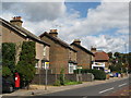
Photos of BR2 0YH
Area Information
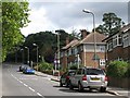
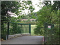
Living in BR2 0YH offers a specific slice of suburban life within the London Borough of Bromley. This postcode covers a small residential cluster measuring just 5131 square metres, home to a population of 1704 people. The area sits within the broader context of Shortlands and Park Langley, suburbs that developed significantly in the early 20th century. Park Langley emerged between 1909 and 1913 on the former Langley Park Estate, while Shortlands established itself as an ecclesiastical parish in 1870. The ground here is characterised by a sylvan, garden city layout featuring individual houses in generous landscapes. You will find gated communities such as Langley Park and Langley Waterside alongside historical landmarks like Shortlands House, which dates back to around 1702. The local environment remains largely free from major planning constraints, with no protected woodland, nature reserves, or Ramsar wetland sites affecting development potential. Daily life here is defined by proximity to key infrastructure without the density of central London. The ward itself was formally established for 2022 elections, reflecting its current status as a distinct electoral area. Residents enjoy a residential focus where historical heritage meets practical commuter access.
- Area Type
- Postcode
- Area Size
- 5131 m²
- Population
- 1704
- Population Density
- 5437 people/km²
The property market in BR2 0YH presents a unique picture due to the specific composition of the housing stock. With 59% home ownership, the area leans towards a market where residents are settled rather than transient. The dominant accommodation type is flats, which distinguishes this small cluster from the surrounding suburban sprawl of individual houses found in wider Shortlands and Park Langley. You are looking at a high-density living arrangement within a small 5131 square metre boundary, which can create a close-knit atmosphere despite the urban London setting. The presence of a majority home ownership rate often correlates with properties held for the long term, potentially reducing turnover frequency. For buyers examining this area, the flat designation means you will likely find apartments rather than the semi-detached or detached homes typical of the immediate neighbourhood. The mix suggests units might be part of larger developments or converted buildings within the former estate or parish structures. While the area is defined by flats, the surrounding ward includes substantial garden city housing from the early 1900s. Understanding that this postcode is primarily flat-backed is crucial for anyone checking their specific property requirements against the local inventory.
House Prices in BR2 0YH
Showing 17 properties
| Address | Type | Beds | Baths | Last Sale Price | Last Sale Date | |
|---|---|---|---|---|---|---|
| 16 Hildenlea Place, Shortlands, Bromley, BR2 0YH | Flat | - | - | £590,000 | Mar 2025 | |
| 15 Hildenlea Place, Shortlands, Bromley, BR2 0YH | Flat | 2 | 2 | £415,000 | Nov 2024 | |
| 10 Hildenlea Place, Shortlands, Bromley, BR2 0YH | Semi-detached | 3 | 2 | £581,000 | Jun 2023 | |
| 11 Hildenlea Place, Shortlands, Bromley, BR2 0YH | Detached | 2 | 1 | £470,000 | Aug 2020 | |
| 3 Hildenlea Place, Shortlands, Bromley, BR2 0YH | Flat | 2 | 2 | £365,000 | Sep 2016 | |
| 5 Hildenlea Place, Shortlands, Bromley, BR2 0YH | Flat | - | - | £510,000 | Sep 2014 | |
| 7 Hildenlea Place, Shortlands, Bromley, BR2 0YH | Semi-detached | 3 | 2 | £310,000 | Mar 2007 | |
| 4 Hildenlea Place, Shortlands, Bromley, BR2 0YH | Flat | - | - | £245,000 | Sep 2006 | |
| 9 Hildenlea Place, Shortlands, Bromley, BR2 0YH | Semi-detached | - | - | £117,500 | Feb 1998 | |
| 12 Hildenlea Place, Shortlands, Bromley, BR2 0YH | Flat | 2 | 2 | £90,000 | Jul 1997 |
Energy Efficiency in BR2 0YH
Daily life in BR2 0YH is enriched by a wide array of nearby amenities within practical reach. Retail options are plentiful with five major locations, including Sainsburys Bromley, Lidl Bromley, and M&S Bromley, ensuring your weekly shop is a short trip. Transport diversity is matched by leisure and travel infrastructure, with five railway stations and five tram stops like the Beckenham Road Tram Stop providing rapid links. Residents also benefit from proximity to two airports and two ferry piers at Greenwich and Masthouse Terrace. The area supports a lively local economy centred on these key service providers. Living here means you can access high-street shopping and leisure facilities without needing a lengthy commute into central London. The combination of these five rail stations, five retail landmarks, and the variety of transit options creates a self-contained hub for daily errands and social activities. You gain the convenience of city-centre amenities while retaining the quieter residential character of Shortlands and Park Langley.
Amenities
Schools
Educational options for families living in BR2 0YH are well represented by the proximity of Bishop Challoner School. This institution is the nearest school to the postcode and operates as an independent facility. Its presence offers a private education choice for residents in this specific residential cluster. Independent schools often provide curricula and fee structures distinct from the state sector, allowing families to select an educational environment that aligns with their values and financial planning. While Bishop Challoner School does not have an Ofsted rating listed in the available data, its designation as an independent school confirms its status outside the maintained school system. The single school mentioned highlights a focused option for secondary or secondary-plus education, though primary schooling options for younger children depend on the broader parish boundaries not detailed in this specific dataset. Families choosing homes in BR2 0YH will have the immediate advantage of accessing an independent institution without travelling far to the ward centre. The location of the school near Shortlands House further integrates education into the historic fabric of the community.
| Rank | School | Type | Entry gender | Ages |
|---|
Explore more schools in this area
Go to Schools tabDemographics
The community in BR2 0YH reflects a mature and established neighbourhood. The median age stands at 47, with the most common age range falling between adults aged 30 and 64 years. This demographic profile suggests an area that may appeal to families with grown children or professionals seeking stability. Home ownership is prevalent, with 59% of residents owning their homes outright or with a mortgage. The remaining households likely comprise long-term renters or younger occupants entering the market. Accommodation types in this specific cluster are dominated by flats, indicating a vertical living solution within the small footprint of the postcode. The predominant ethnic group is White, mirroring the broader demographic patterns often seen in older British suburbs. The population density reaches an exceptionally high figure of 332,090 people per square kilometre, a statistical anomaly driven by the very small total area of the postcode compared to the rounded population figure. This density metric underscores the compact nature of the specific cluster rather than the wider suburban character. For those considering moving here, the adult-dominated age profile and high ownership rate suggest a stable environment with established resident habits.
Household Size
Accommodation Type
Tenure
Ethnic Group
Religion
Household Composition
Age
Household Deprivation
NS-SEC
Explore more demographic insights in this area
Go to Demographics tabPlanning
Planning Constraints
- Flood RiskPremium
- Ramsar Wetland SitesPremium
- Area of Outstanding Natural BeautyPremium
- Protected Nature ReservePremium
- Protected WoodlandPremium