Area Overview for BR2 0SF
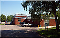
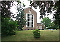
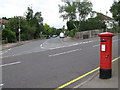
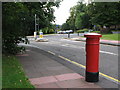
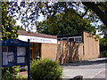
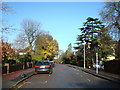
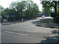
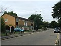
Photos of BR2 0SF
Area Information
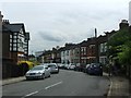
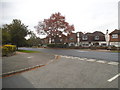
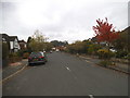
Living in BR2 0SF means residing within a specific residential cluster in the London Borough of Bromley. This postcode covers an area of 8,962 square metres, accommodating a population of 1,769 people. The density here is approximately 197,393 people per square kilometre, indicating a tightly packed neighbourhood despite its small geographical footprint. The location sits within the Shortlands and Park Langley ward, a suburb with a distinct history. Park Langley developed between 1909 and 1913 under garden city principles on the former Langley Park Estate. Shortlands, which became an ecclesiastical parish in 1870, retains historical structures like Shortlands House, built around 1702. Today, the ward features individual houses set in generous landscapes, often within gated communities such as Langley Park and Langley Waterside. Residents enjoy a predominantly residential environment where local history is visible in conservation areas and former mansions converted into housing. You can experience daily life in a setting where the original estate layout still influences the street structure, yet modern transport links provide rapid access to wider Bromley and beyond.
- Area Type
- Postcode
- Area Size
- 8962 m²
- Population
- 1769
- Population Density
- 7936 people/km²
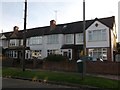
BR2 0SF represents a property market dominated by freehold houses and owner-occupiers. With a 67% home ownership rate, the area is characterised by residents who have purchased their dwellings rather than tenants. The accommodation type is listed as houses, meaning you will not find the high-rise blocks or large apartment complexes common in central London. This implies a quieter, more private living environment where property values are likely influenced by the specific layout and condition of each individual house. The small size of the postcode area, covering just 8,962 square metres, means the stock is limited. Buyers looking at homes in this specific cluster should anticipate a competitive market for available properties. The history of the area, including its development as part of the garden city movement, adds value to the housing stock. High ownership rates often correlate with lower turnover, so patience may be required to find a suitable home in BR2 0SF.
House Prices in BR2 0SF
Showing 32 properties
| Address | Type | Beds | Baths | Last Sale Price | Last Sale Date | |
|---|---|---|---|---|---|---|
| 188 Queen Anne Avenue, Shortlands, Bromley, BR2 0SF | Terraced | 4 | 2 | £595,000 | Oct 2020 | |
| 150 Queen Anne Avenue, Shortlands, Bromley, BR2 0SF | Terraced | 4 | 1 | £559,167 | Jul 2020 | |
| 154 Queen Anne Avenue, Shortlands, Bromley, BR2 0SF | Terraced | 3 | 1 | £530,000 | Jun 2019 | |
| 174 Queen Anne Avenue, Shortlands, Bromley, BR2 0SF | Terraced | 3 | 1 | £490,000 | Nov 2018 | |
| 166 Queen Anne Avenue, Shortlands, Bromley, BR2 0SF | Terraced | 4 | 2 | £475,000 | Nov 2018 | |
| 128 Queen Anne Avenue, Shortlands, Bromley, BR2 0SF | Terraced | 3 | 1 | £513,250 | Dec 2017 | |
| 172 Queen Anne Avenue, Shortlands, Bromley, BR2 0SF | house | - | - | £500,000 | Jul 2017 | |
| 164 Queen Anne Avenue, Shortlands, Bromley, BR2 0SF | Terraced | 3 | 1 | £555,000 | Jun 2017 | |
| 186 Queen Anne Avenue, Shortlands, Bromley, BR2 0SF | Terraced | 3 | - | £505,000 | Apr 2017 | |
| 178 Queen Anne Avenue, Shortlands, Bromley, BR2 0SF | house | - | - | £270,000 | Jul 2011 |
Energy Efficiency in BR2 0SF
Residents of BR2 0SF enjoy direct access to a variety of amenities without needing to travel far. Within practical reach, there are five retail options, including Lidl Bromley, Sainsburys Bromley, and M&S Bromley, ensuring you have access to daily groceries and household essentials. For public transport, five rail stations are nearby, featuring Shortlands Station and Bromley South Station, while five metro stops such as Beckenham Road Tram Stop provide local connectivity. The area is also near two airports, Biggin Hill Airport and London Biggin Hill Airport, and two ferry locations, Greenwich Pier and Masthouse Terrace Pier. You can shop at the local supermarkets and commute via the nearby rail network. The lifestyle here blends convenience with quiet residential life, supported by the local retail and transport infrastructure within the Shortlands and Park Langley ward. Daily errands are manageable on foot or by short drive given the concentration of shops and stations.
Amenities
Schools
Familiesliving in BR2 0SF have access to specific educational facilities nearby. The most prominent institution is St Mark's Church of England Primary School, which holds an outstanding Ofsted rating. This school is noted twice in the local records, confirming its central role in the ward's education provision. There are no secondary schools listed within the immediate data for BR2 0SF, meaning families often look beyond the immediate postcode boundaries for older pupils or rely on transport links to reach neighbouring boroughs. The presence of an outstanding-rated primary school suggests a high standard of early education is available within walking distance or a short bus ride. For parents considering schools near BR2 0SF, the focus is heavily on this single primary provider. You should check catchment areas carefully, as entry is typically determined by address proximity. The high performance of the local primary school is a significant factor for property buyers in this residential cluster.
| Rank | School | Type | Entry gender | Ages |
|---|
Explore more schools in this area
Go to Schools tabDemographics
The community in BR2 0SF is defined by a mature demographic profile with a median age of 47 years. Most residents fall into the 30-64 age range, suggesting an established population rather than a transient student or young professional demographic. Home ownership stands at 67%, which is significantly higher than the national average, indicating that the area is primarily a settlement for owner-occupiers rather than a rental market. The predominant form of accommodation is houses, reinforcing the suburban character of the neighbourhood. Demographically, the area is predominantly White. The high proportion of homeowners combined with the older age profile suggests long-term residents who have built stability in the ward. This demographic makes sense of the local economy, where demand often centres on family homes and properties suitable for retirees rather than starter flats or student lodgings. You will find a established community where household stability is common.
Household Size
Accommodation Type
Tenure
Ethnic Group
Religion
Household Composition
Age
Household Deprivation
NS-SEC
Explore more demographic insights in this area
Go to Demographics tabPlanning
Planning Constraints
- Flood RiskPremium
- Ramsar Wetland SitesPremium
- Area of Outstanding Natural BeautyPremium
- Protected Nature ReservePremium
- Protected WoodlandPremium