Area Overview for BR2 0BS
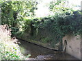
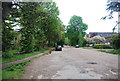
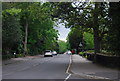
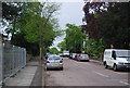
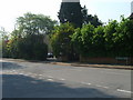
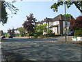
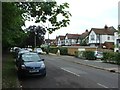
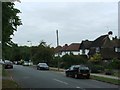
Photos of BR2 0BS
Area Information
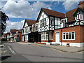
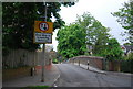
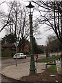
BR2 0BS is a compact residential postcode in the London Borough of Bromley, encompassing parts of Shortlands and Park Langley. With a population of 1,704 spread over 8,564 square metres, this area is densely populated yet retains a suburban character. The neighbourhood features a mix of historic and modern housing, including garden city-style developments from the early 1900s. Shortlands, an ecclesiastical parish since 1870, and Park Langley, originally a 19th-century estate, form a cohesive community. Residents benefit from proximity to multiple rail stations, including Shortlands and Ravensbourne, and a network of tram stops. The area’s compact size means amenities are within practical reach, from supermarkets like Sainsburys Bromley to local schools. BR2 0BS appeals to those seeking a balance between urban connectivity and residential tranquility, with a population skewed toward adults aged 30–64 and a strong sense of established community.
- Area Type
- Postcode
- Area Size
- 8564 m²
- Population
- 1704
- Population Density
- 5437 people/km²
BR2 0BS is characterised by a high proportion of flats, with 59% of homes owner-occupied. This suggests a mix of long-term residents and possibly a smaller rental market, though the data does not specify the latter. The area’s compact size and focus on flats indicate a need for efficient space utilisation, typical of suburban zones near London’s transport hubs. Given the high population density, property availability may be limited, and buyers should consider the proximity to key amenities like rail stations and schools. The historical development of Park Langley, with its garden city principles, adds value through architectural heritage. However, the small area size means buyers must evaluate not just the property itself but also its integration with surrounding infrastructure, such as retail and transport links, which are critical for daily life.
House Prices in BR2 0BS
Showing 3 properties
| Address | Type | Beds | Baths | Last Sale Price | Last Sale Date | |
|---|---|---|---|---|---|---|
| Headmasters Flat, Bishop Challoner School, 228 Bromley Road, Beckenham, BR2 0BS | Flat | - | - | - | - | |
| Caretakers Flat, Bishop Challoner School, 228 Bromley Road, Beckenham, BR2 0BS | Flat | - | - | - | - | |
| Scout Hut, Bishop Challoner School, 228 Bromley Road, Beckenham, BR2 0BS | Leisure | - | - | - | - |
Energy Efficiency in BR2 0BS
BR2 0BS offers a blend of suburban convenience and urban accessibility. Residents can access Sainsburys Bromley, Lidl Bromley, and Co-op Bromley for shopping, while the area’s proximity to rail and tram networks ensures easy travel to Bromley, Beckenham, and central London. Parks and green spaces, though not explicitly named, are implied by the historical garden city planning of Park Langley. The presence of ferry services and nearby airports adds versatility for leisure and travel. The compact layout means amenities are within walking or cycling distance, fostering a community-oriented lifestyle. Local shops, schools, and transport links create a self-contained environment, ideal for those seeking a balance between convenience and a quieter residential setting.
Amenities
Schools
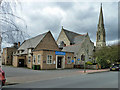
The nearest school to BR2 0BS is Bishop Challoner School, an independent institution. While no Ofsted rating is provided, the school’s presence reflects the area’s appeal to families seeking quality education. The absence of other schools in the data suggests a reliance on nearby institutions in Bromley or Beckenham, which may offer a range of state and private options. The mix of school types—primarily independent—indicates a community that may prioritise private education, though local state schools could also be accessible within commuting distance. Families should verify the specific catchment areas and transportation links to schools, as BR2 0BS’s proximity to rail and tram networks could ease access to broader educational opportunities.
| Rank | School | Type | Entry gender | Ages |
|---|
Explore more schools in this area
Go to Schools tabDemographics
BR2 0BS has a median age of 47, with the majority of residents aged 30–64. Home ownership accounts for 59% of households, reflecting a stable, long-term resident base. The area is predominantly occupied by flats, suggesting a mix of owner-occupied and rental properties. The predominant ethnic group is White, aligning with broader trends in the borough. The population density of 198,980 people per square kilometre indicates a tightly packed residential cluster, which may influence the character of daily life. While the data does not specify deprivation levels, the high home ownership rate and low crime score (84/100) suggest a relatively affluent and secure environment. The age profile implies a community with established careers and families, likely contributing to a mature, low-turnover housing market.
Household Size
Accommodation Type
Tenure
Ethnic Group
Religion
Household Composition
Age
Household Deprivation
NS-SEC
Explore more demographic insights in this area
Go to Demographics tabPlanning
Planning Constraints
- Flood RiskPremium
- Ramsar Wetland SitesPremium
- Area of Outstanding Natural BeautyPremium
- Protected Nature ReservePremium
- Protected WoodlandPremium