Area Overview for BR1 5RF
Photos of BR1 5RF
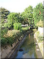
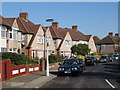
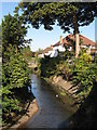
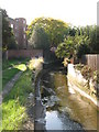
100 photos from this area
Area Information
Key information about the BR1 5RF including its size, population, and administrative classification.
- Area Type
- Postcode
- Area Size
- 4550 m²
- Population
- 1785
- Population Density
- 6900 people/km²
House Prices in BR1 5RF
12
Properties
£273,929
Average Sold Price
£102,000
Lowest Price
£455,000
Highest Price
Showing 12 properties
| Address | Type | Beds | Baths | Last Sale Price | Last Sale Date | |
|---|---|---|---|---|---|---|
| 82 Brockman Rise, Bromley, BR1 5RF | Semi-detached | 3 | 1 | £390,000 | Mar 2021 | |
| 92 Brockman Rise, Bromley, BR1 5RF | Semi-detached | 3 | 1 | £455,000 | Feb 2020 | |
| 70 Brockman Rise, Bromley, BR1 5RF | Terraced | 3 | - | £245,000 | Feb 2013 | |
| 86 Brockman Rise, Bromley, BR1 5RF | Terraced | 3 | 1 | £248,000 | Nov 2006 | |
| 76 Brockman Rise, Bromley, BR1 5RF | Terraced | - | - | £247,500 | Oct 2006 | |
| 84 Brockman Rise, Bromley, BR1 5RF | Semi-detached | - | - | £230,000 | Apr 2006 | |
| 80 Brockman Rise, Bromley, BR1 5RF | house | - | - | £102,000 | Sep 1998 | |
| 78 Brockman Rise, Bromley, BR1 5RF | Semi-detached | 3 | 1 | - | - | |
| 74 Brockman Rise, Bromley, BR1 5RF | Terraced | - | - | - | - | |
| 72 Brockman Rise, Bromley, BR1 5RF | Terraced | 3 | - | - | - |
Page 1 of 2
Energy Efficiency in BR1 5RF
Amenities
Schools
| Rank | School | Type | Entry gender | Ages |
|---|
Explore more schools in this area
Go to Schools tabDemographics
Household Size
Family (3-5 people)
most common
Accommodation Type
Houses
most common
Tenure
74
majority
Ethnic Group
White
most common
Religion
N/A
most common
Household Composition
N/A
most common
Age
47
median
Adults (30-64 years)
most common
Household Deprivation
N/A
with no deprivation
NS-SEC
33
in Lower managerial occupations
Explore more demographic insights in this area
Go to Demographics tabPlanning
Planning Constraints
- Flood RiskPremium
- Ramsar Wetland SitesPremium
- Area of Outstanding Natural BeautyPremium
- Protected Nature ReservePremium
- Protected WoodlandPremium