Area Overview for BR1 5EP
Photos of BR1 5EP
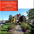
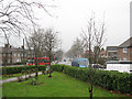
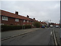
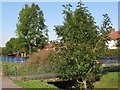
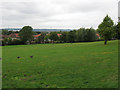
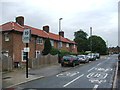
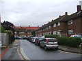
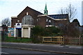
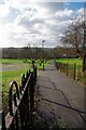
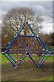
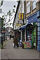
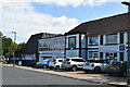
46 photos from this area
Area Information
Key information about the BR1 5EP including its size, population, and administrative classification.
- Area Type
- Postcode
- Area Size
- 6.4 hectares
- Population
- 1689
- Population Density
- 6516 people/km²
House Prices in BR1 5EP
58
Properties
£239,185
Average Sold Price
£59,500
Lowest Price
£425,000
Highest Price
Showing 58 properties
| Address | Type | Beds | Baths | Last Sale Price | Last Sale Date | |
|---|---|---|---|---|---|---|
| 103 Moorside Road, Bromley, BR1 5EP | Terraced | 3 | 1 | £422,500 | Apr 2024 | |
| 133 Moorside Road, Bromley, BR1 5EP | Terraced | 3 | 1 | £405,000 | Jan 2024 | |
| 121 Moorside Road, Bromley, BR1 5EP | Terraced | 2 | 1 | £305,000 | Jan 2024 | |
| 21 Moorside Road, Bromley, BR1 5EP | Terraced | 2 | 1 | £385,000 | Jul 2023 | |
| Good Shepherd Schoolhouse, 43 Moorside Road, Bromley, BR1 5EP | house | - | - | £420,000 | Jan 2023 | |
| 87 Moorside Road, Bromley, BR1 5EP | Terraced | 2 | 1 | £370,000 | Oct 2022 | |
| 1 Moorside Road, Bromley, BR1 5EP | Retail | 3 | 1 | £425,000 | Jul 2022 | |
| 25 Moorside Road, Bromley, BR1 5EP | house | 2 | 1 | £358,000 | Jun 2022 | |
| 31 Moorside Road, Bromley, BR1 5EP | house | - | - | £360,000 | Jan 2021 | |
| 111 Moorside Road, Bromley, BR1 5EP | Terraced | 2 | 1 | £302,500 | Jun 2018 |
Page 1 of 6
Energy Efficiency in BR1 5EP
Amenities
Schools
| Rank | School | Type | Entry gender | Ages |
|---|
Explore more schools in this area
Go to Schools tabDemographics
Household Size
Family (3-5 people)
most common
Accommodation Type
Houses
most common
Tenure
43
majority
Ethnic Group
White
most common
Religion
N/A
most common
Household Composition
N/A
most common
Age
47
median
Adults (30-64 years)
most common
Household Deprivation
N/A
with no deprivation
NS-SEC
27
in Lower managerial occupations
Explore more demographic insights in this area
Go to Demographics tabPlanning
Planning Constraints
- Flood RiskPremium
- Ramsar Wetland SitesPremium
- Area of Outstanding Natural BeautyPremium
- Protected Nature ReservePremium
- Protected WoodlandPremium