Area Overview for BR1 5DS
Photos of BR1 5DS
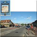
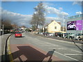
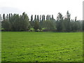
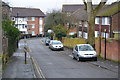
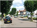
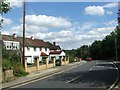
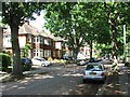
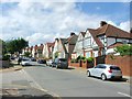
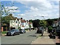
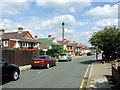
57 photos from this area
Area Information
Key information about the BR1 5DS including its size, population, and administrative classification.
- Area Type
- Postcode
- Area Size
- 9859 m²
- Population
- 1689
- Population Density
- 9542 people/km²
House Prices in BR1 5DS
48
Properties
£196,651
Average Sold Price
£45,650
Lowest Price
£395,000
Highest Price
Showing 48 properties
| Address | Type | Beds | Baths | Last Sale Price | Last Sale Date | |
|---|---|---|---|---|---|---|
| 37 Galahad Road, Bromley, BR1 5DS | Terraced | 2 | 1 | £338,000 | Dec 2023 | |
| 13 Galahad Road, Bromley, BR1 5DS | Terraced | 2 | 1 | £395,000 | Mar 2023 | |
| 93 Galahad Road, Bromley, BR1 5DS | house | - | - | £365,000 | Sep 2021 | |
| 81 Galahad Road, Bromley, BR1 5DS | Terraced | 2 | 1 | £305,000 | Mar 2019 | |
| 95 Galahad Road, Bromley, BR1 5DS | house | 2 | - | £348,000 | May 2018 | |
| 65 Galahad Road, Bromley, BR1 5DS | house | - | - | £337,000 | May 2016 | |
| 33 Galahad Road, Bromley, BR1 5DS | Terraced | 2 | - | £287,000 | Feb 2016 | |
| 27 Galahad Road, Bromley, BR1 5DS | Terraced | 2 | - | £230,000 | May 2014 | |
| 59 Galahad Road, Bromley, BR1 5DS | Terraced | 2 | - | £225,000 | Feb 2014 | |
| 75 Galahad Road, Bromley, BR1 5DS | house | - | - | £200,000 | Dec 2012 |
Page 1 of 5
Energy Efficiency in BR1 5DS
Amenities
Schools
| Rank | School | Type | Entry gender | Ages |
|---|
Explore more schools in this area
Go to Schools tabDemographics
Household Size
Family (3-5 people)
most common
Accommodation Type
Houses
most common
Tenure
38
majority
Ethnic Group
White
most common
Religion
N/A
most common
Household Composition
N/A
most common
Age
47
median
Adults (30-64 years)
most common
Household Deprivation
N/A
with no deprivation
NS-SEC
25
in Lower managerial occupations
Explore more demographic insights in this area
Go to Demographics tabPlanning
Planning Constraints
- Flood RiskPremium
- Ramsar Wetland SitesPremium
- Area of Outstanding Natural BeautyPremium
- Protected Nature ReservePremium
- Protected WoodlandPremium