Area Overview for BR1 4UL
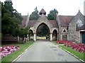
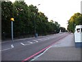
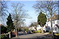
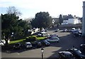
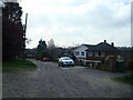
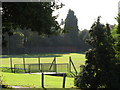
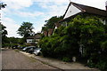
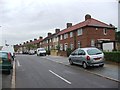
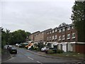
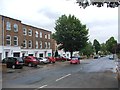
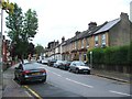
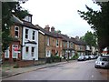
Photos of BR1 4UL
Area Information
BR1 4UL is a small residential postcode area in England, home to 1450 people spread across a compact cluster of properties. This area is defined by its quiet, established character, with a population skewed toward adults aged 30–64, reflecting a mature, settled community. Daily life here is shaped by proximity to essential services and transport links, with a mix of retail, rail, and public transport options within easy reach. The area’s modest size means it is not densely populated, offering a balance between urban convenience and a sense of local cohesion. While it lacks the sprawling infrastructure of larger cities, BR1 4UL benefits from being near key amenities such as supermarkets, train stations, and tram stops. Its location also places residents within reach of nearby natural and cultural landmarks, though it does not sit within any protected environmental designations. For those seeking a low-maintenance lifestyle with access to modern comforts, BR1 4UL provides a straightforward, no-frills environment.
- Area Type
- Postcode
- Area Size
- Not available
- Population
- 1450
- Population Density
- 3869 people/km²
The property market in BR1 4UL is dominated by owner-occupied homes, with 86% of residents living in properties they own. This high rate of home ownership suggests a community focused on long-term residency rather than rental turnover. The accommodation type is predominantly houses, which is unusual for areas with higher population density but aligns with BR1 4UL’s small, residential footprint. This means the housing stock is likely to include semi-detached or detached homes, offering private outdoor space and a sense of seclusion. For buyers, this creates a market where properties are likely to be in stable demand, though the limited size of the area means opportunities are constrained to a small number of listings. Proximity to transport links and amenities may enhance appeal, but the area’s compact nature limits scalability for larger developments.
House Prices in BR1 4UL
No properties found in this postcode.
Energy Efficiency in BR1 4UL
Living in BR1 4UL offers access to a range of essential amenities within walking or short driving distance. Retail options include major supermarkets such as Tesco Downham, Tesco Bromley, and Iceland Downham, ensuring convenience for daily shopping. Transport links are extensive, with rail stations like Ravensbourne and Sundridge Park, as well as tram stops such as Beckenham Road and Harrington Road, providing easy access to nearby towns and London. Ferries at Greenwich Pier and Royal Wharf Pier add to the area’s connectivity, while proximity to Biggin Hill Airport caters to frequent travellers. While the area lacks large leisure or cultural venues, its practical location ensures residents can reach broader destinations swiftly. The mix of retail, transport, and nearby natural spaces creates a functional, low-effort lifestyle for those prioritising accessibility over sprawling amenities.
Amenities
Schools
| Rank | School | Type | Entry gender | Ages |
|---|
Explore more schools in this area
Go to Schools tabDemographics
The community in BR1 4UL is predominantly composed of adults aged 30–64, with a median age of 47. This suggests a population that is largely settled, with fewer young families or elderly residents compared to other areas. Home ownership is high, with 86% of residents owning their homes, indicating a stable and long-term presence. The accommodation type is primarily houses, which aligns with the area’s residential character and suggests a preference for private, family-oriented living spaces. The predominant ethnic group is White, though no specific data on diversity beyond this is provided. The absence of detailed information on deprivation or income levels means the quality of life cannot be fully assessed, but the high home ownership rate and mature age profile imply a relatively stable socioeconomic environment.
Household Size
Accommodation Type
Tenure
Ethnic Group
Religion
Household Composition
Age
Household Deprivation
NS-SEC
Explore more demographic insights in this area
Go to Demographics tabPlanning
Planning Constraints
- Flood RiskPremium
- Ramsar Wetland SitesPremium
- Area of Outstanding Natural BeautyPremium
- Protected Nature ReservePremium
- Protected WoodlandPremium
- Crime RiskPremium