Area Overview for BR1 2UR
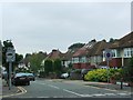
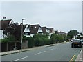
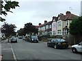
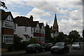
Photos of BR1 2UR
Area Information
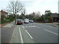
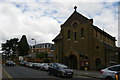
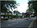
BR1 2UR is a small, residential postcode area in the London Borough of Bromley, combining the districts of Bickley and Sundridge. With a population of 1,541, it is a quiet, suburban enclave characterised by large detached homes and green spaces. The area’s history dates back to the 10th century, with Sundridge first mentioned as ‘Sundresse’ in a 987 charter. Today, it is a blend of historic charm and modern convenience, bordered by Bromley Town to the west and Petts Wood to the south-east. Residents benefit from proximity to parks, cycle routes, and the London LOOP walking trail. The area’s wealth is evident in its housing stock, with many properties dating to the 19th and 20th centuries. Its location offers easy access to Central London via rail, while retaining a distinct local identity shaped by its rural heritage and suburban layout.
- Area Type
- Postcode
- Area Size
- Not available
- Population
- Not available
- Population Density
- Not available
BR1 2UR is predominantly an owner-occupied area, with 81% of homes owned by residents rather than rented. The accommodation type is largely houses, reflecting a trend towards larger, detached properties typical of suburban London. This contrasts with areas dominated by flats or rental properties, suggesting a market skewed towards long-term residents seeking stability. The high home ownership rate and prevalence of houses indicate limited turnover, which may make the property market competitive for buyers. The small size of the postcode area means that properties are likely to be spread across nearby suburbs, requiring buyers to consider surrounding areas for a broader selection. The focus on houses also implies higher property values and a preference for private, spacious living over shared or rental options.
House Prices in BR1 2UR
No properties found in this postcode.
Energy Efficiency in BR1 2UR
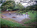
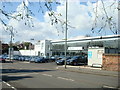
BR1 2UR offers a range of amenities within easy reach, enhancing daily life for residents. Retail options include major stores such as M&S Widmore Bromley BP and Tesco Bromley, providing convenience for shopping needs. The area’s proximity to parks like Jubilee Country Park (62 acres) and nearby National Trust sites at Petts Wood and Scadbury Park Nature Reserve ensures access to outdoor recreation. Cycle routes and footpaths, including the London LOOP trail, cater to active lifestyles. Leisure opportunities are further supported by nearby rail stations and ferry piers, which connect to cultural and commercial hubs. The mix of green spaces, retail, and transport options creates a balanced lifestyle, blending suburban tranquillity with urban accessibility. The area’s character is defined by its parks, historic sites, and practical amenities, offering both relaxation and convenience.
Amenities
Schools
Residents of BR1 2UR have access to a mix of primary and independent schools. Scotts Park Primary School, a state-funded institution, has an Ofsted rating of ‘good’, indicating reliable educational standards. Nearby, Breaside Preparatory School offers independent education with an ‘outstanding’ Ofsted rating, catering to families seeking private schooling. The presence of both state and independent options provides flexibility for parents, whether prioritising affordability or specialised curricula. These schools are within practical reach, serving the area’s primary and secondary education needs. The high rating of Breaside Preparatory School suggests a strong reputation for academic excellence, while Scotts Park Primary’s ‘good’ rating reflects consistent performance. Families can choose between local state schools or the more selective private sector, depending on their priorities.
| Rank | School | Type | Entry gender | Ages |
|---|
Explore more schools in this area
Go to Schools tabDemographics
The population of BR1 2UR has a median age of 47, with the majority of residents aged between 30 and 64. This suggests a community of established professionals and families. Home ownership is high at 81%, with houses being the predominant type of accommodation. The predominant ethnic group is White, reflecting a relatively homogenous demographic. The absence of specific data on deprivation means that quality of life is likely influenced by the area’s low crime rate and access to amenities. The age profile indicates a stable, mature population, with fewer young families or retirees compared to other parts of London. This demographic structure may influence local services and community dynamics, prioritising convenience for working-age residents over childcare or retirement-focused facilities.
Household Size
Accommodation Type
Tenure
Ethnic Group
Religion
Household Composition
Age
Household Deprivation
NS-SEC
Explore more demographic insights in this area
Go to Demographics tabPlanning
Planning Constraints
- Flood RiskPremium
- Ramsar Wetland SitesPremium
- Area of Outstanding Natural BeautyPremium
- Protected Nature ReservePremium
- Protected WoodlandPremium