Area Overview for BR1 2TF
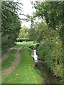
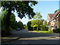
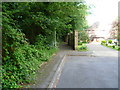
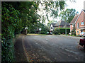
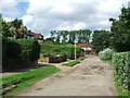
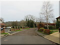
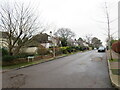
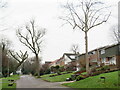
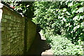
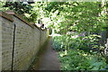
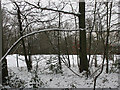
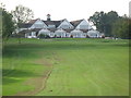
Photos of BR1 2TF
Area Information
BR1 2TF is a small residential postcode area nestled in the London Borough of Bromley, blending suburban comfort with historical roots. With a population of 1,541, it is a tightly knit community characterised by large detached homes and a quiet, leafy atmosphere. The area lies within the Bickley & Sundridge ward, a district with medieval origins, including Sundridge, first recorded in 987, and Bickley, a rural village until the 1850s. Today, it offers easy access to Central London via rail links and is bordered by Bromley Town, Chislehurst, and Petts Wood. Residents benefit from parks, cycle routes, and the London LOOP, while nearby amenities include Jubilee Country Park and connections to National Trust countryside. The area’s mix of historical sites, like the former Bickley Hall, and modern infrastructure makes it appealing for those seeking a balance between tradition and convenience. Daily life here is defined by proximity to green spaces, direct transport routes, and a community that retains a distinct local identity despite its integration into Greater London.
- Area Type
- Postcode
- Area Size
- Not available
- Population
- Not available
- Population Density
- Not available
BR1 2TF is predominantly an owner-occupied area, with 81% of homes owned by residents rather than rented. The accommodation type is largely houses, which is typical of suburban and semi-rural areas in London. This suggests a market focused on larger, detached properties rather than apartments or shared housing. Given the small size of the postcode area, the housing stock is likely limited, making it a niche market for buyers seeking spacious homes in a quieter setting. The high home ownership rate indicates a stable community with long-term residents, which may influence property values and desirability. For buyers, the proximity to transport links and green spaces adds appeal, though the limited size of the area means opportunities for expansion or development may be constrained. Those considering BR1 2TF should view it as a destination for those prioritising space, privacy, and a connection to the surrounding natural environment.
House Prices in BR1 2TF
No properties found in this postcode.
Energy Efficiency in BR1 2TF
Life in BR1 2TF is enriched by a range of amenities within practical reach. Retail options include M&S Widmore Bromley BP, Tesco Bromley, and other local shops, providing everyday convenience. The area’s transport network connects residents to Bromley’s broader retail and dining scenes. Nearby parks, such as Jubilee Country Park, offer recreational space, while historical sites like the former Bickley Hall and Sundridge Park Manor add cultural depth. The London LOOP cycle route and footpaths provide opportunities for outdoor activity. Residents also benefit from access to National Trust countryside at Petts Wood and Scadbury Park Nature Reserve, ideal for nature enthusiasts. The mix of green spaces, historical landmarks, and modern amenities creates a balanced lifestyle, blending suburban tranquillity with urban accessibility.
Amenities
Schools
The area is served by Scotts Park Primary School, which has an Ofsted rating of ‘good’, and Breaside Preparatory School, an independent institution with an ‘outstanding’ rating. A second Scotts Park Primary School is also listed, though no rating is provided. The presence of both state and independent schools offers families flexibility, with the state school providing accessible, high-quality education and the independent option catering to those seeking smaller class sizes and specialist facilities. The ‘outstanding’ rating at Breaside Preparatory School suggests it is a strong choice for parents prioritising academic excellence. The availability of multiple primary schools within proximity reduces the need for long commutes, supporting a family-friendly environment. The mix of school types reflects the area’s appeal to a range of households, from those seeking affordability to those investing in private education.
| Rank | School | Type | Entry gender | Ages |
|---|
Explore more schools in this area
Go to Schools tabDemographics
The population of BR1 2TF is predominantly middle-aged, with a median age of 47 and the majority of residents falling within the 30-64 age range. Home ownership is high, at 81%, reflecting a stable, long-term community. The area is primarily composed of houses, indicating a preference for larger properties over flats. The predominant ethnic group is White, though no specific diversity statistics are provided. The age profile suggests a mature demographic, which may influence local services and amenities. With no data on deprivation levels, the focus remains on the area’s established character and the presence of families in the 30-64 bracket, who likely contribute to a steady demand for housing and community facilities. The high home ownership rate also implies a lower proportion of rental properties, which may affect the local property market dynamics.
Household Size
Accommodation Type
Tenure
Ethnic Group
Religion
Household Composition
Age
Household Deprivation
NS-SEC
Explore more demographic insights in this area
Go to Demographics tabPlanning
Planning Constraints
- Flood RiskPremium
- Ramsar Wetland SitesPremium
- Area of Outstanding Natural BeautyPremium
- Protected Nature ReservePremium
- Protected WoodlandPremium