Area Overview for BR1 2RW
Photos of BR1 2RW
Area Information
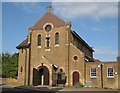
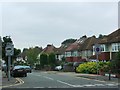
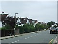
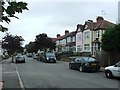
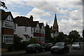
BR1 2RW is a small, residential postcode cluster in the London Borough of Bromley, blending the historic villages of Bickley and Sundridge. With a population of 1,707, it reflects a suburban, affluent character defined by large detached homes and green spaces. The area’s roots stretch back to the 10th century, with Sundridge’s name appearing in a 987 charter, while Bickley’s development accelerated after the 1858 railway station opened. Today, it is bordered by Bromley Town, Chislehurst, and Petts Wood, placing it 10.4 miles southeast of Charing Cross. The landscape features parks, cycle routes, and the London LOOP walking trail, catering to active lifestyles. Residents benefit from proximity to Bromley’s cultural hubs and direct rail links to Central London. This is a place where historic charm meets modern convenience, ideal for those seeking a quieter, family-oriented environment with easy access to the capital.
- Area Type
- Postcode
- Area Size
- Not available
- Population
- Not available
- Population Density
- Not available
BR1 2RW is a largely owner-occupied area, with 75% of homes owned by residents rather than rented. The accommodation type is predominantly houses, which is typical of suburban settings. This suggests a market skewed towards family homes rather than apartments or flats, offering larger living spaces and gardens. Given the small size of the postcode and its integration into the wider Bickley & Sundridge ward, property availability may be limited, but the focus on owner-occupation indicates a strong local demand. Buyers should consider the area’s proximity to Bromley’s amenities and transport links, which enhance its appeal. However, the lack of rental properties means the market is less dynamic for investors seeking turnover.
House Prices in BR1 2RW
No properties found in this postcode.
Energy Efficiency in BR1 2RW
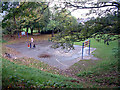
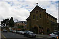
BR1 2RW offers a mix of retail, leisure, and green spaces. Nearby shops include M&S Widmore Bromley BP, Tesco Bromley, and Waitrose Bromley, providing everyday essentials. For recreation, Jubilee Country Park (62 acres) and nearby National Trust sites like Petts Wood and Scadbury Park Nature Reserve offer walking, cycling, and wildlife opportunities. Historical sites such as Sundridge Park Manor and the former Bickley Hall add cultural depth. The area’s suburban layout ensures a balance between urban amenities and natural tranquillity, supporting an active, community-focused lifestyle.
Amenities
Schools
The nearest school to BR1 2RW is St George’s, Bickley, Church of England Primary School, which serves the local community. This primary school holds an Ofsted rating of outstanding, reflecting high standards in education. The presence of a top-rated primary school is a significant draw for families, ensuring children receive a quality education. While no secondary schools are listed in the data, the proximity to Bromley’s broader educational network likely provides additional options. The school’s rating underscores the area’s commitment to education, making it a strong consideration for homebuyers prioritising family needs.
| Rank | School | Type | Entry gender | Ages |
|---|
Explore more schools in this area
Go to Schools tabDemographics
BR1 2RW has a median age of 47, with the majority of residents aged 30–64. This suggests a stable, mature community, likely centred around families and professionals. Home ownership is high at 75%, indicating a strong presence of long-term residents. The area is predominantly composed of houses, reflecting a suburban rather than urban layout. The predominant ethnic group is White, though specific data on other demographics is not provided. The age profile and ownership rates imply a low turnover of properties, contributing to a sense of continuity. With no data on deprivation levels, the area’s quality of life appears supported by its infrastructure and amenities. The demographic profile aligns with a middle-to-upper-income bracket, with residents prioritising stability and space.
Household Size
Accommodation Type
Tenure
Ethnic Group
Religion
Household Composition
Age
Household Deprivation
NS-SEC
Explore more demographic insights in this area
Go to Demographics tabPlanning
Planning Constraints
- Flood RiskPremium
- Ramsar Wetland SitesPremium
- Area of Outstanding Natural BeautyPremium
- Protected Nature ReservePremium
- Protected WoodlandPremium