Area Overview for BR1 2RG
Photos of BR1 2RG
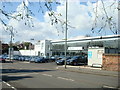
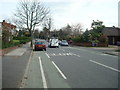
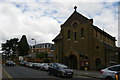
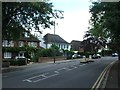
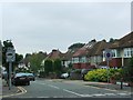
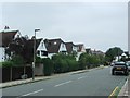
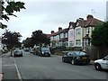
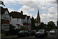
53 photos from this area
Area Information
Key information about the BR1 2RG including its size, population, and administrative classification.
- Area Type
- Postcode
- Area Size
- 1.2 hectares
- Population
- 1828
- Population Density
- 5199 people/km²
House Prices in BR1 2RG
28
Properties
£469,121
Average Sold Price
£175,000
Lowest Price
£1,090,000
Highest Price
Showing 28 properties
| Address | Type | Beds | Baths | Last Sale Price | Last Sale Date | |
|---|---|---|---|---|---|---|
| 203 Widmore Road, Bromley, BR1 2RG | Semi-detached | 4 | 1 | £842,000 | Dec 2022 | |
| 207 Widmore Road, Bromley, BR1 2RG | house | 4 | - | £1,090,000 | Sep 2022 | |
| 191A Widmore Road, Bromley, BR1 2RG | Flat | - | - | £350,000 | Apr 2022 | |
| 197A Widmore Road, Bromley, BR1 2RG | Flat | 3 | 1 | £275,000 | Jun 2021 | |
| 195A Widmore Road, Bromley, BR1 2RG | Maisonette | 3 | 2 | £175,000 | Sep 2018 | |
| 211 Widmore Road, Bromley, BR1 2RG | house | 3 | - | £630,000 | Aug 2017 | |
| 201 Widmore Road, Bromley, BR1 2RG | house | 5 | - | £500,000 | Aug 2011 | |
| 205 Widmore Road, Bromley, BR1 2RG | house | - | - | £430,000 | Feb 2011 | |
| 213 Widmore Road, Bromley, BR1 2RG | hospital_care_home | - | - | £615,000 | Jan 2006 | |
| 183 Widmore Road, Bromley, BR1 2RG | house | - | - | £249,950 | Aug 2002 |
Page 1 of 3
Energy Efficiency in BR1 2RG
Amenities
Schools
| Rank | School | Type | Entry gender | Ages |
|---|
Explore more schools in this area
Go to Schools tabDemographics
Household Size
One person
most common
Accommodation Type
Flats
most common
Tenure
67
majority
Ethnic Group
White
most common
Religion
N/A
most common
Household Composition
N/A
most common
Age
47
median
Adults (30-64 years)
most common
Household Deprivation
N/A
with no deprivation
NS-SEC
50
in Lower managerial occupations
Explore more demographic insights in this area
Go to Demographics tabPlanning
Planning Constraints
- Flood RiskPremium
- Ramsar Wetland SitesPremium
- Area of Outstanding Natural BeautyPremium
- Protected Nature ReservePremium
- Protected WoodlandPremium