Area Overview for BR1 2GE
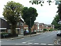
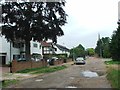
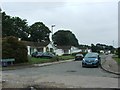
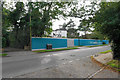
Photos of BR1 2GE
Area Information
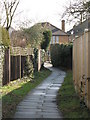
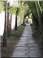
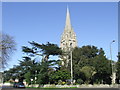
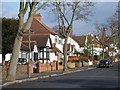
Living in BR1 2GE means residing in a small residential cluster within the Bickley and Sundridge ward of Bromley. This district spans 7,568 square metres and is home to just over 2,000 people. The area sits approximately 10.4 miles south-east of Charing Cross, bordered by Bromley Town to the west and Chislehurst to the north-east. Historically, Sundridge appeared in a 987 charter, while Bickley was noted in 1279 as a forest clearing. The character here is largely defined by large detached housing in a wealthy district. You will find parks, recreation grounds, and cycle routes like those connecting to the London LOOP. The Bickley and Sundridge ward was formed in 2022, consolidating these distinct communities. Residents enjoy access to significant green spaces, including the 62-acre Jubilee Country Park and links to Petts Wood and Scadbury Park Nature Reserve via National Trust countryside. Daily life balances suburban convenience with historical depth. You are steps away from the site of former Bickley Hall, though the current architecture is modern and established. The area remains predominantly residential, offering a quiet environment that contrasts with the urban centres nearby.
- Area Type
- Postcode
- Area Size
- 7568 m²
- Population
- Not available
- Population Density
- Not available
The housing market in BR1 2GE is defined by a robust pace of owner occupation. With 80% of properties in owner-occupied hands, the area operates largely outside the rental spiral common in major city zones. Houses dominate the landscape, offering standalone properties that suit the older, established demographic. This high ownership rate implies that many current residents bought their homes decades ago and may be looking to move once they have outgrown their current footprint. For buyers considering homes in BR1 2GE, competition for quality detached properties will be fierce due to the scarcity of stock. The 7,568 square metre size of this specific cluster limits the volume of transactions but guarantees exclusivity for those securing a property here. You are looking at an area where investment often means inheriting a historic location rather than finding a speculative new-build. The prevalence of houses over flats aligns with the median age of 47, as this group typically values space and garden access over proximity to nightlife. Buyers should expect prices to reflect the wealth of the district and the historical significance of sites like Sundridge Park Manor.
House Prices in BR1 2GE
Showing 7 properties
| Address | Type | Beds | Baths | Last Sale Price | Last Sale Date | |
|---|---|---|---|---|---|---|
| 5 Taryn Grove, Bickley, Bromley, BR1 2GE | Detached | - | - | £1,975,000 | Jun 2021 | |
| 3 Taryn Grove, Bickley, Bromley, BR1 2GE | Detached | 5 | 4 | £1,400,000 | Jan 2021 | |
| 1 Taryn Grove, Bickley, Bromley, BR1 2GE | Detached | 5 | 4 | £1,300,000 | Apr 2019 | |
| 4 Taryn Grove, Bickley, Bromley, BR1 2GE | Detached | 5 | - | £1,375,000 | Sep 2014 | |
| 6 Taryn Grove, Bickley, Bromley, BR1 2GE | Detached | 5 | 4 | £1,300,000 | Oct 2011 | |
| 2 Taryn Grove, Bickley, Bromley, BR1 2GE | house | - | - | £1,300,000 | Sep 2011 | |
| Westways, Bickley Park Road, Bickley, Bromley, BR1 2GE | Detached | - | - | - | - |
Energy Efficiency in BR1 2GE
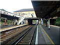
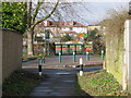
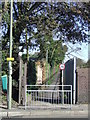
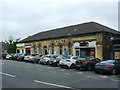
Daily life in BR1 2GE centres on access to substantial green spaces and local retail outlets. Residents have five noted railway stations, five retail hubs, and five metro stops within practical reach. Budgens Southborough, Tesco Bromley, and Co-op Bromley serve as primary grocery destinations, ensuring daily shopping needs are met without long drives. The area features five accessible tram stops, including Beckenham Road, facilitating easy hops across the borough. Five rail stations, ranging from Bickley to Chislehurst, support direct journeys into the city. Beyond commerce, the lifestyle benefits from significant outdoor areas. Jubilee Country Park offers 62 acres for walking and recreation. Links extend to National Trust countryside at Petts Wood and Scadbury Park Nature Reserve. You can explore historic sites like the former Bickley Hall location or visit the 17th-century Sundridge Park Manor ruins. The presence of cycle routes and footpaths integrates leisure with utility. Living in BR1 2GE grants you a foundation of convenience that meets both practical and recreational needs without leaving the doorstep.
Amenities
Schools
| Rank | School | Type | Entry gender | Ages |
|---|
Explore more schools in this area
Go to Schools tabDemographics
The community in BR1 2GE is stable and mature, with a median age of 47 years. Most residents fall into the adult age range between 30 and 64 years, indicating a settled population rather than a transient one. This demographic profile suggests a neighbourhood where families have taken root and established long-term homes. Home ownership stands at a high 80%, reflecting a strong preference for buying rather than renting. You are statistically more likely to find homeowners looking to stay in their local properties than expatriate tenants. The predominant ethnic group is White, which shapes the cultural identity of the local school community and social groups. Almost all accommodation consists of houses, meaning you will not find high-rise flats or terraced rows as the primary housing stock. This uniformity creates a consistent streetscape focused on privacy and garden space. The low density of 273,271 people per square kilometre indicates spacious living conditions compared to central London boroughs. The area does not show signs of rapid turnover, supporting a cohesive neighbourhood where local businesses can thrive on repeat custom.
Household Size
Accommodation Type
Tenure
Ethnic Group
Religion
Household Composition
Age
Household Deprivation
NS-SEC
Explore more demographic insights in this area
Go to Demographics tabPlanning
Planning Constraints
- Flood RiskPremium
- Ramsar Wetland SitesPremium
- Area of Outstanding Natural BeautyPremium
- Protected Nature ReservePremium
- Protected WoodlandPremium