Area Overview for BR1 2BS
Photos of BR1 2BS
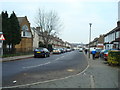
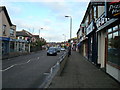
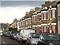
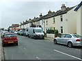
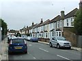
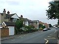
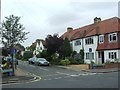
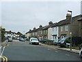
68 photos from this area
Area Information
Key information about the BR1 2BS including its size, population, and administrative classification.
- Area Type
- Postcode
- Area Size
- 3.8 hectares
- Population
- 1792
- Population Density
- 6068 people/km²
House Prices in BR1 2BS
33
Properties
£545,428
Average Sold Price
£305,000
Lowest Price
£810,000
Highest Price
Showing 33 properties
| Address | Type | Beds | Baths | Last Sale Price | Last Sale Date | |
|---|---|---|---|---|---|---|
| 27 The Avenue, Bickley, Bromley, BR1 2BS | house | - | - | £500,000 | Dec 2022 | |
| 31 The Avenue, Bickley, Bromley, BR1 2BS | Semi-detached | 3 | - | £650,000 | Sep 2021 | |
| 5 The Avenue, Bickley, Bromley, BR1 2BS | house | - | - | £799,995 | May 2015 | |
| 11 The Avenue, Bickley, Bromley, BR1 2BS | Semi-detached | 6 | - | £810,000 | Oct 2014 | |
| 1 The Avenue, Bickley, Bromley, BR1 2BS | house | 3 | - | £361,000 | Feb 2011 | |
| 25 The Avenue, Bickley, Bromley, BR1 2BS | Semi-detached | - | - | £305,000 | Aug 2004 | |
| 7 The Avenue, Bickley, Bromley, BR1 2BS | Semi-detached | - | - | £392,000 | Jun 2001 | |
| 15A The Avenue, Bickley, Bromley, BR1 2BS | Flat | 3 | 2 | - | - | |
| 28 The Avenue, Bickley, Bromley, BR1 2BS | Detached | - | - | - | - | |
| 32 The Avenue, Bickley, Bromley, BR1 2BS | Detached | - | - | - | - |
Page 1 of 4
Energy Efficiency in BR1 2BS
Amenities
Schools
| Rank | School | Type | Entry gender | Ages |
|---|
Explore more schools in this area
Go to Schools tabDemographics
Household Size
Family (3-5 people)
most common
Accommodation Type
Houses
most common
Tenure
77
majority
Ethnic Group
White
most common
Religion
N/A
most common
Household Composition
N/A
most common
Age
47
median
Adults (30-64 years)
most common
Household Deprivation
N/A
with no deprivation
NS-SEC
45
in Lower managerial occupations
Explore more demographic insights in this area
Go to Demographics tabPlanning
Planning Constraints
- Flood RiskPremium
- Ramsar Wetland SitesPremium
- Area of Outstanding Natural BeautyPremium
- Protected Nature ReservePremium
- Protected WoodlandPremium