Area Overview for BR1 1UG
Photos of BR1 1UG
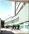
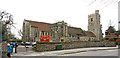
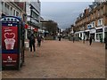
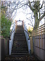
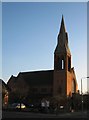
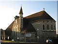
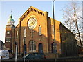
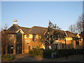
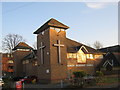
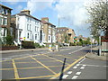
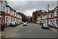
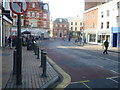
Area Information
BR1 1UG lies within the London Borough of Bromley, a historically rural village that evolved into a suburban commuter hub. With a population of 1,902, this postcode area is a small, tightly knit residential cluster, typical of Bromley’s post-19th-century expansion. The area’s character blends suburban tranquillity with proximity to London’s infrastructure, offering a balance of local charm and urban connectivity. Bromley itself, once a market town with roots stretching back over a millennium, remains a place of historical significance, including Bromley Palace, now a civic centre. Daily life here is shaped by its mature population, with a median age of 47, and a focus on stable, owner-occupied homes. Residents benefit from nearby amenities such as Valley Primary School, rail links to Bromley North and South stations, and access to retail outlets like Lidl and Sainsburys. The area’s compact size means it is both a self-contained community and a gateway to Greater London’s broader networks.
- Area Type
- Postcode
- Area Size
- Not available
- Population
- 1902
- Population Density
- 4984 people/km²
BR1 1UG is predominantly an owner-occupied area, with 60% of homes owned by residents rather than rented. The accommodation type is largely houses, which aligns with the area’s suburban character and appeal to families. This suggests a housing stock that prioritises privacy and space over high-density living. Given the small size of the postcode area, the property market is likely limited in scale, with buyers needing to consider nearby suburbs for more options. The prevalence of owner-occupied homes indicates a stable market, but the lack of rental properties may mean limited flexibility for those seeking short-term accommodation. For buyers, the focus on houses could mean higher property values and a need to evaluate proximity to amenities like schools and transport links, which are critical in this compact area.
House Prices in BR1 1UG
No properties found in this postcode.
Energy Efficiency in BR1 1UG
The lifestyle in BR1 1UG is shaped by its proximity to a range of amenities. Retail options include supermarkets like Lidl, M&S, and Sainsburys, ensuring daily shopping needs are met locally. The area’s rail and tram networks provide easy access to Bromley’s town centre and beyond, while nearby airports and ferries add to its connectivity. Though the postcode area itself is small, its integration with Bromley’s broader infrastructure means residents can access parks, leisure facilities, and cultural hubs in the surrounding borough. The presence of multiple transport hubs and retail outlets contributes to a convenient, suburban lifestyle that balances local convenience with urban accessibility.
Amenities
Schools
The nearest school to BR1 1UG is Valley Primary School, which serves the local community with primary education. The school holds an Ofsted rating of ‘good’, reflecting satisfactory standards in teaching, leadership, and student outcomes. As a primary school, it caters to children aged 4–11, making it a key consideration for families with young children. The absence of secondary schools in the immediate vicinity means students may need to commute to nearby areas for further education. However, the ‘good’ rating suggests that Valley Primary provides a reliable foundation for early learning, which is a significant advantage for families prioritising quality schooling in their choice of residence.
| Rank | School | Type | Entry gender | Ages |
|---|
Explore more schools in this area
Go to Schools tabDemographics
The population of BR1 1UG is 1,902, with a median age of 47, indicating a community dominated by adults aged 30–64. Home ownership stands at 60%, reflecting a stable, long-term resident base. The majority of properties are houses, suggesting a preference for family-friendly, spacious living. The predominant ethnic group is White, though no specific diversity statistics are provided. This age profile implies a mature, established population, likely with strong local ties and a focus on community continuity. The absence of data on deprivation or income levels means the area’s economic profile remains unquantified, but the high home ownership rate suggests a relatively secure financial environment for residents.
Household Size
Accommodation Type
Tenure
Ethnic Group
Religion
Household Composition
Age
Household Deprivation
NS-SEC
Explore more demographic insights in this area
Go to Demographics tabPlanning
Planning Constraints
- Flood RiskPremium
- Ramsar Wetland SitesPremium
- Area of Outstanding Natural BeautyPremium
- Protected Nature ReservePremium
- Protected WoodlandPremium