Area Overview for BR1 1TP
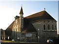
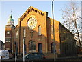
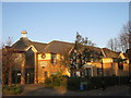
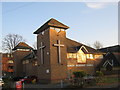
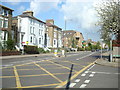
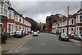
Photos of BR1 1TP


Area Information
BR1 1TP is a compact postcode area in the London Borough of Bromley, nestled in a small residential cluster with a population of 2,033. Covering just 8,697 square metres, it is one of the most densely populated areas in England, with 233,772 people per square kilometre. This density reflects its role as a suburban hub within Greater London, where Bromley’s history as a 12th-century market town has evolved into a modern commuter destination. The area’s proximity to Bromley North and South railway stations, along with tram stops like Beckenham Road, ensures easy access to central London and surrounding suburbs. Daily life here is shaped by its mix of historical roots and contemporary infrastructure, with the Bromley market still operating as a focal point. The area’s small size means it is tightly knit, with residents likely to know their neighbours. For those seeking a blend of suburban convenience and historical character, BR1 1TP offers a distinct slice of London’s evolving landscape.
- Area Type
- Postcode
- Area Size
- 8697 m²
- Population
- 2033
- Population Density
- 6120 people/km²
The property market in BR1 1TP is characterised by a low home ownership rate of 31%, with flats being the primary accommodation type. This suggests a rental-dominated market, where ownership is less common than in other parts of London. The small area size of 8,697 square metres means the housing stock is limited, with flats likely forming the bulk of available properties. For buyers, this implies a focus on rental properties rather than owner-occupied homes, and the compact nature of the area may mean limited scope for expansion or new developments. The high population density and prevalence of flats indicate a demand for efficient, smaller living spaces, possibly appealing to commuters or those prioritising proximity to transport links. However, the low ownership rate may also reflect challenges in affordability or investment opportunities for buyers seeking long-term residency.
House Prices in BR1 1TP
No properties found in this postcode.
Energy Efficiency in BR1 1TP
Daily life in BR1 1TP is shaped by its proximity to essential amenities. Retail options include Sainsburys Bromley, Lidl Bromley, and M&S Bromley, offering a range of shopping needs. The area’s rail and metro stations provide swift access to Bromley’s town centre and beyond, while nearby airports cater to regional travel. Ferries at Greenwich Pier and Masthouse Terrace Pier add a layer of connectivity to London’s waterways. Though the data does not list parks or leisure facilities explicitly, the area’s historical market and town hall suggest a community-oriented environment. The combination of retail, transport, and regional travel options creates a lifestyle that balances convenience with suburban accessibility, ideal for those prioritising practicality and connectivity.
Amenities
Schools
The only school explicitly listed near BR1 1TP is Bromley Mencap, a special school catering to students with specific needs. No other schools are mentioned in the data, meaning families with children requiring mainstream education may need to look beyond the immediate area. The presence of a special school highlights the area’s accessibility for those with particular educational requirements but does not indicate a comprehensive range of primary or secondary schools. For families seeking a broader selection of schools, proximity to Bromley’s town centre or neighbouring wards may be necessary. This limited school offering could be a consideration for prospective homebuyers, particularly those prioritising a diverse range of educational options for their children.
| Rank | School | Type | Entry gender | Ages |
|---|
Explore more schools in this area
Go to Schools tabDemographics
The community in BR1 1TP is predominantly middle-aged, with a median age of 47 and the most common age range being 30–64 years. This suggests a population of working-age adults, many of whom may be employed in nearby London or Bromley’s commercial sectors. Home ownership is relatively low at 31%, indicating a rental market dominated by flats. The accommodation type is largely flats, reflecting the area’s high population density and compact footprint. The predominant ethnic group is White, though no specific data on diversity or deprivation levels is provided. The age profile and housing stock suggest a community focused on stability and practicality, with a significant portion of residents likely renting rather than owning. This dynamic may influence local amenities and services, tailored to a transient or semi-permanent population.
Household Size
Accommodation Type
Tenure
Ethnic Group
Religion
Household Composition
Age
Household Deprivation
NS-SEC
Explore more demographic insights in this area
Go to Demographics tabPlanning
Planning Constraints
- Flood RiskPremium
- Ramsar Wetland SitesPremium
- Area of Outstanding Natural BeautyPremium
- Protected Nature ReservePremium
- Protected WoodlandPremium