Area Overview for BR1 1TG
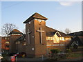
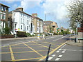
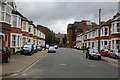
Photos of BR1 1TG


Area Information
Living in BR1 1TG means being part of a small, tightly knit residential cluster within the London Borough of Bromley. With a population of just 1,451, this postcode area reflects the suburban character of Bromley, a town that evolved from a rural village into a commuter hub. The area’s proximity to London’s transport networks and historical roots as a market town contribute to its quiet, established charm. Daily life here is shaped by its mix of traditional housing and modern amenities, with residents benefiting from nearby rail links, retail hubs, and a range of schools. The community is predominantly middle-aged, with a strong emphasis on home ownership, suggesting a stable, long-term demographic. While the area lacks the density of larger urban centres, its small size fosters a sense of familiarity. For those seeking a balance between suburban tranquillity and access to London’s infrastructure, BR1 1TG offers a compact, practical living environment. Its historical significance as part of Bromley’s 20th-century expansion adds a layer of heritage to its contemporary appeal.
- Area Type
- Postcode
- Area Size
- Not available
- Population
- Not available
- Population Density
- Not available
The property market in BR1 1TG is characterised by a high rate of home ownership (69%) and a predominance of houses. This suggests a market where owner-occupied properties are the norm, rather than rental or leasehold options. The concentration of houses, as opposed to flats or apartments, indicates a preference for traditional, family-sized homes, which may appeal to buyers seeking stability and space. Given the small size of the postcode area, the housing stock is likely limited in volume, making it a niche market for those prioritising specific locations. The high home ownership rate also implies lower turnover, which can stabilise property values but may limit opportunities for investors. For buyers, this means a focus on individual properties rather than large-scale developments, with potential for long-term equity growth. The absence of rental data means the extent of the rental market remains unclear, but the dominance of owner-occupied homes suggests limited demand for short-term lets.
House Prices in BR1 1TG
Showing 1 properties
| Address | Type | Beds | Baths | Last Sale Price | Last Sale Date | |
|---|---|---|---|---|---|---|
| Splash Damage Limited, Royal Court, 81 Tweedy Road, Bromley, BR1 1TG | office_workshop | - | - | - | - |
Energy Efficiency in BR1 1TG
Residents of BR1 1TG have access to a range of amenities within walking or short driving distance. Retail options include Sainsburys Bromley, M&S Bromley, and Lidl Bromley, providing everyday shopping needs. The area’s rail and metro stations, such as Bromley North and Beckenham Road Tram Stop, connect to broader transport networks, enabling easy travel to London or nearby suburbs. For leisure, two airports—Biggin Hill and London Biggin Hill—offer regional flight options, while ferries at Greenwich Pier and Masthouse Terrace Pier provide water-based travel. The presence of multiple transport hubs and retail centres suggests a lifestyle that balances convenience with suburban tranquillity. Though the area lacks large parks or cultural institutions, its proximity to Bromley’s historic market and civic buildings adds a layer of local character. The mix of retail, transport, and travel options supports a practical, accessible daily life.
Amenities
Schools
Near BR1 1TG are two distinct educational institutions: Ashgrove School Ltd, an independent school, and Education and Youth Services Ltd, a special school. Ashgrove’s independent status suggests it may offer fee-based education, catering to families seeking private schooling options. Education and Youth Services Ltd, as a special school, provides tailored support for students with specific needs, highlighting the area’s commitment to inclusive education. The presence of both school types indicates a diverse educational landscape, accommodating both traditional and specialist needs. For families, this mix offers flexibility, whether they prioritise private education or require support for children with learning differences. However, the lack of Ofsted ratings or performance data means the quality of these institutions cannot be assessed here. Parents should investigate further to determine how these schools align with their child’s requirements.
| Rank | School | Type | Entry gender | Ages |
|---|
Explore more schools in this area
Go to Schools tabDemographics
The population of BR1 1TG is 1,451, with a median age of 47, indicating a community skewed toward middle-aged adults. The most common age range is 30–64 years, suggesting a stable, family-oriented demographic. Home ownership is high at 69%, with houses being the predominant type of accommodation. This points to a market dominated by owner-occupied properties rather than rentals, reflecting a long-term, settled population. The predominant ethnic group is White, which aligns with broader trends in Bromley. While no specific deprivation data is provided, the high home ownership rate and age profile suggest a relatively stable economic environment. However, the absence of detailed diversity metrics means the full scope of the community’s social composition remains unexplored. The age range and housing stock imply a focus on established families and individuals seeking long-term residency, rather than transient populations.
Household Size
Accommodation Type
Tenure
Ethnic Group
Religion
Household Composition
Age
Household Deprivation
NS-SEC
Explore more demographic insights in this area
Go to Demographics tabPlanning
Planning Constraints
- Flood RiskPremium
- Ramsar Wetland SitesPremium
- Area of Outstanding Natural BeautyPremium
- Protected Nature ReservePremium
- Protected WoodlandPremium