Area Overview for BR1 1SG
Photos of BR1 1SG
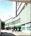
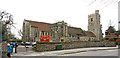
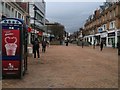
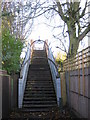
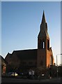
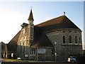
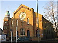
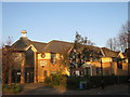
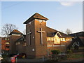
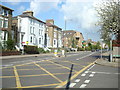
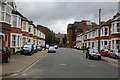
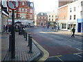
Area Information
BR1 1SG is a small residential cluster in the London Borough of Bromley, a historic town that evolved from a rural village into a suburban commuter hub. With a population of 1,451, the area reflects Bromley’s 20th-century expansion, offering a quiet, established residential character. The postcode lies within Bromley Town Ward, an electoral area with roots tracing back over a millennium. Daily life here is shaped by its proximity to transport networks, including five nearby rail stations such as Bromley North and Sundridge Park, and a mix of retail and leisure options. The area’s demographics suggest a mature community, with a median age of 47 and a majority of residents aged 30–64. Most homes are owner-occupied, and the housing stock is dominated by houses rather than flats. While the area lacks large-scale commercial developments, its compact size and access to Bromley’s historic market and civic amenities create a distinct sense of locality. Living in BR1 1SG means balancing suburban tranquillity with easy access to London’s transport arteries and the cultural legacy of a town once graced by Prime Minister Harold Macmillan.
- Area Type
- Postcode
- Area Size
- Not available
- Population
- Not available
- Population Density
- Not available
The property market in BR1 1SG is characterised by a high rate of home ownership (69%) and a focus on houses rather than flats. This suggests a stable, owner-occupied market with limited rental activity, typical of a small, residential postcode area. The dominance of houses indicates a suburban layout, possibly with larger gardens and more private outdoor space. Given the area’s compact size and the prevalence of owner-occupied homes, the housing stock is likely limited, making it a competitive market for buyers. The small population of 1,451 further implies that properties are closely spaced, with limited scope for new development. For buyers, this means a focus on existing homes, often in established neighborhoods with mature gardens. The high home ownership rate also suggests a community with long-term residents, which may influence property values and local amenities.
House Prices in BR1 1SG
No properties found in this postcode.
Energy Efficiency in BR1 1SG
Living in BR1 1SG offers a blend of suburban convenience and access to a variety of amenities. The area’s retail options include five stores such as Sainsburys and Lidl, providing everyday shopping needs within reach. Five rail stations and five metro stops, including Bromley South and Avenue Road Tram Stop, ensure easy access to public transport for commuting or leisure trips. The proximity to two airports, Biggin Hill and London Biggin Hill, makes regional travel straightforward. For leisure, four ferry piers—such as Barrier Gardens Pier—offer opportunities for water-based activities or scenic outings. The area’s historic character is complemented by Bromley’s market, which has operated since medieval times, and its civic centre, housed in Bromley Palace. This mix of practical amenities and historical sites creates a lifestyle that balances modern convenience with a sense of place.
Amenities
Schools
Near BR1 1SG, two schools are listed: Ashgrove School Ltd, an independent institution, and Education and Youth Services Ltd, a special school. These options cater to different educational needs, with the independent school likely offering a broader curriculum and the special school providing tailored support for students with specific learning requirements. The presence of both types of schools suggests a diverse range of educational provision, though the data does not include Ofsted ratings or academic performance metrics. For families, this mix may be advantageous, offering choice between private and state-supported education. However, the lack of information on school quality or capacity means prospective buyers should conduct further research to assess whether these institutions meet their children’s needs. The small size of BR1 1SG may also mean that school catchment areas are limited, requiring careful consideration of proximity to these institutions.
| Rank | School | Type | Entry gender | Ages |
|---|
Explore more schools in this area
Go to Schools tabDemographics
The community in BR1 1SG is predominantly composed of adults aged 30–64, with a median age of 47. This suggests a mature, stable population, likely drawn to the area for its established residential character and proximity to Bromley’s amenities. Home ownership is high, at 69%, indicating a strong presence of long-term residents. The accommodation type is primarily houses, reflecting a low-density, suburban layout. The predominant ethnic group is White, though specific diversity metrics are not provided in the data. The population size of 1,451 implies a close-knit community, where local services and social networks are likely well-established. The age profile suggests a mix of families and older adults, with fewer young children or retirees compared to other areas. This demographic profile aligns with Bromley’s historical role as a commuter town, attracting professionals and families seeking a balance between urban and rural living.
Household Size
Accommodation Type
Tenure
Ethnic Group
Religion
Household Composition
Age
Household Deprivation
NS-SEC
Explore more demographic insights in this area
Go to Demographics tabPlanning
Planning Constraints
- Flood RiskPremium
- Ramsar Wetland SitesPremium
- Area of Outstanding Natural BeautyPremium
- Protected Nature ReservePremium
- Protected WoodlandPremium