Area Overview for BR1 1RN
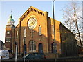
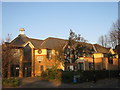
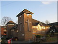
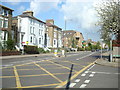
Photos of BR1 1RN


Area Information
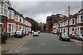
BR1 1RN is a small residential postcode area nestled within the London Borough of Bromley, a historic town that evolved from a rural village into a suburban hub. With a population of 2,033 spread over 306 square metres, the area is densely populated, reflecting its role as a commuter destination for London. Bromley itself has roots dating back over a millennium, with a royal charter granted in 1205 that spurred its growth. Today, BR1 1RN benefits from its proximity to transport links, including multiple rail stations and tram stops, making it a practical choice for those balancing suburban living with urban access. The area’s compact size and high population density mean it is a tightly knit community, though its small footprint limits the diversity of local amenities. Residents here are likely to be commuters, drawn by Bromley’s historical significance and its integration into Greater London’s infrastructure. The area’s character is shaped by its past as a market town and its transformation into a modern residential cluster, offering a blend of historical context and contemporary convenience.
- Area Type
- Postcode
- Area Size
- 306 m²
- Population
- 2033
- Population Density
- 6120 people/km²
The property market in BR1 1RN is characterised by a low home ownership rate of 31%, suggesting that the area is more of a rental market than an owner-occupied one. The predominant accommodation type is flats, which aligns with the area’s high population density and small size. This means the housing stock is likely to consist of smaller, purpose-built units rather than detached or semi-detached homes. For buyers, this presents a challenge: the limited availability of owner-occupied properties and the focus on flats may restrict options for those seeking larger or more traditional housing. The area’s small footprint also means that the immediate surroundings are crucial for prospective buyers, as BR1 1RN itself offers little in terms of varied property types. Those considering the area should look beyond the postcode to nearby suburbs or districts for a broader range of housing styles and sizes.
House Prices in BR1 1RN
No properties found in this postcode.
Energy Efficiency in BR1 1RN
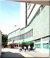
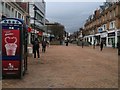
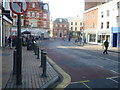
Residents of BR1 1RN have access to a range of retail and dining options, including Sainsburys Bromley, Lidl Bromley, and M&S Bromley, ensuring everyday shopping needs are met. The area’s transport links also grant access to broader leisure opportunities, with nearby airports and ferry piers offering travel to London and beyond. While the data does not specify parks or recreational spaces within the postcode, the proximity to Bromley’s historic market and the town’s suburban character suggest a mix of urban and semi-rural amenities. The presence of multiple rail and metro stops, combined with nearby airports, means residents can easily reach cultural and commercial hubs in London. However, the area’s small footprint means that larger parks or leisure facilities may lie outside the immediate vicinity, requiring a short commute to access.
Amenities
Schools
The only school explicitly listed near BR1 1RN is Bromley Mencap, a special school catering to students with specific educational needs. No mainstream schools or primary/secondary institutions are detailed in the data, which may limit the area’s appeal for families requiring a broader range of educational options. The presence of a special school indicates a focus on inclusive education, but it does not address the needs of children in mainstream education. Families considering BR1 1RN should investigate nearby schools beyond the immediate postcode, as the data does not provide information on other educational institutions. This absence of detailed school data highlights a potential gap for prospective residents seeking to evaluate the area’s suitability for children’s education.
| Rank | School | Type | Entry gender | Ages |
|---|---|---|---|---|
| 1 | Bromley Mencap | special | N/A | N/A |
Explore more schools in this area
Go to Schools tabDemographics
The community in BR1 1RN is predominantly composed of adults aged 30–64, with a median age of 47. This suggests a mature population, likely settled in long-term housing or retirement. Home ownership is relatively low at 31%, indicating that a significant portion of residents are likely to be renters, possibly including professionals or families seeking flexibility. The accommodation type is primarily flats, reflecting the area’s high population density and compact footprint. The predominant ethnic group is White, though no data is provided on other demographic groups. The absence of specific information on deprivation or socioeconomic diversity means the area’s full social profile remains unclear. However, the age range and housing stock suggest a community focused on stability and practicality, with limited scope for younger or more transient populations. The high population density, while enabling efficient use of space, may also contribute to a more homogenous demographic structure.
Household Size
Accommodation Type
Tenure
Ethnic Group
Religion
Household Composition
Age
Household Deprivation
NS-SEC
Explore more demographic insights in this area
Go to Demographics tabPlanning
Planning Constraints
- Flood RiskPremium
- Ramsar Wetland SitesPremium
- Area of Outstanding Natural BeautyPremium
- Protected Nature ReservePremium
- Protected WoodlandPremium
- Crime RiskPremium