Area Overview for BR1 1NX
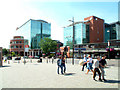
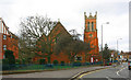
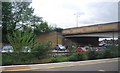
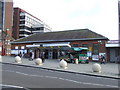
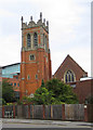
Photos of BR1 1NX

Area Information
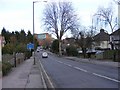
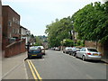
BR1 1NX is a small, densely populated residential cluster in the London Borough of Bromley, England. With a population of 1,252 spread across 2,485 square metres, the area reflects the suburban character of Bromley, a town that evolved from a medieval village into a key commuter hub. Its compact size and high density create a tightly knit community, though the area’s historical roots as a rural settlement remain evident in its modest scale. Bromley itself, part of Greater London since 1965, has long served as a suburban gateway to the capital, with its 19th-century railway expansion fueling growth. Living here means proximity to London’s infrastructure, including multiple rail and metro stops, while retaining a quieter, more residential feel. The area’s demographics—primarily adults aged 30–64—suggest a stable, working-age population, with a strong presence of flats indicating a mix of owner-occupied and rental properties. Daily life is shaped by the town’s market heritage, modern retail, and transport links, making it a practical choice for those seeking convenience without the city’s congestion.
- Area Type
- Postcode
- Area Size
- 2485 m²
- Population
- Not available
- Population Density
- Not available
BR1 1NX is a rental-driven area, with only 35% of homes owned by residents. The accommodation type is predominantly flats, which aligns with the high population density and compact layout of the postcode. This suggests a housing stock focused on smaller, multi-unit buildings rather than detached or semi-detached properties. For buyers, the limited home ownership rate and concentration of flats may indicate a market more suited to investors or those seeking long-term rental income rather than owner-occupation. The small area size and proximity to transport hubs like Bromley South Station and the Beckenham Road Tram Stop could make it an attractive option for commuters, though the lack of larger homes may deter those prioritising family-sized properties. The high density also means competition for available units, which could affect both rental and purchase prices in the immediate vicinity.
House Prices in BR1 1NX
Showing 1 properties
| Address | Type | Beds | Baths | Last Sale Price | Last Sale Date | |
|---|---|---|---|---|---|---|
| Employment Service London & South East, Unicorn House, 28 Elmfield Road, Bromley, BR1 1NX | office_workshop | - | - | - | - |
Energy Efficiency in BR1 1NX
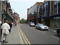
Residents of BR1 1NX have access to a range of amenities within walking or short-vehicle distance. Retail options include major supermarkets like Tesco Bromley, Sainsburys Bromley, and Waitrose Bromley, ensuring convenience for daily shopping. The area’s transport links, including five rail stations and three metro stops, provide easy access to London and surrounding suburbs. For leisure, the nearby Biggin Hill Airport and Greenwich Pier offer unique experiences, while the town’s historic market, established in the 13th century, continues to serve as a focal point for local commerce. The compact layout means amenities are closely clustered, reducing the need for long commutes. However, the high population density may mean limited green spaces or recreational areas, though Bromley’s broader borough includes parks and open land. The mix of retail, transport, and historical sites creates a lifestyle that balances practicality with a touch of traditional charm.
Amenities
Schools
| Rank | School | Type | Entry gender | Ages |
|---|
Explore more schools in this area
Go to Schools tabDemographics
The population of BR1 1NX skews toward adults aged 30–64, with a median age of 47. This suggests a mature, working-age community, likely composed of professionals and families. Home ownership here is relatively low at 35%, indicating a higher proportion of renters, which may influence the area’s social dynamics and housing market. The predominant accommodation type is flats, reflecting a focus on smaller, managed properties rather than detached homes. The majority of residents identify as White, though specific data on diversity is not provided. With a population density of 503,903 people per square kilometre, the area is intensely compact, which can foster a sense of community but may also strain local amenities. The absence of detailed deprivation data means the quality of life remains unquantified, though the high density and age profile suggest a stable, though possibly aging, population.
Household Size
Accommodation Type
Tenure
Ethnic Group
Religion
Household Composition
Age
Household Deprivation
NS-SEC
Explore more demographic insights in this area
Go to Demographics tabPlanning
Planning Constraints
- Flood RiskPremium
- Ramsar Wetland SitesPremium
- Area of Outstanding Natural BeautyPremium
- Protected Nature ReservePremium
- Protected WoodlandPremium