Area Overview for BR1 1NS
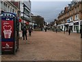
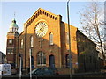
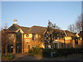
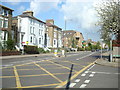
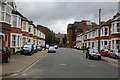
Photos of BR1 1NS


Area Information
BR1 1NS is a small residential postcode area nestled within the London Borough of Bromley, a historically significant town that evolved from a medieval village into a suburban commuter hub. With a population of just 1,252, this area reflects Bromley’s legacy as a market town, shaped by its 13th-century royal charter and 19th-century railway expansion. The postcode covers a compact cluster of homes, predominantly flats, catering to a community of adults aged 30–64, with a median age of 47. Daily life here is defined by proximity to Bromley’s historic market, modern retail, and robust transport links. Residents benefit from five rail stations, including Bromley South and North, and three tram stops, ensuring easy access to London and surrounding areas. The area’s blend of historical roots and contemporary infrastructure makes it a practical choice for those seeking a balance between suburban tranquillity and urban connectivity.
- Area Type
- Postcode
- Area Size
- Not available
- Population
- Not available
- Population Density
- Not available
The property market in BR1 1NS is dominated by flats, with 35% of homes owned outright by residents. This low home ownership rate suggests a rental market that caters to a transient or younger demographic, possibly drawn by the area’s transport links and proximity to Bromley’s amenities. The compact nature of the postcode means housing options are limited to high-density developments, which may appeal to those seeking affordable, centrally located living. However, the lack of detached or semi-detached properties could deter buyers looking for long-term investment or family homes. The area’s small size also means that property prices and availability are closely tied to Bromley’s broader market, which has historically been influenced by its role as a commuter town. Buyers should consider the limited housing stock and potential for rental demand when evaluating opportunities here.
House Prices in BR1 1NS
No properties found in this postcode.
Energy Efficiency in BR1 1NS
Living in BR1 1NS offers access to a mix of retail, transport, and leisure amenities. The area is within walking distance of Sainsburys, M&S, and Lidl in Bromley, providing everyday shopping needs. Residents can also reach Bromley’s historic market, which has operated since medieval times, for local produce and crafts. Transport options are extensive, with five rail stations and three tram stops ensuring easy access to London and nearby towns. Two airports, including Biggin Hill, are nearby, while ferries at Greenwich Pier offer river travel. The area’s proximity to Bromley’s cultural and commercial hubs, combined with its transport links, creates a convenient lifestyle. However, the lack of green spaces or major parks within the postcode itself means residents may need to travel slightly further for outdoor recreation.
Amenities
Schools
| Rank | School | Type | Entry gender | Ages |
|---|
Explore more schools in this area
Go to Schools tabDemographics
The population of BR1 1NS is 1,252, with a median age of 47 and the majority of residents falling within the 30–64 age range. This suggests a mature, stable community, likely composed of professionals and families. Home ownership rates are low at 35%, indicating that a significant portion of the housing stock is rented out, possibly to younger or transient residents. The area is characterised by flats, reflecting a focus on high-density living rather than detached homes. The predominant ethnic group is White, though specific data on diversity or deprivation is not provided. This demographic profile implies a community with established routines and a reliance on local services, such as Bromley’s historic market and nearby retail hubs like Sainsburys and M&S. The age range and home ownership figures also hint at a population that may prioritise convenience over property investment.
Household Size
Accommodation Type
Tenure
Ethnic Group
Religion
Household Composition
Age
Household Deprivation
NS-SEC
Explore more demographic insights in this area
Go to Demographics tabPlanning
Planning Constraints
- Flood RiskPremium
- Ramsar Wetland SitesPremium
- Area of Outstanding Natural BeautyPremium
- Protected Nature ReservePremium
- Protected WoodlandPremium