Area Overview for BR1 1NE
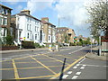
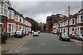
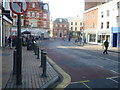
Photos of BR1 1NE

Area Information
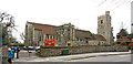
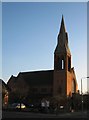
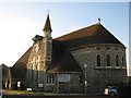
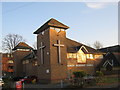
Living in BR1 1NE places you within the Bromley Town Ward, an electoral ward in the London Borough of Bromley with a population of approximately 2,033. This specific postcode covers a small residential cluster situated at coordinates 51.408226, 0.017578. While the immediate vicinity is a defined residential zone, you are positioned in the historic heart of Bromley, a town with recorded history extending back to 862 CE. The area has evolved from an agrarian village into a significant suburban destination following the arrival of railway facilities in 1858. Daily life here benefits from proximity to civic landmarks such as Bromley Palace, which now houses the town hall, and a market that has operated since medieval times. The location offers a direct connection to the town's heritage while providing practical access to modern amenities. Residents enjoy easy reach of Bromley North Station and Bromley South Station, which transformed Bromley into a popular commuter hub. The BR1 1NE cluster is part of the broader Bromley and Biggin Hill Parliament constituency, reflecting its role within the local political landscape. You are not in a remote pocket; you are embedded in a town with a millennium of recorded history, balancing its royal market traditions with contemporary urban living standards.
- Area Type
- Postcode
- Area Size
- Not available
- Population
- 2033
- Population Density
- 6120 people/km²
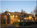
The property market in BR1 1NE is dominated by flats, which form the predominant accommodation type in this small residential cluster. With only 31% home ownership, the area functions primarily as a rental market rather than an owner-occupied estate. This high reliance on tenanted property suggests a housing stock designed for professional workers or those downsizing rather than long-term family settlement. Buyers looking for detached houses or semi-detached properties will find this specific postcode less suitable than neighbouring areas where ownership rates might differ. The concentration of flats aligns with the demographic reality of a median age of 47. Potential purchasers entering the market here should expect a stock focused on urban living and density. The low figure for owner occupation indicates that capital growth may be driven by rental demand and location convenience rather than family expansion. For investors, the high rent-to-own ratio suggests stable demand from tenants who value the proximity to Bromley Town Centre and transport links. Anyone considering homes in BR1 1NE must approach the purchase with an understanding that the asset class is fundamentally different from suburban pockets with higher ownership rates.
House Prices in BR1 1NE
No properties found in this postcode.
Energy Efficiency in BR1 1NE
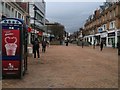
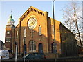
Residents of BR1 1NE enjoy immediate access to five retail venues, including Sainsburys Bromley, Lidl Bromley, and M&S Bromley. These shops provide practical daily necessities without the need for long journeys into central London. The area also sits at the intersection of five railway stations and five tram stops, including Harrington Road Tram Stop, facilitating quick travel across South London. With Biggin Hill Airport and London Biggin Hill Airport nearby, private aviation or commercial flights are conveniently located within reach. Cultural and civic life benefits from the proximity to Bromley Palace, the historic town hall, and the authentic Tuesday and Thursday market. You can walk to或与 five ferry terminals including Greenwich Pier and Masthouse Terrace Pier for leisure cruises. The local amenities strip includes five distinct rail hubs that serve as gateways to the wider borough. Dining and shopping options are concentrated around the town centre, accessible via the tram and train network. This blend of historic market shopping and modern retail availability ensures that daily errands are quick and simple. The area offers a self-contained lifestyle where the best of Bromley's legacy and convenience intersect.
Amenities
Schools
The nearest educational establishment to BR1 1NE is Bromley Mencap, which serves as a special school. This institution caters to students with specific educational needs rather than functioning as a mainstream primary or secondary academy for the general population. Living in BR1 1NE means your children may require specialised local provisions if their needs align with those served by this specific facility. The absence of listed mainstream schools in the immediate vicinity suggests that families with general education requirements will likely drive to other locations for their children's schooling. The presence of Bromley Mencap highlights the area's capability to support diverse family structures, including those with children requiring specialist care. However, parents seeking a choice of comprehensive schools or academies nearby may need to look beyond the immediate neighbourhood boundaries. The local education landscape is defined by this single special school entry, meaning that parental choice is limited to this specific provision unless they relocate to find a mainstream primary or secondary option. This single data point underscores the importance of checking catchment areas for nearby towns if standard schooling is a priority for your household plans.
| Rank | School | Type | Entry gender | Ages |
|---|
Explore more schools in this area
Go to Schools tabDemographics
The community in BR1 1NE is characterised by a mature demographic profile, with a median age of 47 years. The most common age range comprises adults between 30 and 64 years old, indicating a population that has weathered early adulthood and established themselves. Home ownership stands at 31% of the total, suggesting that a majority of residents occupy their homes through renting arrangements rather than ownership. This dynamic is consistent with the broader breakdown of accommodation types, which predominantly consist of flats. The predominant ethnic group within this cluster is White. The age structure supports a view of the area as a established residential zone rather than a destination for younger families entering the tenure market. With fewer than a third of residents owning their property, the local economy relies significantly on the rental sector. The concentration of adults in the 30-64 bracket suggests stability, yet the low home ownership rate implies that many residents may be downsizing or working within the private rental sector. Consequently, the social fabric likely centres around long-term tenancies within flat-based developments rather than owner-occupied detached housing.
Household Size
Accommodation Type
Tenure
Ethnic Group
Religion
Household Composition
Age
Household Deprivation
NS-SEC
Explore more demographic insights in this area
Go to Demographics tabPlanning
Planning Constraints
- Flood RiskPremium
- Ramsar Wetland SitesPremium
- Area of Outstanding Natural BeautyPremium
- Protected Nature ReservePremium
- Protected WoodlandPremium