Area Overview for Bowes Ward
Photos of Bowes Ward


Area Information
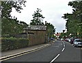
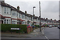
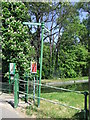
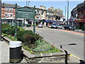
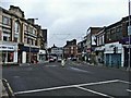
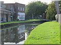
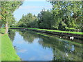
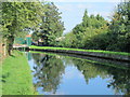
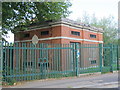
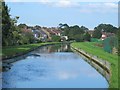
Bowes Ward is a distinct residential district situated within the London Borough of Haringey. This area, which covers 1.3 square kilometres, occupies a strategic position on the borders of Wood Green, Palmers Green, and Bounds Green. The ward encompasses postcodes N11, N13, and N22, defining a community that grew from rural farmland into a suburban hub during the late nineteenth and early twentieth centuries. Development here was spurred by the arrival of the Great Northern Railway branch in 1871 and the subsequent opening of Bowes Park railway station in 1880. The landscape retains elements of its history, including streets named after Whig politicians and the remains of the historic Bowes Manor estate. You will find a mixture of Victorian and Edwardian housing primarily located on former sections of the Bowes Park Estate developed between 1880 and 1900. Myddleton Road serves as the principal historic shopping street, undergoing a resurgence after years of decline alongside larger retail malls. The area functions as a suburban residential zone rather than a commercial centre. Local coordinates place the ward at approximately 51.6117° North latitude and -0.0985° West longitude. Living in Bowes Ward involves navigating a space that balances its historic roots with modern connectivity via the Overground and the nearby Piccadilly line at Bounds Green.
- Area Type
- District Borough Unitary Ward
- Area Size
- 1.3 km²
- Population
- Not available
- Population Density
- Not available
Demographics
The community in Bowes Ward reflects a mature demographic profile, with a median age of 70 years. This statistic indicates a population where older residents form a significant portion of the local community. You are looking at a neighbourhood where the most common age group spans the total spectrum, though the high median age suggests a shift away from younger family demographics. Approximately 48 per cent of residents own their homes outright. This figure represents less than half of the population, indicating that rental properties and shared ownership remain significant parts of the local housing stock. The ward lacks specific granularity regarding household composition or predominant ethnic groups in the current dataset. Without these detailed figures, a full picture of cultural diversity within the immediate 1.3 square kilometre area cannot be constructed. The religion data is similarly absent from the provided records. While you know the age structure, the absence of data on ethnicity, household types, and religious affiliation limits the depth of analysis regarding social fabric. Residents must rely on the known median age and home ownership rates to understand the primary demographic characteristics. The area does not provide information on deprivation levels or specific income brackets. Consequently, any assessment of quality of life must depend strictly on the visible age distribution and property ownership statistics.
Household Size
Accommodation Type
Tenure
Ethnic Group
Religion
Household Composition
Age
Household Deprivation
NS-SEC
Explore more demographic insights in this area
Go to Demographics tabPlanning
Planning Constraints
- Flood RiskPremium
- Ramsar Wetland SitesPremium
- Area of Outstanding Natural BeautyPremium
- Protected Nature ReservePremium
- Protected WoodlandPremium
- Crime RiskPremium