Area Overview for Bounds Green Ward
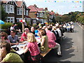
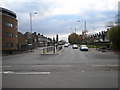
Photos of Bounds Green Ward

Area Information
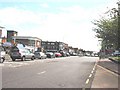
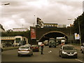
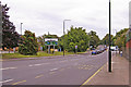
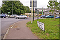
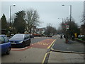
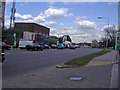
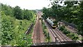
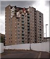
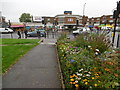
Bounds Green Ward sits in the north-east corner of the London Borough of Haringey, covering just 1.1 km². It forms a compact residential district that originally derived from land held by John Le Bounde in the 14th century. The ward now encompasses areas previously known as Bowes Park and Parts of the historic Bowes parish. You will find the area lies at approximately 51.6053° N, -0.1245° W, placing it firmly within North London. Residency here has a deep historical root, transitioning from a rural hamlet one mile north-west of Wood Green to an urbanised suburb by the early 20th century. Key landmarks include the extant Bounds Green common, an approximately two-acre space bounded by Warwick Road and The Drive. You also have access to Montmorency Park, a development recalling Jerome K. Jerome's dog from *Three Men in a Boat*. Daily life revolves around the Piccadilly line station and the nearby Bowes Park railway station, while the A406 North Circular Road runs close by. This small but distinct ward offers a mix of residential housing and local amenities that define life in this specific Haringey electoral area.
- Area Type
- District Borough Unitary Ward
- Area Size
- 1.1 km²
- Population
- Not available
- Population Density
- Not available
Demographics
The community in Bounds Green Ward has a distinct age profile, with a median age of 70 years. This figure indicates a significant proportion of elderly residents compared to other London districts. Almost every demographic category within your data returns as "total" for age, household composition, and ethnicity, meaning the available dataset does not provide a specific breakdown for these variables. Consequently, the precise distribution of household types, such as single-person vs. family homes, or the specific breakdown of the 50% minority ethnic population mentioned in local history, cannot be stated from the current figures. Home ownership stands at 38 per cent, leaving the majority of residents in rental accommodation. While historical notes mention Ugandan Asians expelled in 1972 and arrivals following the 1974 Turkish invasion of northern Cyprus, the current census data does not confirm if these groups currently form the majority of the ward's population. You must rely on the 38% ownership statistic and the high median age to understand the resident profile.
Household Size
Accommodation Type
Tenure
Ethnic Group
Religion
Household Composition
Age
Household Deprivation
NS-SEC
Explore more demographic insights in this area
Go to Demographics tabPlanning
Planning Constraints
- Flood RiskPremium
- Ramsar Wetland SitesPremium
- Area of Outstanding Natural BeautyPremium
- Protected Nature ReservePremium
- Protected WoodlandPremium
- Crime RiskPremium